


Hiking the Brown Creek-Rhododendron-West Ridge Loop Trail in Prairie Creek Redwoods State Park
Distance: 7.9 miles / 12.7 km
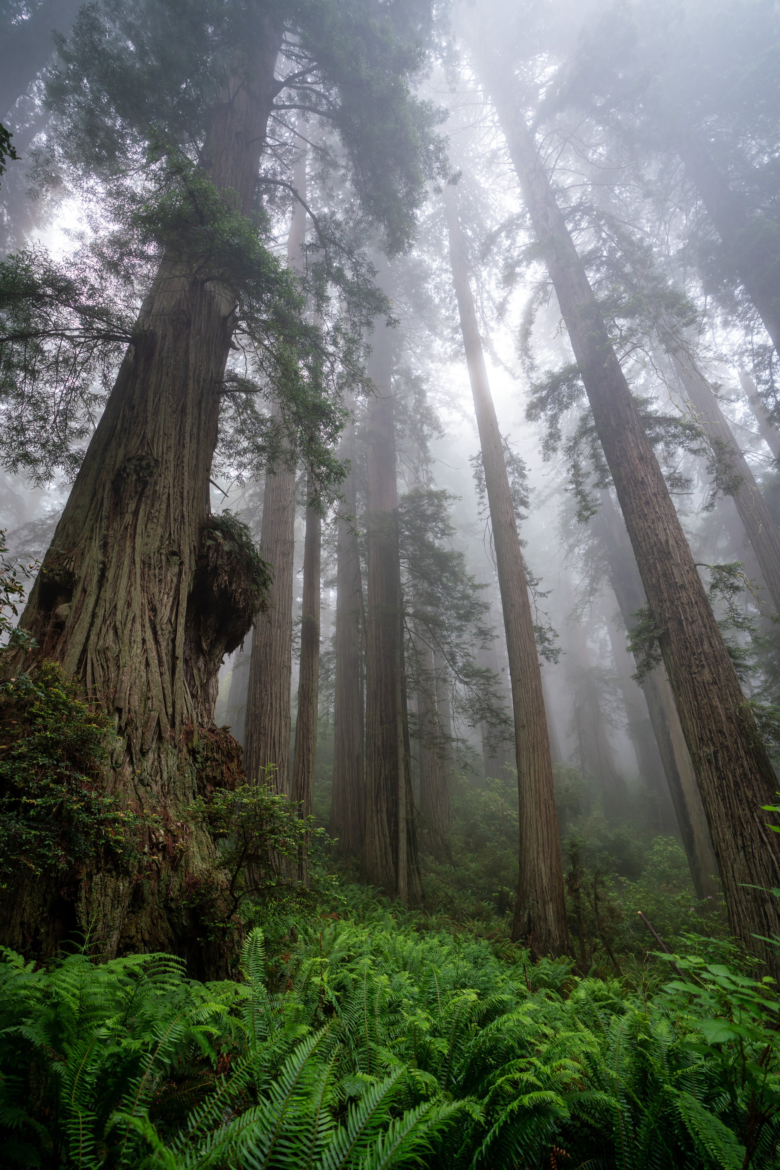
The Brown Creek-Rhododendron-West Ridge Loop Trail in Prairie Creek Redwoods State Park is a combination of several different trails that create this longer loop.
I chose to hike these trails this way because some of the best hiking within Prairie Creek Redwoods is done simply by connecting multiple trails into a larger loop, ensuring that you’re always seeing something new as you hike through these amazing old-growth forests!
For this reason, I couldn’t recommend the Brown Creek-Rhododendron-West Ridge Loop Trail more if you’re looking for a longer adventure through the Redwoods. I say this because this incredible loop is a great way to experience much of what Prairie Creek Redwoods has to offer—not to mention that when you venture out on longer hikes like this, you’re almost guaranteed a quiet experience away from the busier, shorter trails.
All this to say—hiking in the Redwoods is never really about the elevation gain; rather, the distance. While there are some hills and a few switchbacks on this longer loop, the hike is fairly moderate overall, which is why I wouldn’t let the distance alone influence your perception of the this loop’s difficulty.
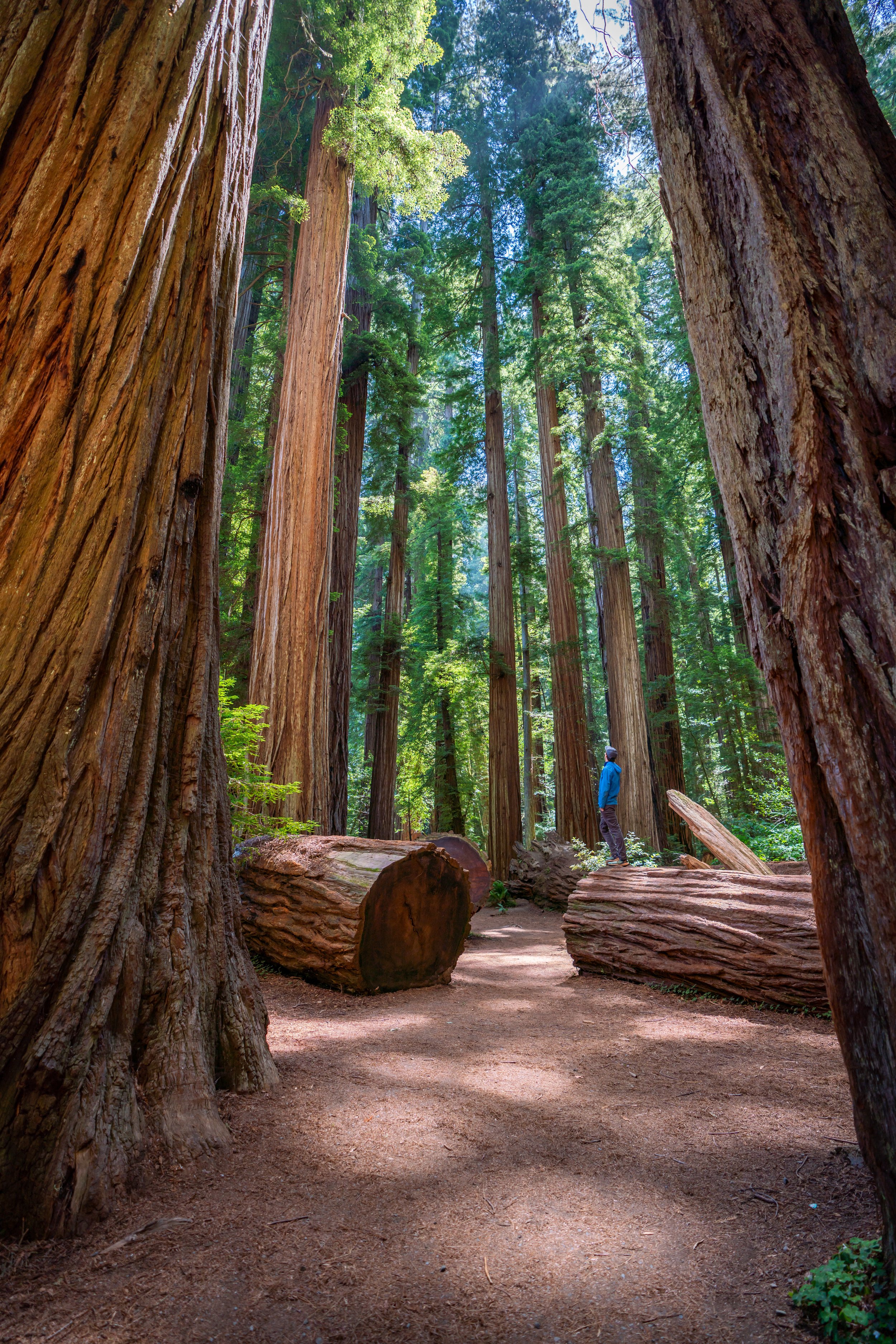
Brown Creek-Rhododendron Trailhead Parking
The Brown Creek-Rhododendron-West Ridge Loop could begin in a number of different directions, depending on which trailhead you choose to begin. However, I wrote this beginning from the South Fork Trailhead, which is how I’ve always hiked this trail.
In any case, parking for the loop is located at either at the South Fork-Karl Knapp Trailhead or at the Moorman Pond Trailhead, both of which are located north of the Prairie Creek Visitor Center on the side of Newton B. Drury Scenic Parkway.
Google Maps Directions: South Fork-Karl Knapp Trailhead / Moorman Pond Trailhead
Hiking Checklist - Redwoods
Here is a complete list of must-have things that you will want for any hike in Redwood National & State Parks.
Bear Spray & Holster - If you aren’t flying, don’t rent bear spray! It’s a waste of money. Prepare ahead of time by buying your own, as this may be one of the most important items on this list.
Osprey 3L Water Bladder - The Osprey 3L water bladder is the most universal hiking and backpacking water bladder on the market, and it’s my go-to because of the slide-off seal that allows it to be quickly filled from the top. Additionally, individual parts are easily replaceable, such as the bite valve.
Black Diamond Headlamp - Personally, I recommend the Black Diamond Storm because it is one of the brightest, lightest, and longest-lasting headlamps on the market—and trust me, the weight-to-battery-life ratio really does matter!
Hiking / Trail Running Shoes - Depending on the type of trail, I prefer to use either the Keen Targhee for longer, more rugged hiking or the HOKA Zinal Trail-Running Shoe for lighter, less intense trails. In either case, both have been amazing to me for many years across countless environments, and both can be found in men’s and women’s sizes. - (Men’s Keen / Women’s Keen) (Men’s HOKA / Women’s HOKA)
Blister / Heel Protectors - I swear by these cheap, amazing heel protectors to prevent blisters for nearly every kind of hiking and backpacking that I do!
Waterproof Rain Shell - You never know when it may rain, and I’ve learned over the years that a rain shell is far better than a rain jacket. By this, I mean that it’s best to have something that the water will roll right off of, which is why I recommend the Patagonia Torrentshell 3L available in both men’s and women’s sizes.
High SPF Sunscreen - Packing high-SPF sunscreen is a must for long days outside!


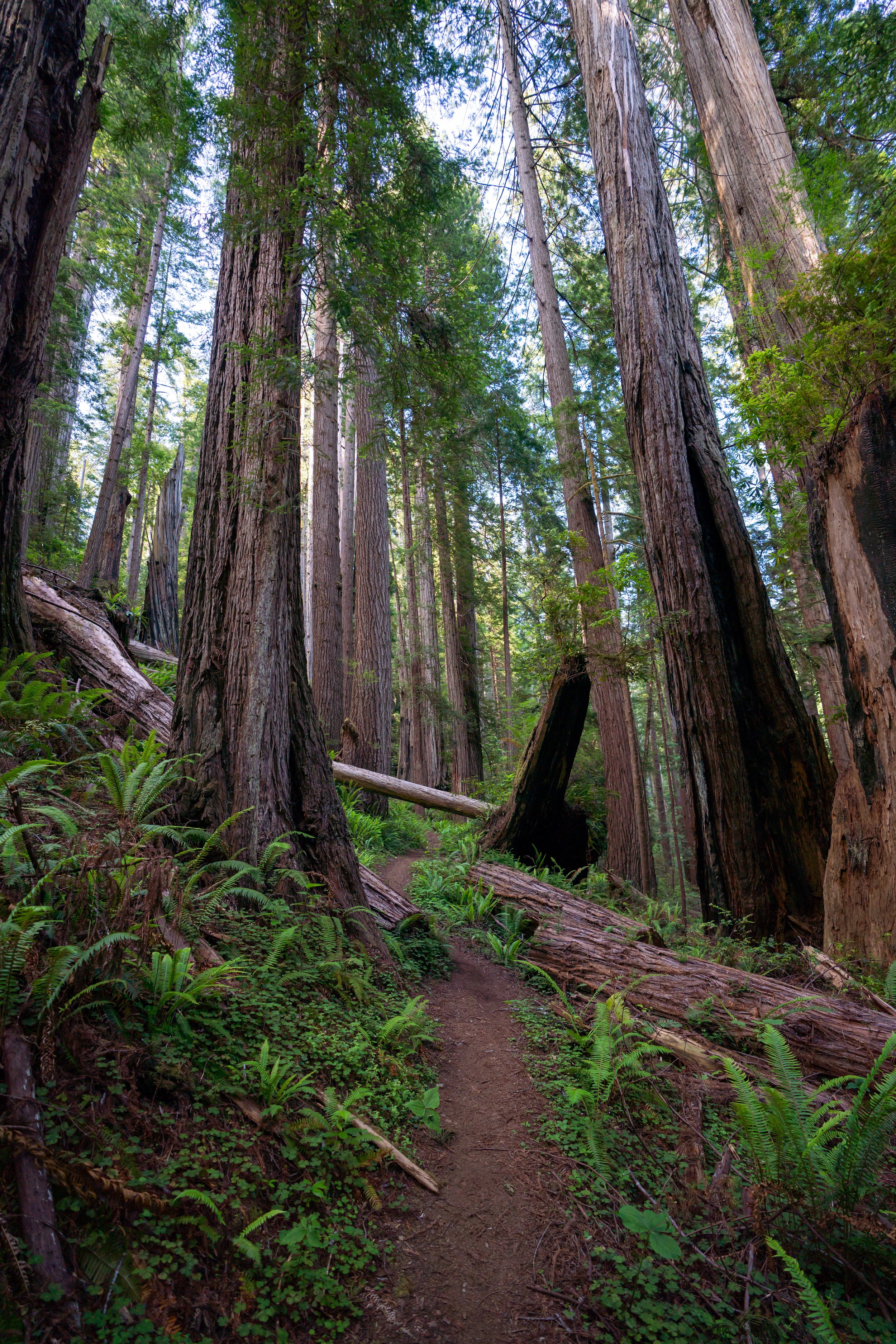
Hiking the Brown Creek-Rhododendron-West Ridge Loop Trail
As mentioned previously, the Brown Creek-Rhododendron-West Ridge Loop could begin from a number of directions, but in this post, I started from the South Fork Trailhead and hiked toward Brown Creek.
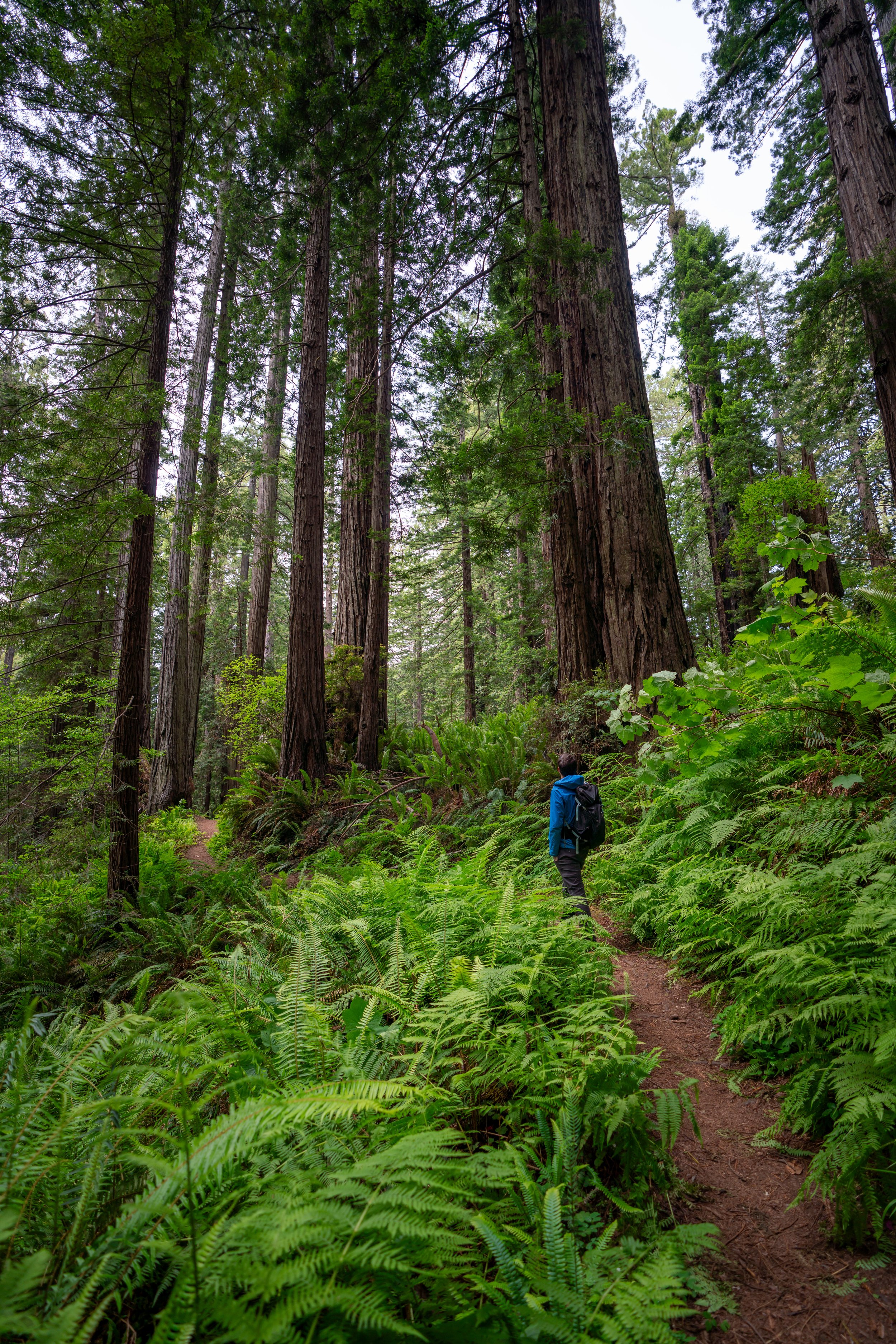
South Fork Trailhead
Distance: 0.3 miles / 0.5 km
In its entirety, the South Fork Trail is only 0.3 miles (0.5 km) long, which then links up with the Brown Creek Trail for the next 1.2 miles (1.9 km).
South Fork-Foothill Junction
After about 0.25 miles (0.4 km), the South Fork will pass by the Foothill Trail, which is a popular hike for those looking to hike to the Big Tree.
Keep going straight (left) to reach the Brown Creek Trail shortly after.
South Fork-Brown Creek Junction
Distance: 1.2 miles / 1.9 km
From the start of Brown Creek Trail, go left to continue on the most direct route to the Rhododendron Trail.
I have hiked this loop in the summer and winter, and in my experience, the summer had much higher bear activity than I’ve ever seen in the winter.
Carl Schenck Grove
After hiking about two-thirds of the Brown Creek Trail, a little side trail called the Carl Schenck Grove will be located across the creek.
It only adds about 0.1 miles (0.2 km) to see the grove.
This was only some of the scat in the area, but there was no shortage of bear activity along the lower elevations of this loop.
However, when the loop climbed above both Brown and Prairie Creeks on the Rhododendron/ West Ridge Trails, the signs of bear activity dropped considerably.
That’s not to say that they aren’t everywhere, but in my experience, I’ve almost exclusively encountered bears near a water source.
Brown Creek-Rhododendron Junction
Distance: 3.1 miles / 5.0 km
Where the Brown Creek Trail ends, the Rhododendron Trail begins.
Turn left to continue on the loop.
In June, there was no shortage of flowers blooming.
These Rhododendrons are exactly where the trail gets its name.
Along with bears and elk, there’s also no shortage of Banana slugs.
C.R.E.A. Junction
After 1.6 miles (2.6 km), the Rhododendron Trail will pass by the C.R.E.A. Trail, which is a shorter trail that connects out to Highway 101 to the east.
Don’t follow it, but rather, stay straight on the Rhododendron Trail until it hits the parkway.
Rhododendron-Moorman Pond Trailhead
Once at the parkway, the look across and to the left to find the Moorman Pond Trailhead shortly ahead.
Karl Knapp-Zig Zag #2 Junction
Distance: 0.6 miles / 1.0 km
Then, almost immediately after the Moorman Pond Trailhead is the junction of the both the Karl Knapp and Zig Zag #2 Trails.
If at this point you wanted to take the easiest path back to the South Fork Trailhead, turn left here, and the Karl Knapp Trail will follow the base of the West Ridge along Prairie Creek all the way back to the beginning. There is essentially no elevation change on this route.
However, if you want to complete this loop as it is written in this post, turn right on the Zig Zag #2 Trail, which will connect with the West Ridge in 0.6 miles (1.0 km).
If it influences your decision, I saw no signs of bear activity on the West Ridge, but almost immediately after descending back down to Prairie Creek, the evidence was abundant again.
Zig Zag #2 Trail
The Zig Zag #2 Trail only stays flat for a short distance before it starts climbing up the West Ridge on the far side of Prairie Creek.
That may sound intimidating, but the trail only gains about 300 ft. (91 m) from the creek to the ridge.
Zig Zag #2-West Ridge Junction
Distance: 1.5 miles / 2.4 km
After a few switchbacks, the Zig Zag #2 Trail ends at the West Ridge.
Go left to continue on the loop back to the South Fork Trailhead.
In my opinion, the West Ridge always feels very easy once you’ve climbed up the switchbacks from the creek below, as it simply meanders through some amazing Redwoods that most visitors don’t venture this far to see!
West Ridge-Zig Zag #1 Junction
Distance: 0.5 miles / 0.8 km
The next junction that the West Ridge meets is the Zig Zag #1 Trail, which will complete the loop back down to Prairie Creek and the South Fork Trailhead shortly after.
Turn left, and the Zig Zag #1 Trail will start descending off the ridge until it reaches Prairie Creek below.
Karl Knapp (Prairie Creek) Junction
Distance: 0.6 miles / 1.0 km
At the bottom of the West Ridge, the Zig Zag #1 Trail meets up with the same Karl Knapp Trail (Prairie Creek Trail) that immediately followed the Moorman Pond Trailhead shown above. This sign may be mislabeled.
Turn right to complete the loop, which will remain flat for the remainder of the hike out to the parkway.
Parkway Junction
Distance: 0.1 miles / 0.2 km
Immediately after the second Prairie Creek bridge crossing, take the short 0.1-mile (0.2 km) trail that connects back out to the parkway.
South Fork Trailhead
Overall, the Brown Creek-Rhododendron-West Ridge Loop is one of the longer loops that you can do within Prairie Creek, but it is no where near the longest.
This and other trails through Prairie Creek could be hiked in any number of directions, but if you’re looking for a longer hike to spend most of a day, I couldn’t recommend this one any higher!
Additionally, you might consider the James Irvine-Fern Canyon-Miners Ridge Loop, which is typically started from the Prairie Creek Visitor Center.
More Redwood Adventures
If you’re interested in reading about some more amazing adventures within Redwood National & State Parks, check out my separate posts below!
Best Way to Find Places to Stay!
Wherever I travel, I love to start my search for places to stay on VRBO.
Even if I don’t end up booking through them, I think it’s one of the best ways to see what’s in the area!

Washington
Best Way to Book Rental Cars!
I travel quite a bit, and I know firsthand that finding a good rental car deal can be a challenge, but that’s why I recommend comparing all of your options with Discover Cars.
In short, Discover Cars is a well-known, reputable business that allows you to search for the best deal across companies, and they have the best full-refund cancellation policy I’ve ever seen, valid up to 72, or sometimes even 48, hours prior to your reservation!
Book Here: Discover Cars

Discover Cars!
Safety
Throughout the Redwoods, Elk and Black Bears are common, and it’s important to know how to react in the event of either wildlife encounter.
Moreover, while hiking in black bear territory usually presents less danger compared to grizzlies, hiking with bear spray is never a bad idea. However, it’s really up to your own discretion and comfort level.
As always, find the most up-to-date information and conditions on the official National Park website.
National Park Service: Redwood National & State Parks
U.S. National Parks Pass
Did you know that the same America the Beautiful Pass that grants access to all 63 U.S. National Parks can be purchased in advance at REI?
Yes, you can save time when you arrive by purchasing your National Park pass, along with your other outdoor gear, at REI before traveling to the park!
More U.S. National Parks
If you’d like to read more about some of my best recommendations when visiting other U.S. National Parks, check out some of my other posts below!


Disclaimer
All information provided on this blog is for informational purposes only and is not intended to be a substitute for information or advice from qualified professionals or managing agencies.
Noah Lang Photography LLC makes no representations or warranties regarding the accuracy or completeness of the information provided here, and readers should use their own discretion, judgement, and seek professional advice where it is appropriate.
Furthermore, Noah Lang Photography LLC shall not be held responsible for any injuries, lost individuals, or legal issues arising from the use of information provided on this website, and if applicable, the above safety disclaimer should be referenced to provide a generic overview of the risks involved.
All said, the content on this blog is for the sole use of Noah Lang Photography LLC, and unauthorized use or reproduction of this content is strictly prohibited.
Disclosure
This post is not sponsored.
However, some of the links in this post are affiliate links, which means that I may earn a small commission if a purchase is made through one of those links. This commission comes at no additional cost to you, and I only recommend products that I personally use and believe will add value to my readers. Thank you for your support, which enables me to continue creating more!
To read the full privacy policy, click here.

About This Blog
Noah Lang Photography, also known as @noahawaii, is 100% reader-supported!
I do not accept guest articles or sponsored content of any kind on my blog, which is why, if you enjoy the outdoor and travel content I create, please consider buying me a coffee!
I appreciate your support, which helps me continue to keep this blog alive!