


Hiking the Cape Sebastian Trail on the Oregon Coast
Distance: 3.6 miles / 5.8 km
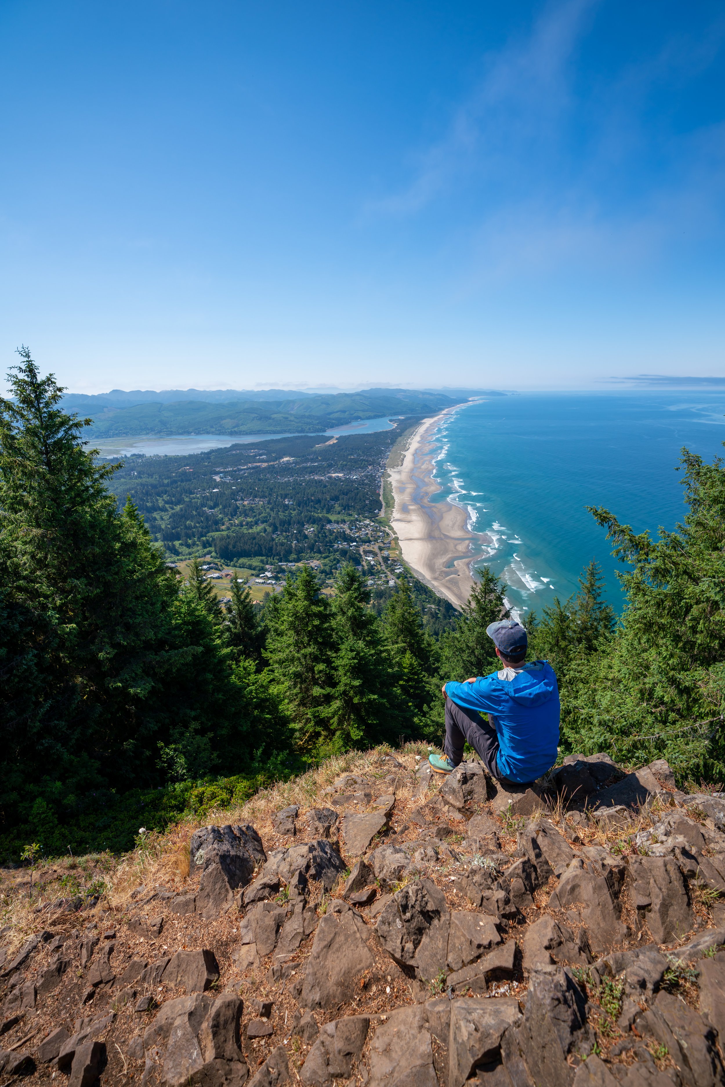
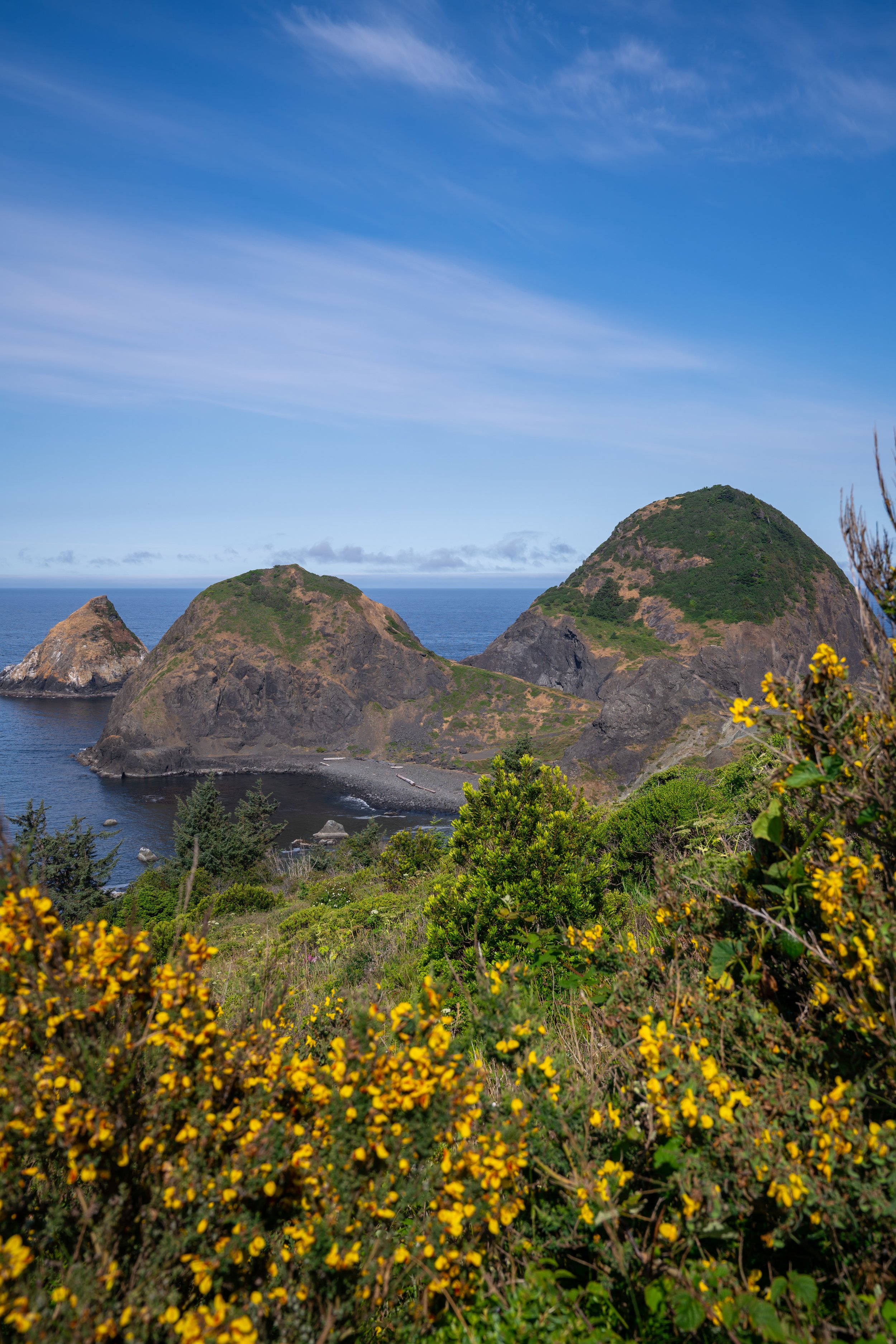
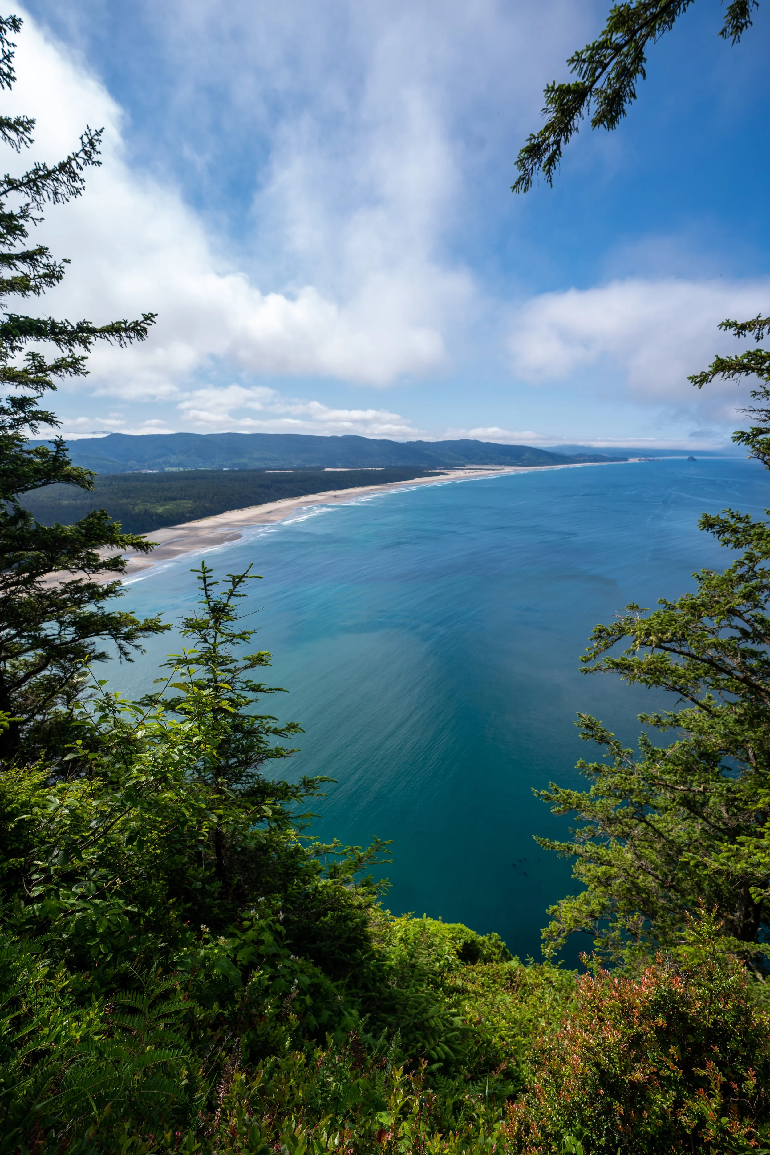
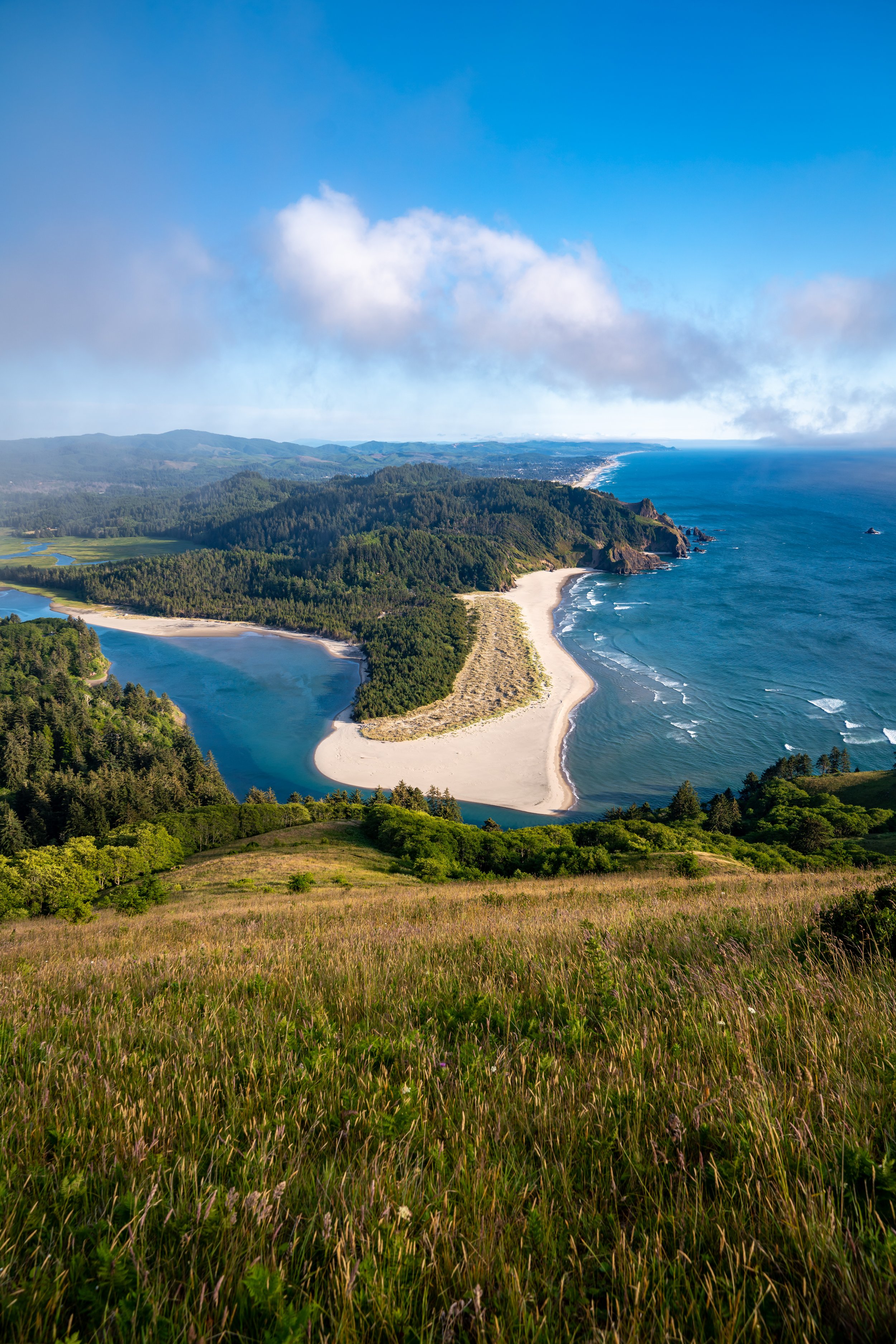
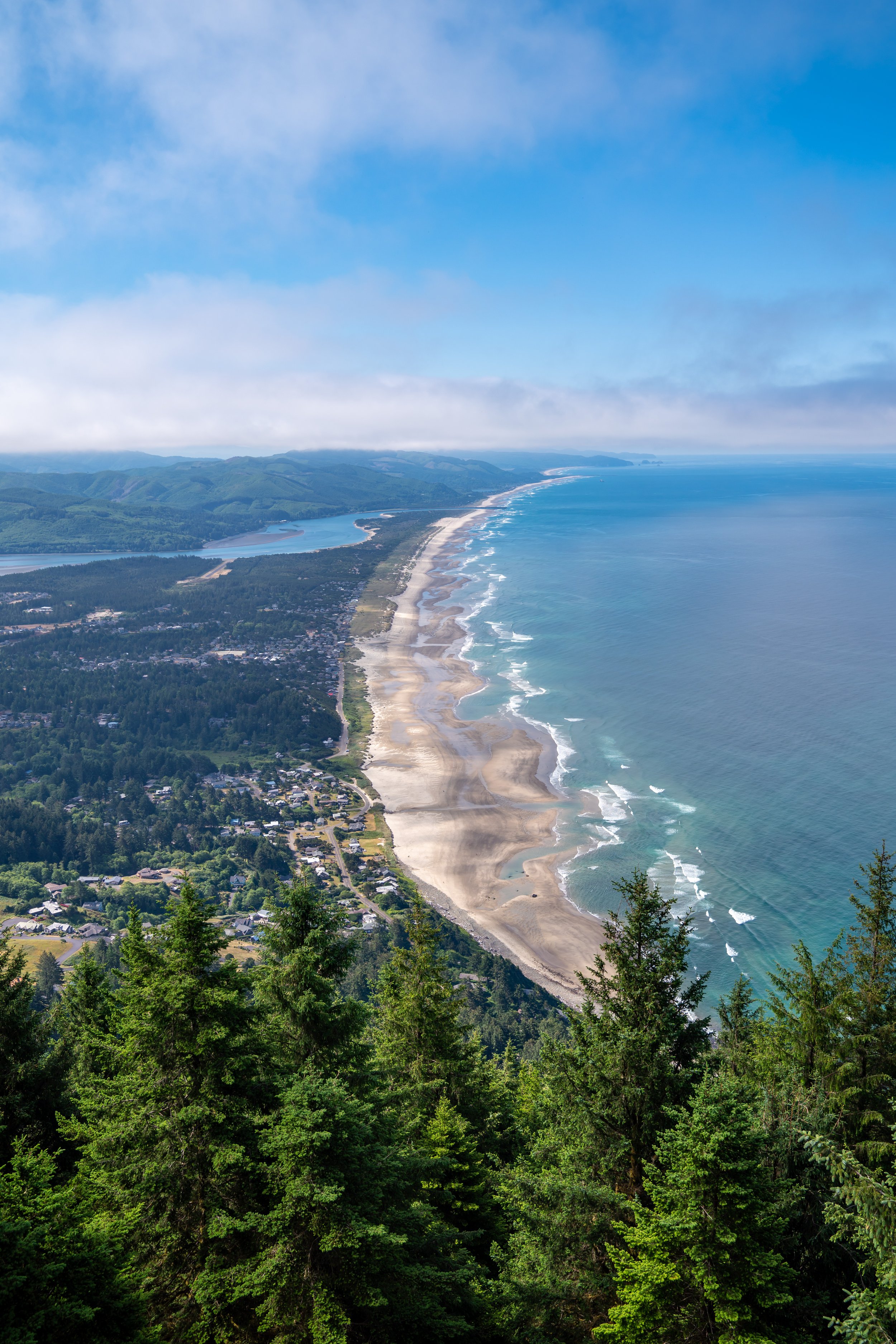
The Cape Sebastian Trail on the southern Oregon Coast is a visitor and local favorite because of the beautiful views that can be seen from the trail within only a short distance of beginning the hike.
That said, the Cape Sebastian Trail to Hunters Cove at the end of the trail is typically a very quiet, uncrowded adventure, as most beachgoers from the neighboring Meyers Creek Beach just down the road don’t venture this far up the coast.
This means that those interested in hiking the full Cape Sebastian Trail will more than likely have a very secluded stretch of beach on the Oregon Coast all to themselves!
Cape Sebastian Trailhead Parking
Parking for the Cape Sebastian Trail is located is a small paved parking lot within the Cape Sebastian State Scenic Corridor off of Highway 101.
Depending on the time of day, this parking lot can fill up quickly when the trail it at its busiest.
Google Maps Directions: Cape Sebastian Trailhead
Hiking Checklist - Oregon Coast
Black bears can be found up and down the Oregon Coast, but hiking with or without bear spray is truly up to your own discretion and comfort level when adventuring in black bear territory.
Furthermore, here is a complete list of must-have things that you will want for any hike on the Oregon Coast.
Hiking the Cape Sebastian Trail
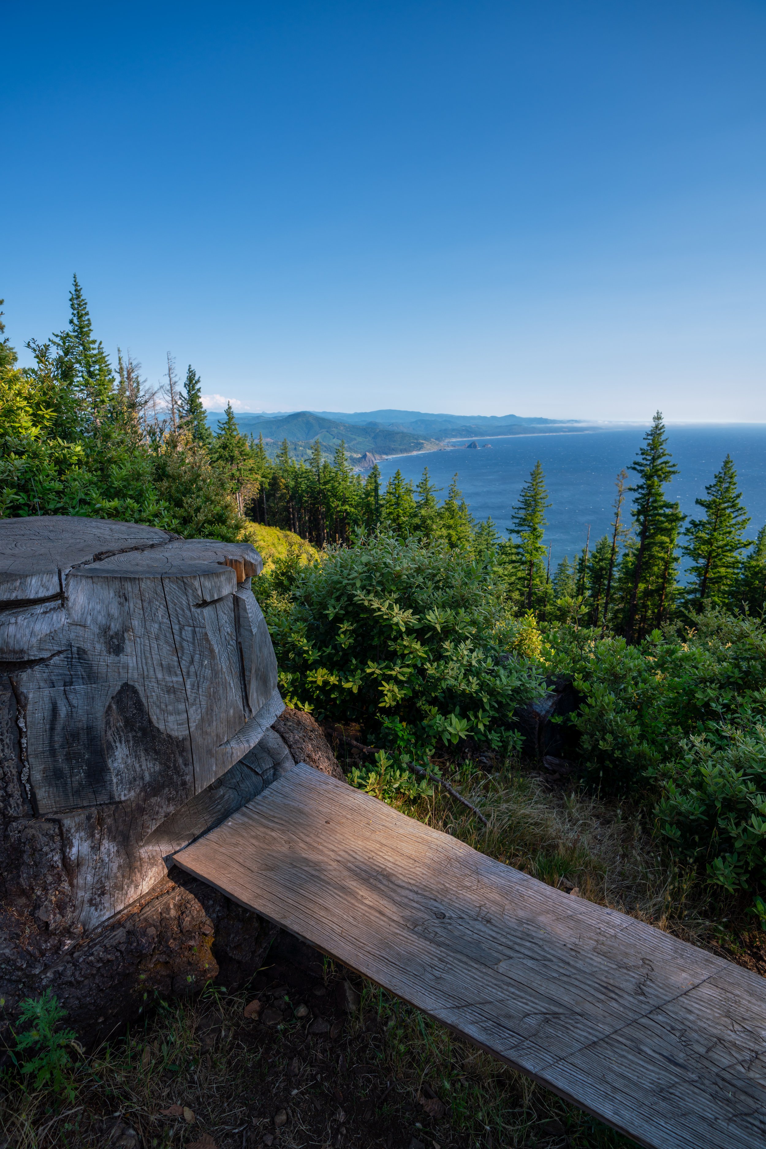
The Cape Sebastian Trail is nearly an all downhill hike, as the trail descends about 650 ft. (198 m) from the trailhead to Hunters Cove down below.
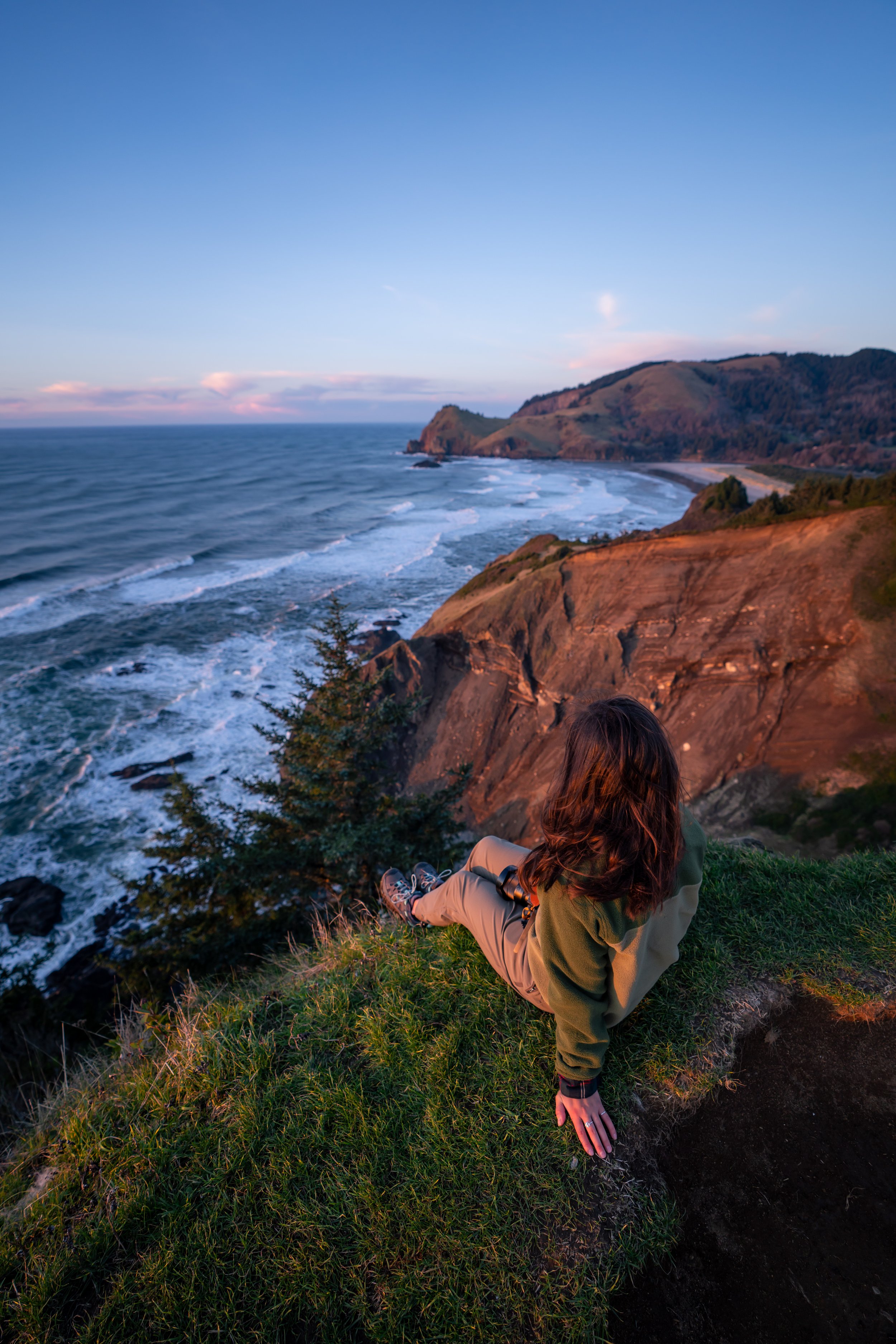
In my opinion, some of the best views on the entire trail were within the first 0.25 miles (0.4 km) of the trailhead.
At about 0.5 miles (0.8 km), the Cape Sebastian Trail begins descending a series of 9 or 10 switchbacks, depending on how you count.
This is also where the most challenging part of the hike is on the way back to the trailhead.
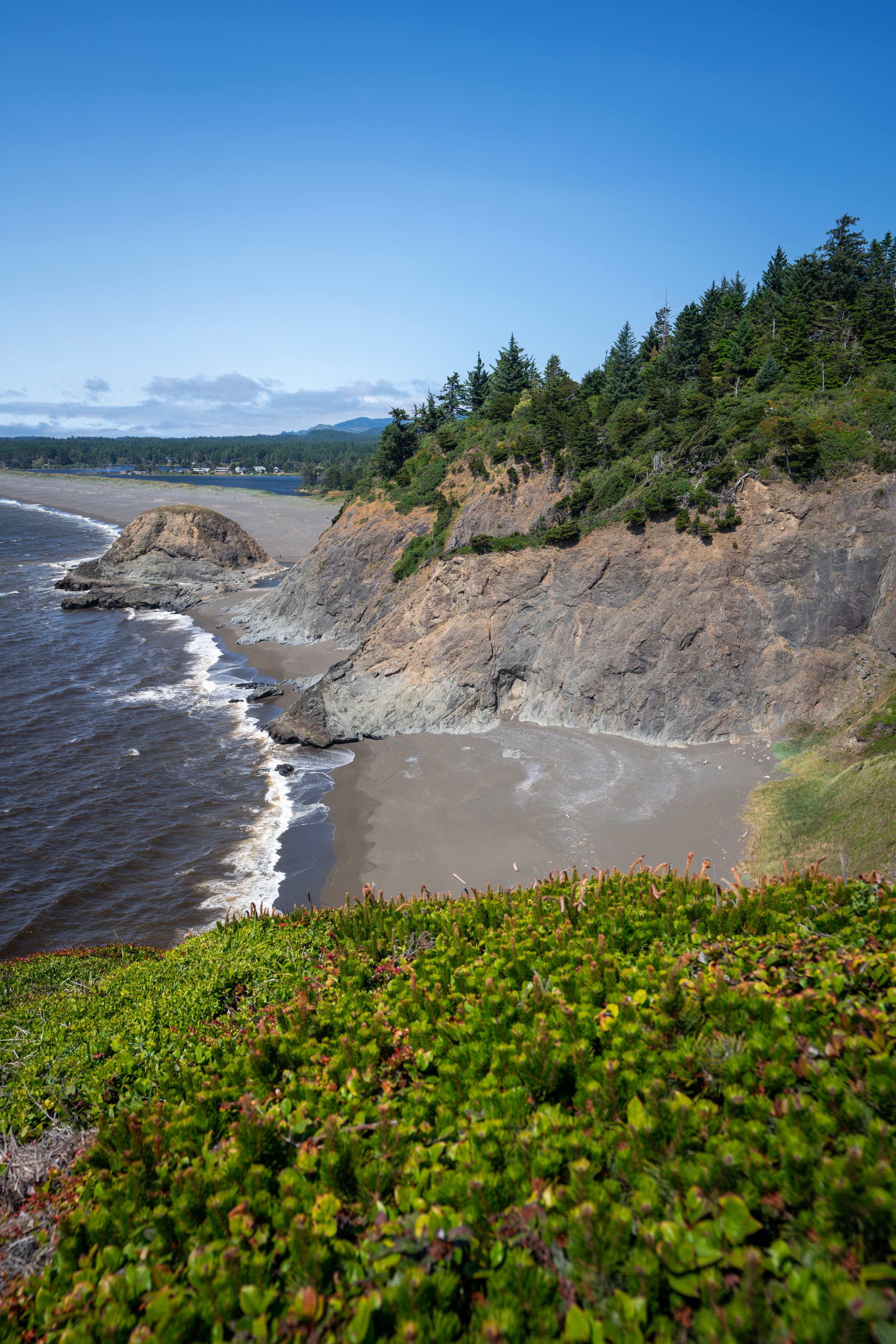
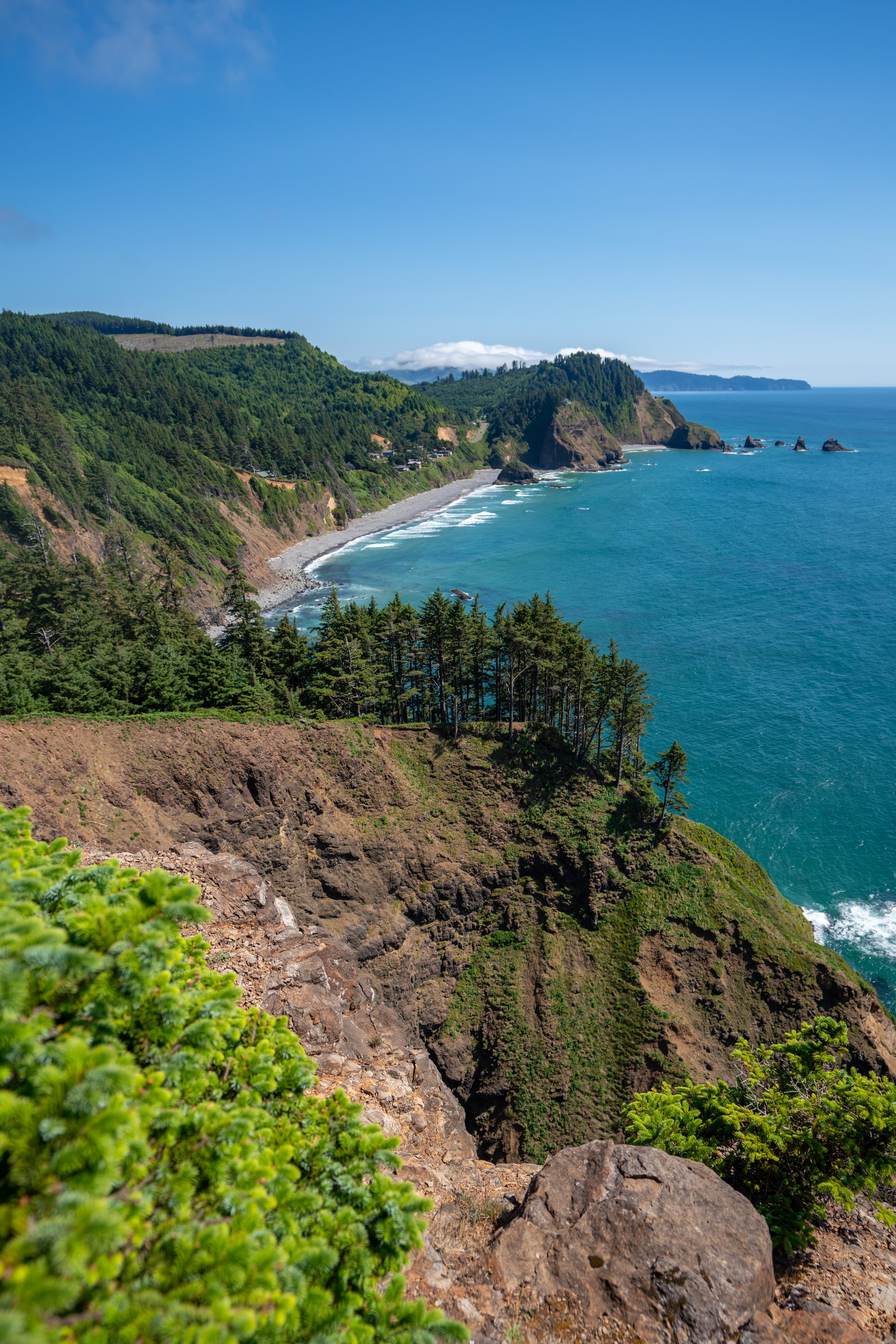
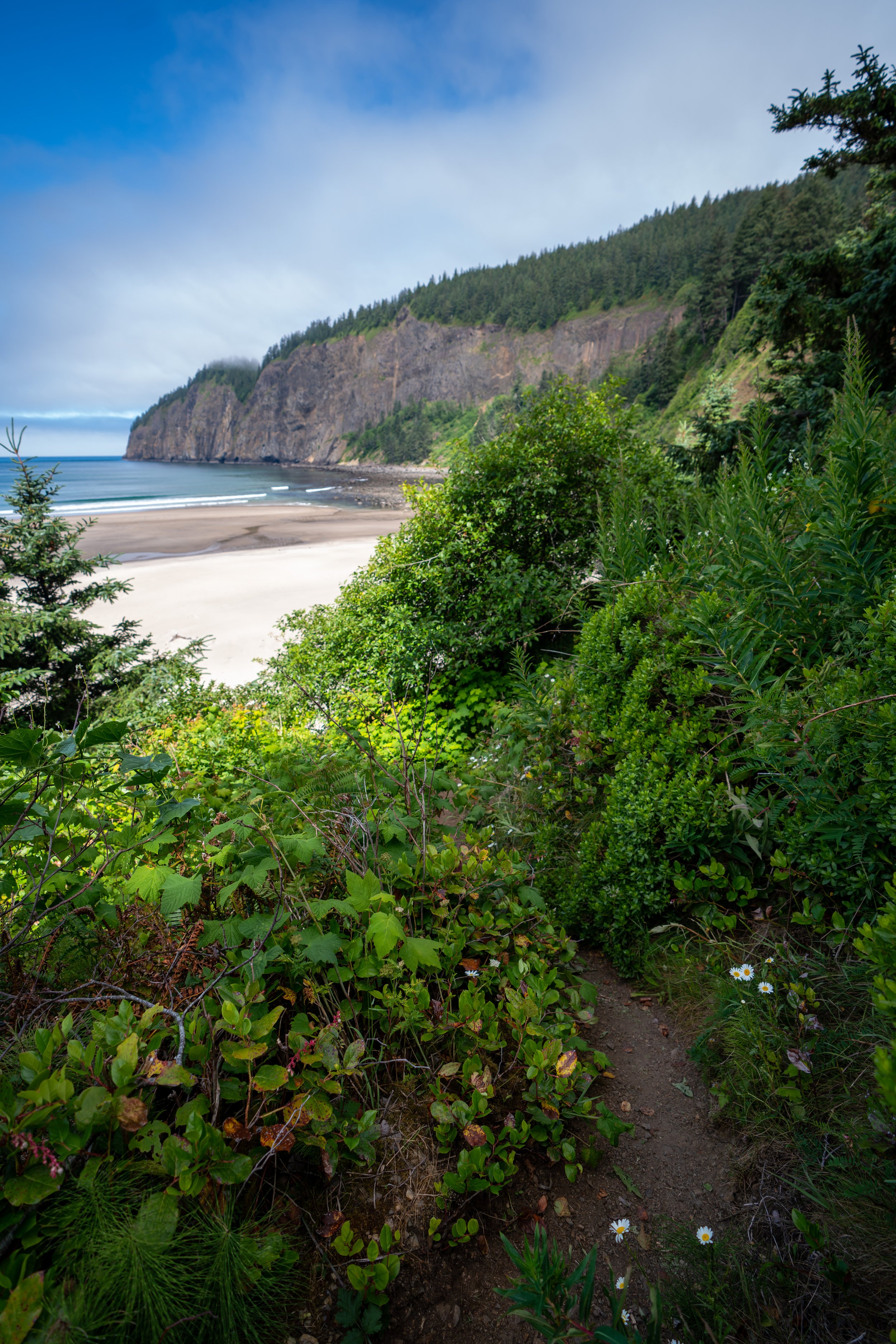
When the trail reaches the bottom, it will parallel the coastline until the last descent down to Hunters Cove.
Watch out for poison oak on these stretches, as I was able to identify a number of plants directly adjacent to the trail.
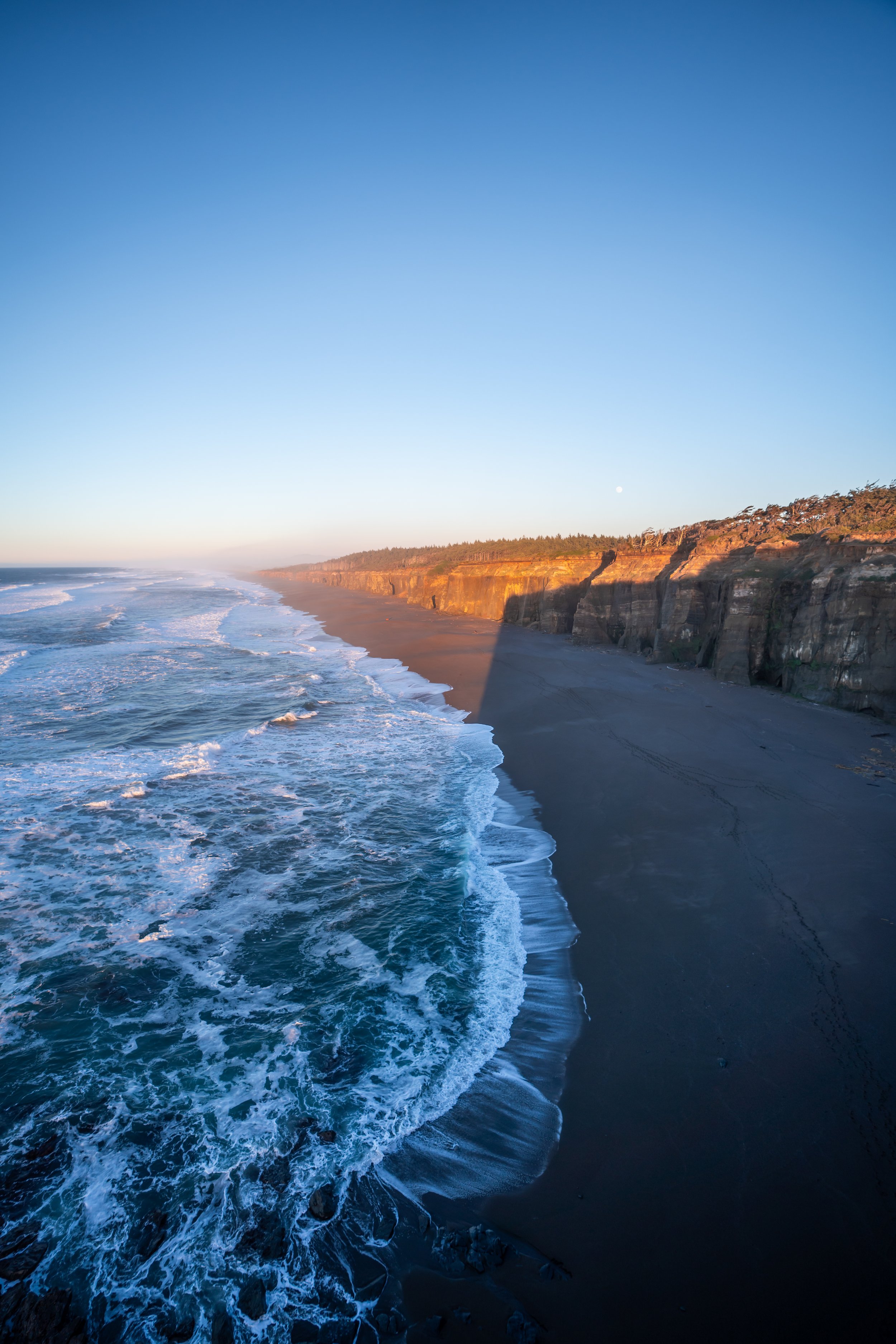
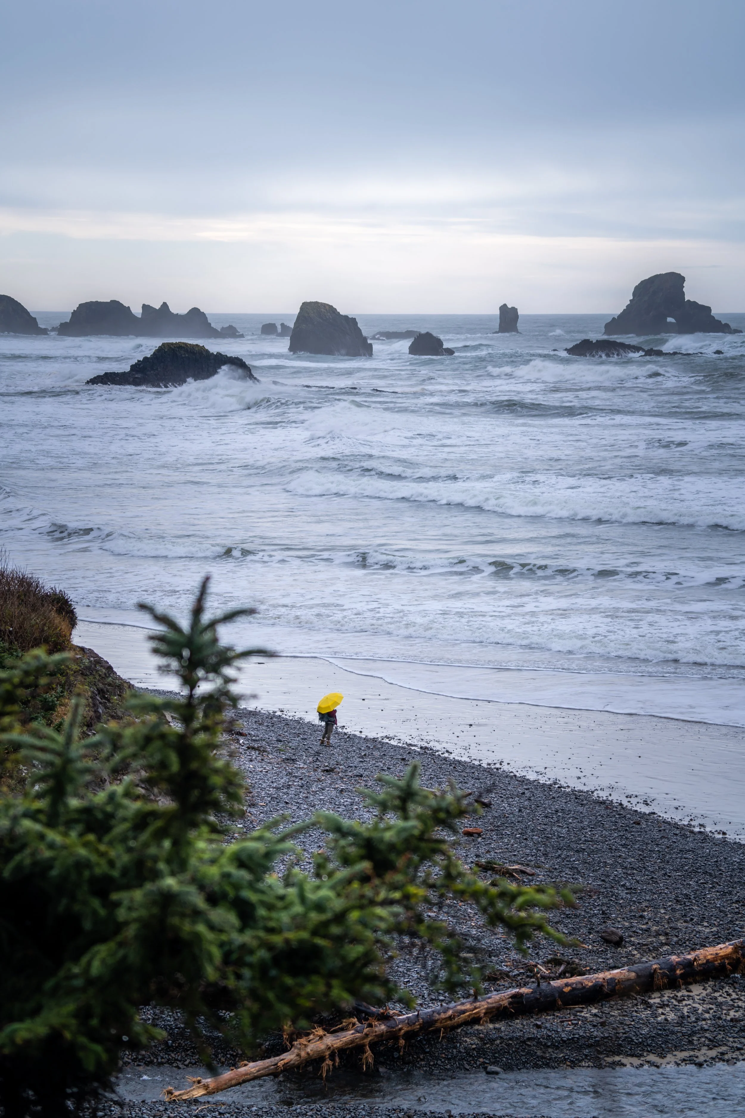
The last stretch down to the beach is about as steep as it looks.
Without the rope present, it would be a very slippery walk on the loose dirt or mud, especially if it happens to be raining.
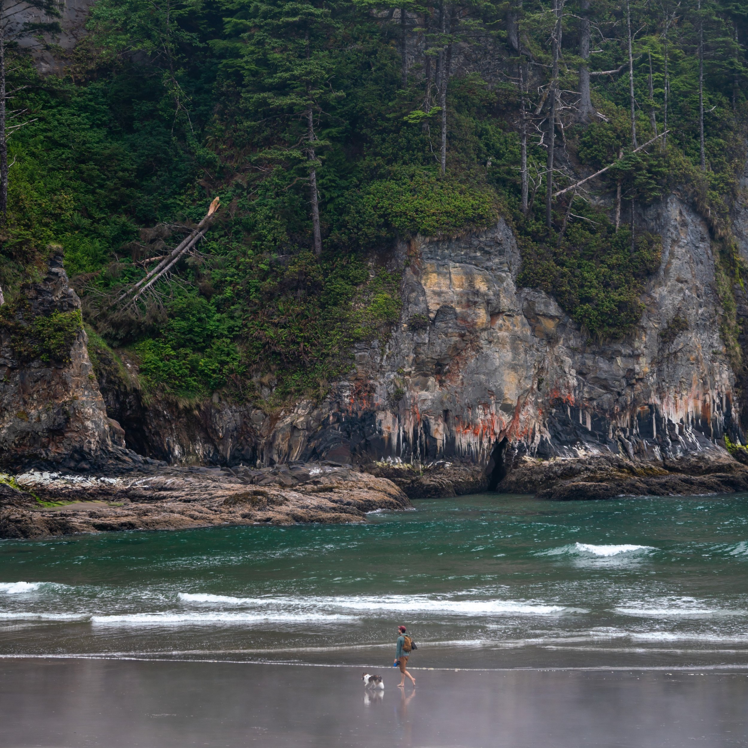
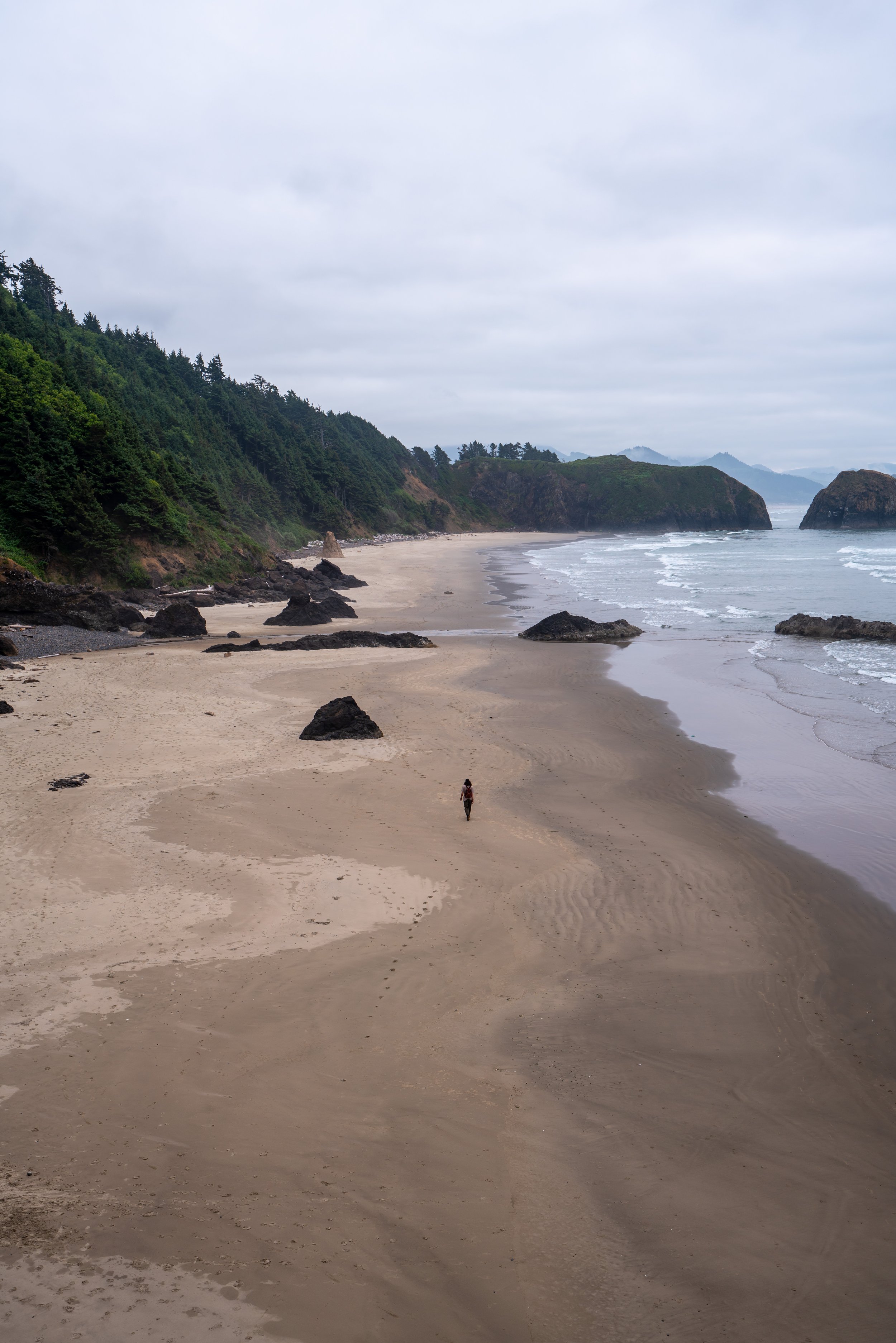
Meyers Creek Beach (Hunters Cove)
The official Meyers Creek Beach is located about 0.75 miles (1.2 km) away, which means that the beautiful stretch of sand around Hunters Cove will likely be empty, with the exception of other hikers.
Best Way to Find Places to Stay!
Wherever I travel, I love to start my search for places to stay on VRBO.
Even if I don’t end up booking through them, I think it’s one of the best ways to see what’s in the area!

Washington
Best Way to Book Rental Cars!
I travel quite a bit, and I know firsthand that finding a good rental car deal can be a challenge, but that’s why I recommend comparing all of your options with Discover Cars.
In short, Discover Cars is a well-known, reputable business that allows you to search for the best deal across companies, and they have the best full-refund cancellation policy I’ve ever seen, valid up to 72, or sometimes even 48, hours prior to your reservation!
Book Here: Discover Cars

Discover Cars!
Disclosure
This post is not sponsored.
However, some of the links in this post are affiliate links, which means that I may earn a small commission if a purchase is made through one of those links. This commission comes at no additional cost to you, and I only recommend products that I personally use and believe will add value to my readers. Thank you for your support, which enables me to continue creating more!
To read the full privacy policy, click here.

About This Blog
Noah Lang Photography, also known as @noahawaii, is 100% reader-supported!
I do not accept guest articles or sponsored content of any kind on my blog, which is why, if you enjoy the outdoor and travel content I create, please consider buying me a coffee!
I appreciate your support, which helps me continue to keep this blog alive!