


Hiking the Golden Canyon-Gower Gulch Loop Trail via Zabriskie Point in Death Valley National Park
Distance: 7.5 miles / 12.1 km
Both Golden Canyon and Gower Gulch in Death Valley National Park are two sister trails in the Black Mountains, just outside of Furnace Creek, that are commonly combined into one longer adventure—hence the name Golden Canyon-Gower Gulch Loop Trail.
That said, the Golden Canyon-Gower Gulch Loop is easily one of the best and most beautiful day hikes in Death Valley—especially when hiked later in the day, toward golden hour!
I say this because the Black Mountains, including the Red Cathedral, light up best in the late afternoon and evening light, as opposed to earlier in the day when these photos were taken.
In any case, the distance above reflects the total Golden Canyon-Gower Gulch Loop, including the hike up to the Red Cathedral. However, excluding the out-and-back Red Cathedral Trail, the Golden Canyon-Gower Gulch Loop Trail is only 6.5 miles (10.5 km) total.
U.S. National Park Pass
Did you know that the same America the Beautiful Pass that grants access to all 63 U.S. National Parks can be purchased in advance at REI?
Yes, you can save time when you arrive by purchasing your National Park pass, along with your other outdoor gear, at REI before traveling to the park!


Zabriskie Point Trailhead Parking
I prefer starting this hike at Zabriskie Point because the Golden Canyon-Gower Gulch Loop is best hiked shortly after sunrise. This way, you can watch the sunrise from Zabriskie Point and then continue with the hike from the same place.
Starting at sunrise also makes parking much easier, which can be competitive at both the Golden Canyon and Zabriskie Point Trailheads.
The photo on the left shows how crowded the parking lot was getting even before sunrise, and the Golden Canyon Trailhead can be just as busy by mid-morning.
Google Maps Directions: Zabriskie Point Trailhead
Hiking Checklist - Death Valley
Here is a complete list of must-have things that you will want for any hike in Death Valley National Park.
Osprey 3L Water Bladder - The Osprey 3L water bladder is the most universal hiking and backpacking water bladder on the market, and it’s my go-to because of the slide-off seal that allows it to be quickly filled from the top. Additionally, individual parts are easily replaceable, such as the bite valve.
Blister / Heel Protectors - I swear by these cheap, amazing heel protectors to prevent blisters for nearly every kind of hiking and backpacking that I do!
Black Diamond Headlamp - Personally, I recommend the Black Diamond Storm because it is one of the brightest, lightest, and longest-lasting headlamps on the market—and trust me, the weight-to-battery-life ratio really does matter!
Hiking / Trail Running Shoes - Depending on the type of trail, I prefer to use either the Keen Targhee for longer, more rugged hiking or the HOKA Zinal Trail-Running Shoe for lighter, less intense trails. In either case, both have been amazing to me for many years across countless environments, and both can be found in men’s and women’s sizes. - (Men’s Keen / Women’s Keen) (Men’s HOKA / Women’s HOKA)
Waterproof Rain Shell - You never know when it may rain, and I’ve learned over the years that a rain shell is far better than a rain jacket. By this, I mean that it’s best to have something that the water will roll right off of, which is why I recommend the Patagonia Torrentshell 3L available in both men’s and women’s sizes.
Sun Shirt w/ Hood - A quality sun shirt can be your best friend on a trail with minimal shade, which can be found in both men’s and women’s sizes.
High SPF Sunscreen - Packing high-SPF sunscreen is a must for long days outside!


Hiking the Golden Canyon-Gower Gulch Loop Trail
The Golden Canyon-Gower Gulch Loop Trail could easily be hiked from Zabriskie Point, or the Golden Canyon Trailhead. However, for the reasons that I mentioned under parking, I prefer to hike it from this direction.
Also, starting the loop shortly after sunrise is one of the best ways to beat the sun!
Initially, the Zabriskie Point Trail drops down into a typically dry wash for the first 0.5 miles (0.8 km) until the Zabriskie Point Junction.
In the photo below on the left, you can see people enjoying the sunrise up at Zabriskie Point.
Zabriskie Point Junction - (Golden Canyon-Gower Gulch Split)
At the Golden Canyon-Gower Gulch split, you can either take go up to the right to take the Golden Canyon Trail first or continue in the wash the hike Gower Gulch first.
I like to hike the Golden Canyon Trail first because there’s more ups and downs that are better hiked in the shade, compared to the relatively flat Gower Gulch.
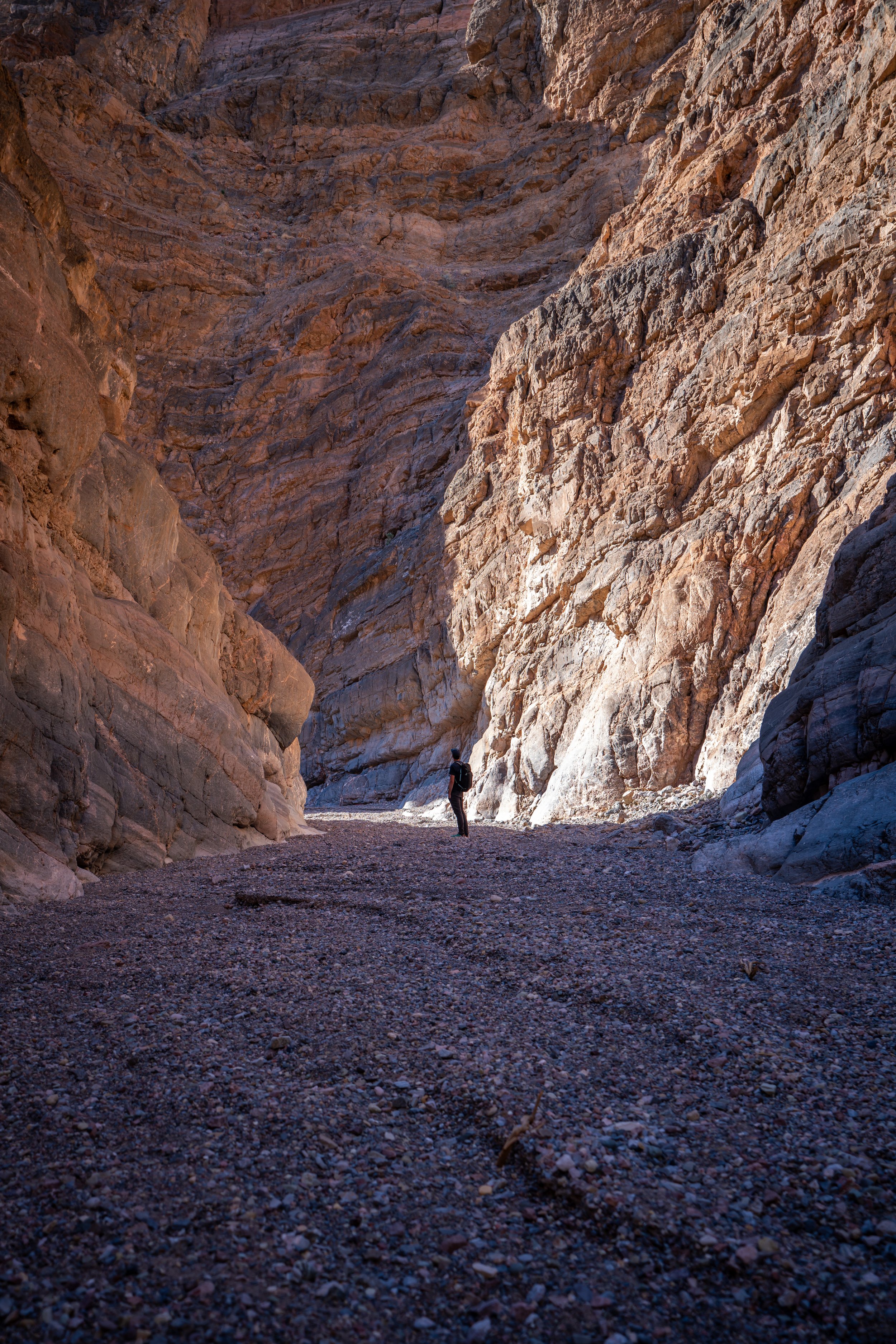
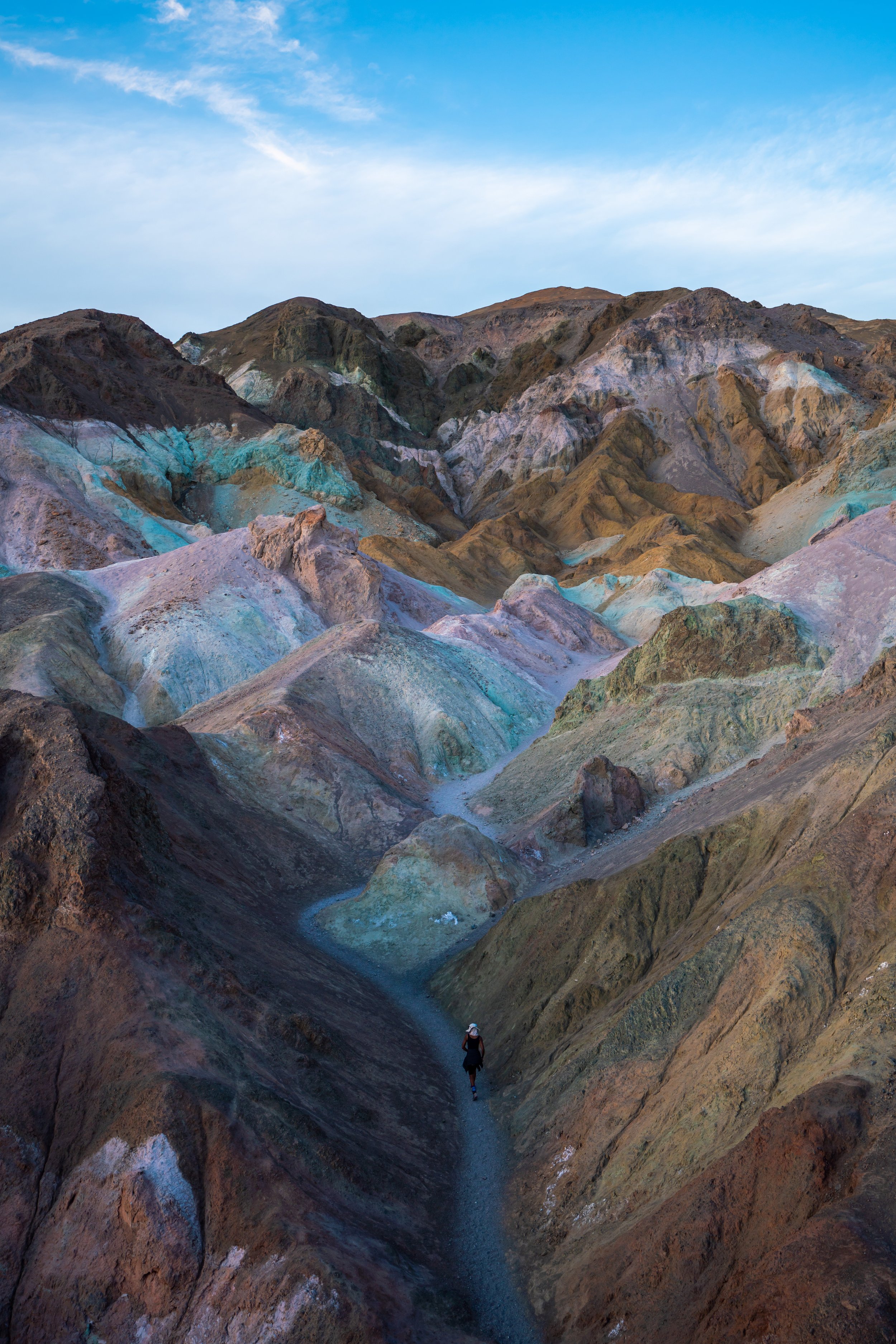
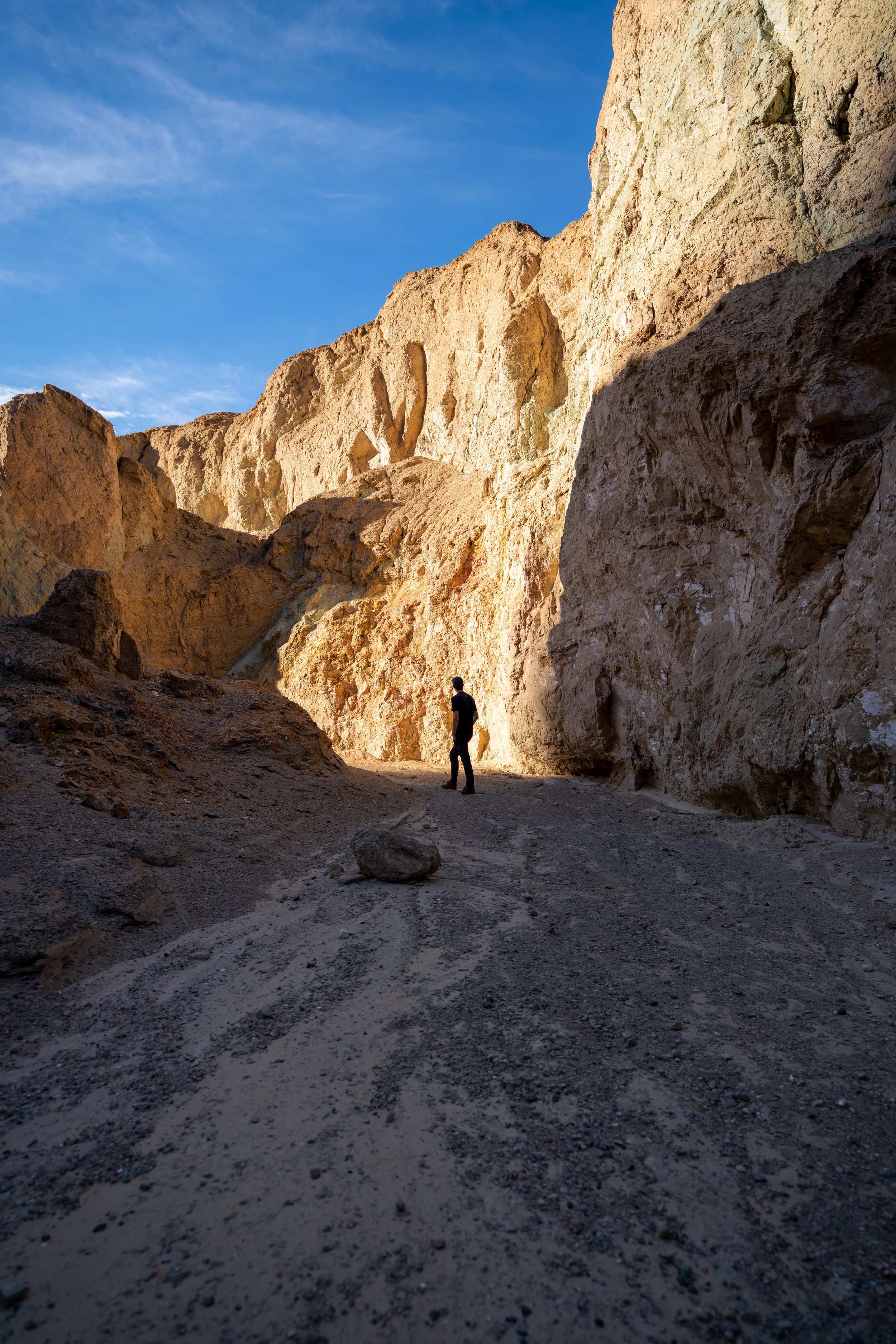
Golden Canyon Trail
The Golden Canyon Trail is one of the best opportunities to get great photos on the entire loop trail.
In my opinion, the rolling ridges and panoramic views of the Panamint Range to the west cannot be beat compared to other areas on the loop.
Badlands Junction
The Badlands Junction is for the shorter and easier Zabriskie Point Loop, also called the Badlands Loop.
Go left to take the shorter loop trail back to Zabriskie Point or continue right on the Golden Canyon Trail to the Red Cathedral Trail.
Red Cathedral Junction
At the Red Cathedral Junction, you can either go left to continue on the Golden Canyon Trail or right for the Red Cathedral Trail.
The Red Cathedral is 0.5 miles (0.8 km) away from this junction, and the trail takes you to a beautiful amphitheater of red rock that is the cathedral.

Red Cathedral Junction
Red Cathedral Trail
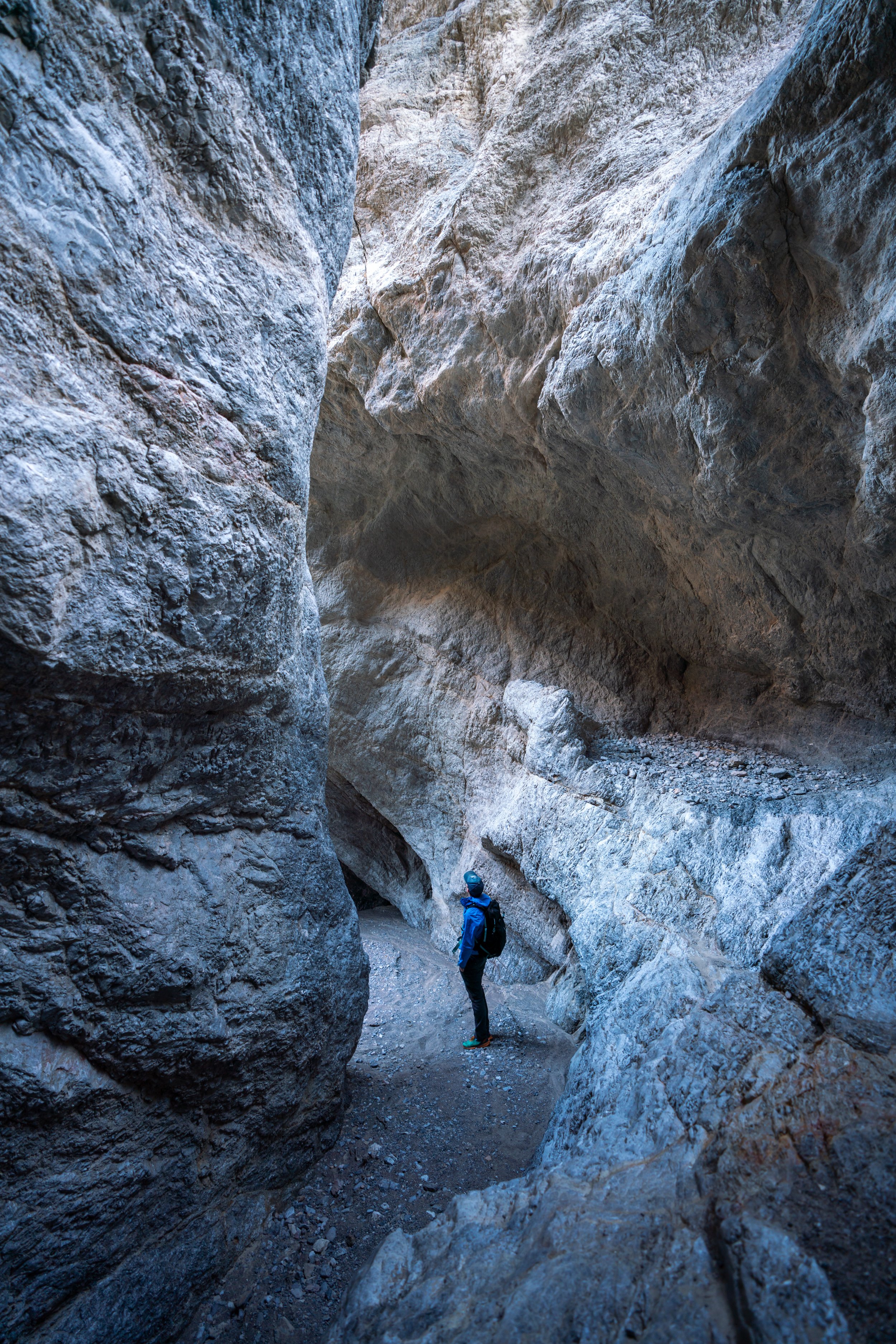
I branched off of the main loop to check out the beautiful Red Cathedral.
It’s much easier to squeeze through the rocks on the left than to try and hike around on the right.
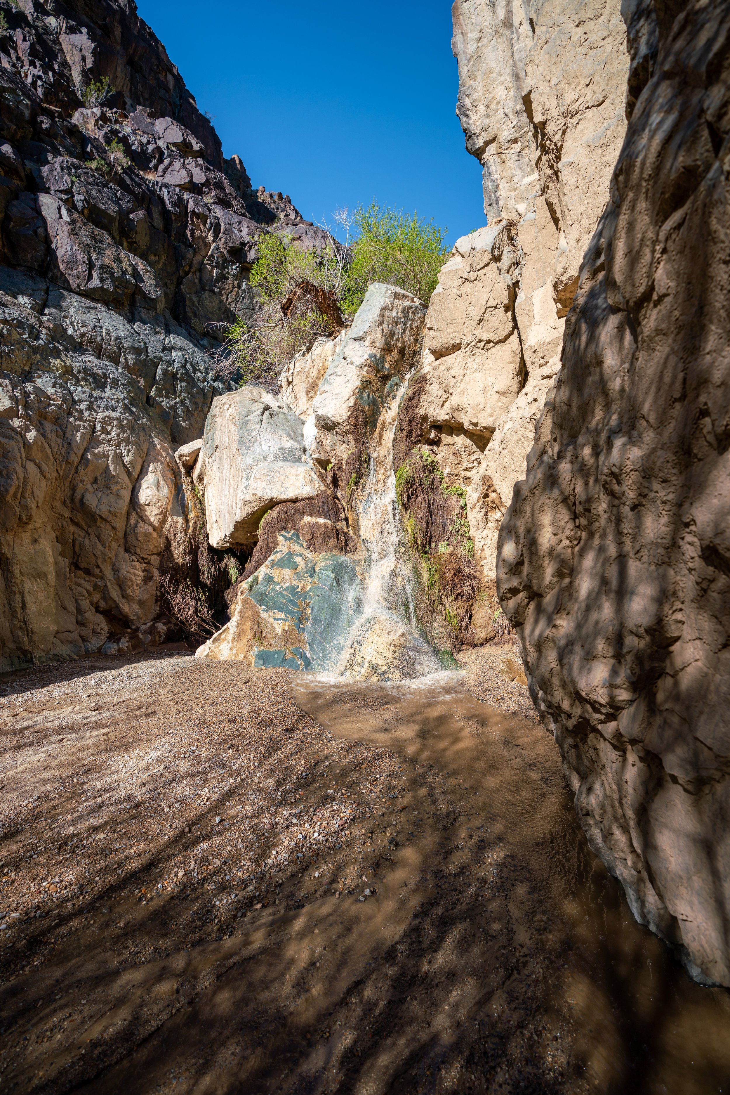
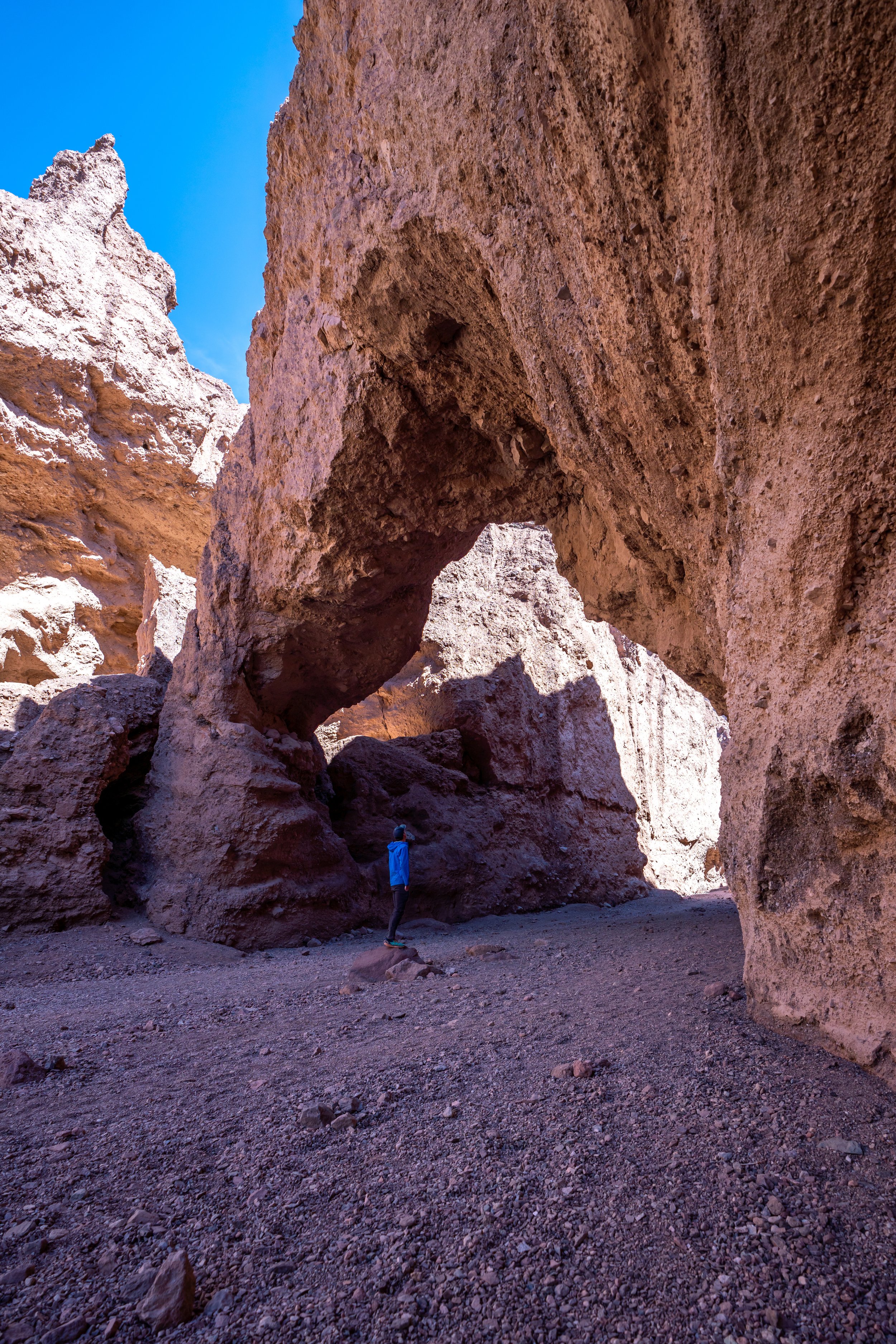
Red Cathedral
I don’t think that this photo does a good job at showing how beautiful the Red Cathedral is when you stand beneath it and look up.
Someday, I plan to return at sunset because I can see how beautiful this red rock would light up in the evening sun.
Golden Canyon Trail - (Red Cathedral Junction)
From the Red Cathedral junction, there is only 1.0 mile (1.6 km) left to reach the Golden Canyon Trailhead.
This is also where you can expect to see more people on the Golden Canyon Trail because many people only hike from the trailhead to the Red Cathedral and back.
Golden Canyon Trailhead
Like Zabriskie Point, the Golden Canyon Trailhead is also a tight place to park.
When it’s mid-afternoon and the trail is at its busiest, cars can typically be seen lining the highway because the Golden Canyon is such a popular place to start.
Golden Canyon-Gower Gulch Connector Trail
Distance: 0.8 miles / 1.3 km
Honestly speaking, the connector trail between Golden Canyon and Gower Gulch has to be worst part of the trail.
It’s best to do this part while it’s still early enough and you can get shade from the ridges, but since I spent so long enjoying the sunrise at Zabriskie Point, this stretch ended up being the longest most exposed section in the hot March sun.
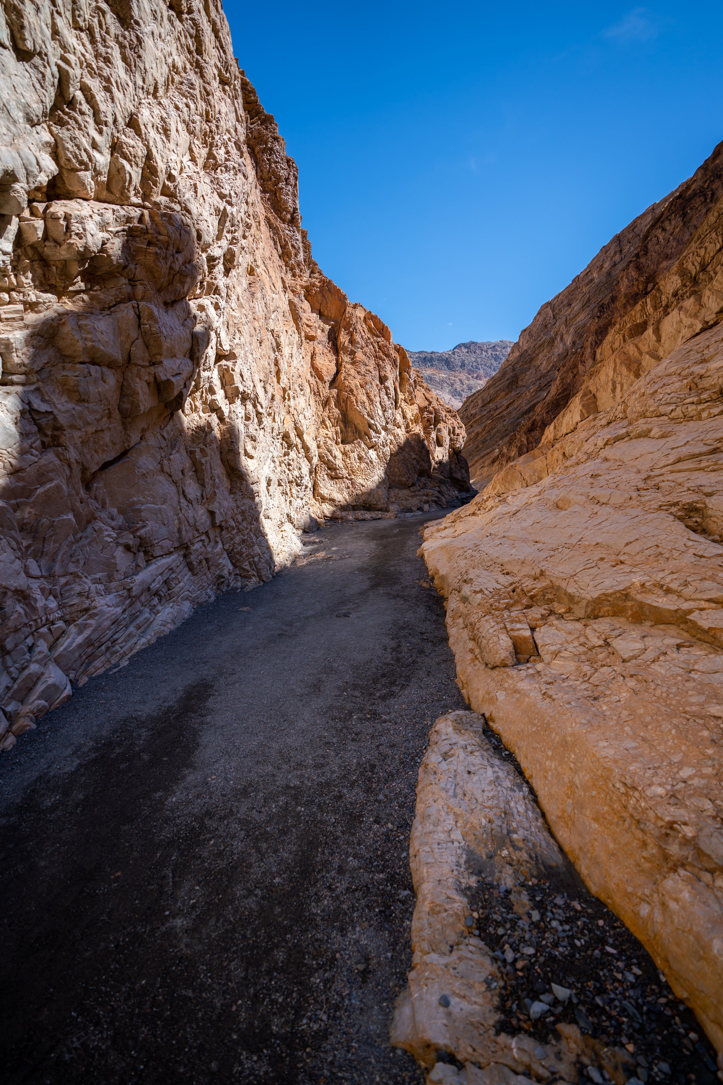
Gower Gulch Trail
In my opinion, some of the best views of Gower Gulch are right in the beginning as you get off of the connector trail.
As the gulch nears the Badlands Loop and the Zabriskie Point Junction, the trail provides much less shade than other parts of the loop, which can make for a very hot, exposed hike depending on the time of the year.
Shortly after entering the gulch, there are a few small ledges to scramble up.
This is where the Gower Gulch Trail really started to lose all its shade by 10 a.m.
Gower Gulch Junction
At the Gower Gulch Junction, you can either go left to use the Badlands Loop to connect back to the Golden Canyon Trail, or continue straight until you reach the Zabriskie Point Junction where I initially branched off on the Golden Canyon Trail.
In these photos, I decided to continue straight in order to complete the Gower Gulch Trail instead of retracing my steps on the Zabriskie Point Trail, which I had originally started on.
Additionally, it’s slightly shorter to continue straight on the Gower Gulch Trail.
Zabriskie Point Junction
This is the same junction from earlier when I initially took the Golden Canyon Trail.
By the time I returned to the Zabriskie Point Trailhead, there were lines of cars all wanting my parking spot right in the front.
More Death Valley Adventures
If you’re interested in reading about some more amazing adventures within Death Valley National Park, check out my separate posts below!

Best Way to Find Places to Stay!
Wherever I travel, I love to start my search for places to stay on VRBO.
Even if I don’t end up booking through them, I think it’s one of the best ways to see what’s in the area!

Washington
Best Way to Book Rental Cars!
I travel quite a bit, and I know firsthand that finding a good rental car deal can be a challenge, but that’s why I recommend comparing all of your options with Discover Cars.
In short, Discover Cars is a well-known, reputable business that allows you to search for the best deal across companies, and they have the best full-refund cancellation policy I’ve ever seen, valid up to 72, or sometimes even 48, hours prior to your reservation!
Book Here: Discover Cars

Discover Cars!
Safety
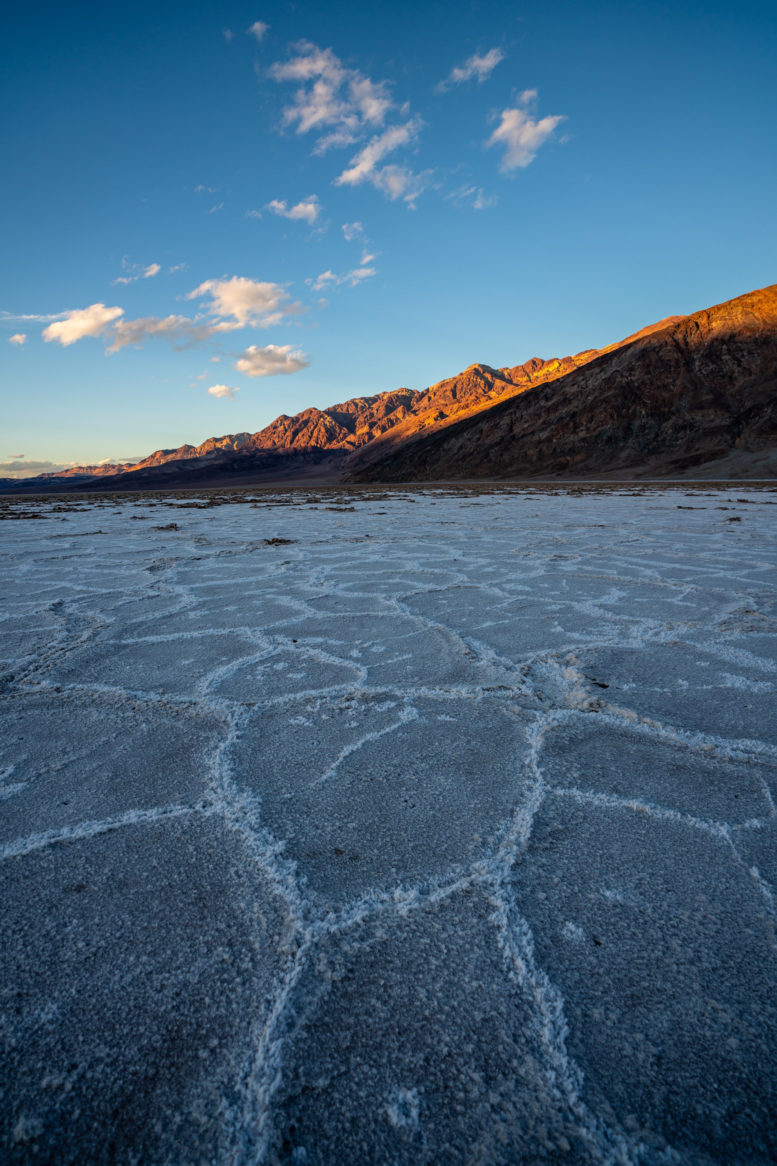
For obvious reasons, Death Valley National Park is widely known for its extreme temperatures and extreme temperature swings, as the park spans from -282 ft. (-86 m) at Badwater Basin to just over 11,000 ft. (3,353 m) atop Telescope Peak.
That being said, the National Park Service recommends visiting in October - April, but even then, exposed hiking during October and April can be pushing it. However, November - February are easily the most desirable months to hike in Death Valley, with the best spring flowers peaking from late March to early April.
Additionally, there are three venomous snakes in Death Valley, as well as scorpions and black widow spiders, meaning it’s important to be mindful where you place your hands and feet—especially when scrambing in the canyons.
In all, always hike with 2-3L of water per person and never take the extreme weather conditions lightly, as the heat has claimed many lives over the years!
As always, find the most up-to-date information and conditions on the official National Park website.
National Park Service: Death Valley National Park
U.S. National Parks Pass
Did you know that the same America the Beautiful Pass that grants access to all 63 U.S. National Parks can be purchased in advance at REI?
Yes, you can save time when you arrive by purchasing your National Park pass, along with your other outdoor gear, at REI before traveling to the park!
More U.S. National Parks
If you’d like to read more about some of my best recommendations when visiting other U.S. National Parks, check out some of my other posts below!


Disclaimer
All information provided on this blog is for informational purposes only and is not intended to be a substitute for information or advice from qualified professionals or managing agencies.
Noah Lang Photography LLC makes no representations or warranties regarding the accuracy or completeness of the information provided here, and readers should use their own discretion, judgement, and seek professional advice where it is appropriate.
Furthermore, Noah Lang Photography LLC shall not be held responsible for any injuries, lost individuals, or legal issues arising from the use of information provided on this website, and if applicable, the above safety disclaimer should be referenced to provide a generic overview of the risks involved.
All said, the content on this blog is for the sole use of Noah Lang Photography LLC, and unauthorized use or reproduction of this content is strictly prohibited.
Disclosure
This post is not sponsored.
However, some of the links in this post are affiliate links, which means that I may earn a small commission if a purchase is made through one of those links. This commission comes at no additional cost to you, and I only recommend products that I personally use and believe will add value to my readers. Thank you for your support, which enables me to continue creating more!
To read the full privacy policy, click here.

About This Blog
Noah Lang Photography, also known as @noahawaii, is 100% reader-supported!
I do not accept guest articles or sponsored content of any kind on my blog, which is why, if you enjoy the outdoor and travel content I create, please consider buying me a coffee!
I appreciate your support, which helps me continue to keep this blog alive!