


Hiking the Highline Trail (The Loop) in Glacier National Park
Distance (One Way): 13.3 miles / 21.4 km
The Highline Trail in Glacier National Park is one of the most beautiful day hikes off Going-to-the-Sun Road!
That being said, the Highline Trail is one that visitors often approach in a variety of ways because of its longer distance—some choosing to treat it as an out-and-back adventure, while others prefer to hike one way.
In my opinion, the best way to hike the Highline Trail is to complete 'The Loop', including the optional 0.8-mile (1.3 km) ascent up to the Grinnell Glacier Overlook, which is included in the distance above.
What is the Highline Trail Loop?
For those interested in hiking the Highline Trail, the first decision to make is whether to treat the trail as an out-and-back hike or a one-way trail—hence the term 'The Loop.'
What 'The Loop' really refers to is a one-way hike from the Logan Pass Visitor Center to the Loop Trailhead, where you would then take the Glacier Shuttle back up Going-to-the-Sun Road to return to Logan Pass.
This is a relatively 'new' option in Glacier National Park because of the 2020 implementation of the Glacier shuttle, which effectively made 'The Loop' the best strategy as opposed to treating the Highline Trail as an out-and-back adventure—and know, an out-and-back hike is a much more difficult choice.
I say this because the majority of the Highline Trail, from Logan Pass to The Loop Trailhead, is all downhill, with only a few notable uphill sections, which I’ll highlight more below.
What is the Best Time of Day to Begin the Highline Trail?
The answer to this question is easy: early morning, but how early is the true question.
First of all, arriving at Logan Pass well before sunrise is essential to find parking, but when to actually begin the trail is what’s up for debate.
Some hikers prefer to start hiking shortly after arriving, but I personally recommend against this strategy. I say this because the best of the Highline Trail is all before Haystack Butte, so if you start hiking shortly after arriving, you’ll miss the most scenic views on the entire trail by starting in the dark. However, by waiting an hour or two, you are inevitably going to be spending more time in the sun, which is why many groups prefer to start before sunrise.
That being said, the Highline Trail is very well shaded in the morning hours because of the mountains that parallel the trail, but as the day goes on, it becomes apparent how little shade there really is on the entire hike.
This is why I recommend starting early enough to try and avoid the sun, but not too early to miss out on the views! For this to work best, hiking with a hooded sun shirt is essential because trying to continually reapply sunscreen as you’re sweating is not the best strategy, and nearly every hiker that ended at the The Loop Trailhead was sunburned in one way or another. For me, it was my face, but my hat and sun shirt did most of the work that sunscreen could not.


U.S. National Park Pass
Did you know that the same America the Beautiful Pass that grants access to all 63 U.S. National Parks can be purchased in advance at REI?
Yes, you can save time when you arrive by purchasing your National Park pass, along with your other outdoor gear, at REI before traveling to the park!

Highline Trailhead Parking
Logan Pass is the most difficult area of Glacier National Park to find parking.
On every nice day during the busy summer season, you can expect the Logan Pass Visitor Center parking lot to fill with cars completely by 7:05-7:10 a.m. I’ve watched it happen more than once.
This means that by 7:20 a.m. cars are already circling the parking lot trying to find a spot, which won’t open up until the first hikers return from the Hidden Lake Overlook.
This also means that if you want to hike either the Hidden Lake or Highline Trail from Logan Pass, you need to arrive by 6:30 a.m. or earlier to be safe, which means factoring in the long drive up Going-to-the-Sun Road from the west entrance. The east entrance to Logan Pass is a bit of a shorter drive.
Overall, having a Glacier vehicle reservation does not mean much if you’re plan is to hike from Logan Pass because of how popular/ competitive it is to find parking.
Google Maps Directions: Logan Pass
Hiking Checklist - Glacier
Here is a complete list of must-have things that you will want for any hike in Glacier National Park.
Bear Spray & Holster - If you aren’t flying, don’t rent bear spray! It’s a waste of money. Prepare ahead of time by buying your own, as this may be one of the most important items on this list.
Osprey 3L Water Bladder - The Osprey 3L water bladder is the most universal hiking and backpacking water bladder on the market, and it’s my go-to because of the slide-off seal that allows it to be quickly filled from the top. Additionally, individual parts are easily replaceable, such as the bite valve.
Black Diamond Headlamp - Personally, I recommend the Black Diamond Storm because it is one of the brightest, lightest, and longest-lasting headlamps on the market—and trust me, the weight-to-battery-life ratio really does matter!
Hiking / Trail Running Shoes - Depending on the type of trail, I prefer to use either the Keen Targhee for longer, more rugged hiking or the HOKA Zinal Trail-Running Shoe for lighter, less intense trails. In either case, both have been amazing to me for many years across countless environments, and both can be found in men’s and women’s sizes. - (Men’s Keen / Women’s Keen) (Men’s HOKA / Women’s HOKA)
Blister / Heel Protectors - I swear by these cheap, amazing heel protectors to prevent blisters for nearly every kind of hiking and backpacking that I do!
Waterproof Rain Shell - You never know when it may rain, and I’ve learned over the years that a rain shell is far better than a rain jacket. By this, I mean that it’s best to have something that the water will roll right off of, which is why I recommend the Patagonia Torrentshell 3L available in both men’s and women’s sizes.
High SPF Sunscreen - Packing high-SPF sunscreen is a must for long days outside!


Hiking the Highline Trail
The Highline Trail begins directly across the road from the Logan Pass Visitor Center, and for the 1.0 miles (1.6 km), the hike is all downhill until the trail begins approaching Haystack Butte.
Almost immediately after starting the hike, the trail was surrounded with bighorn sheep on either side.
If you encounter them, give them space because they have been known to charge at people.
There are many high-exposure sections throughout the trail where you cannot fall; or it would almost certainly mean death, and I say this for two reasons.
First, the Highline Trail (The Loop) is absolutely not a kid-friendly hike because of the long distance, the sun exposure, and the high cliff exposure throughout the hike. However, perhaps more importantly, the Highline Trail is most dangerous for all people when there is yet lingering snow throughout the park, which will stick around longer at these higher elevations.
This risk is exacerbated when it’s melting during the day and freezing again at night.
Additional Early Season Gear
This is all to say that depending on the winter snowpack, micro-spikes may be necessary throughout the Highline Trail, especially on these more exposed sections of the hike.
I personally use the Yaktrax below.


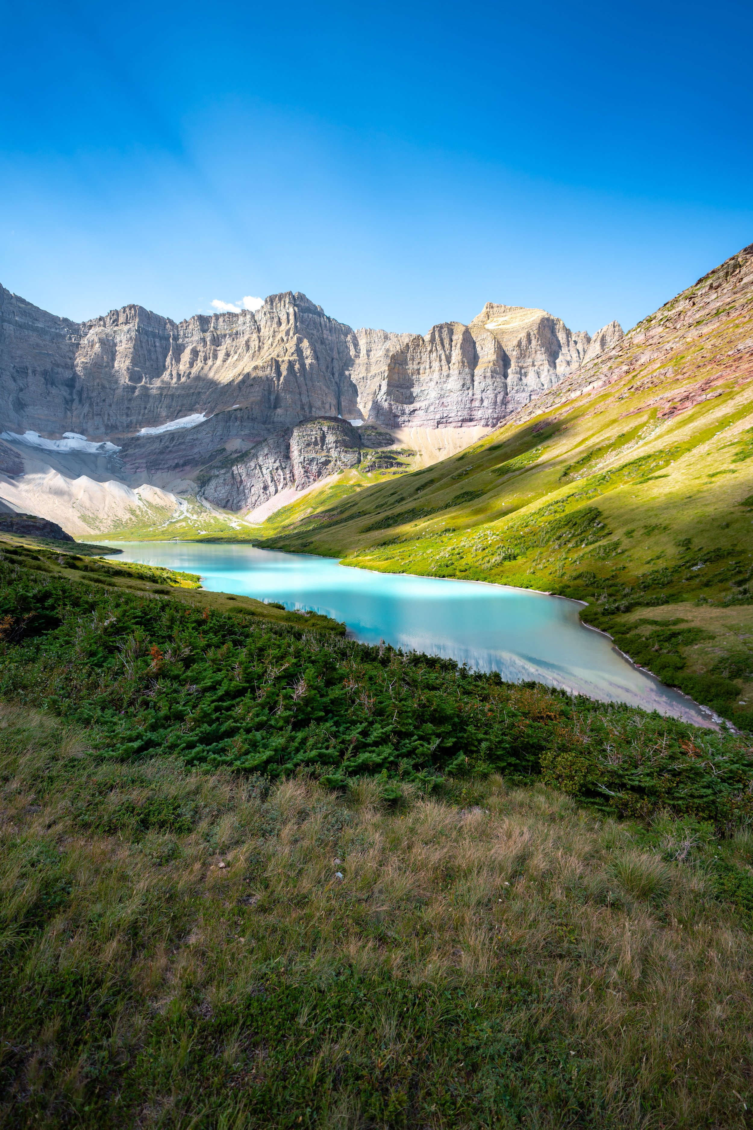
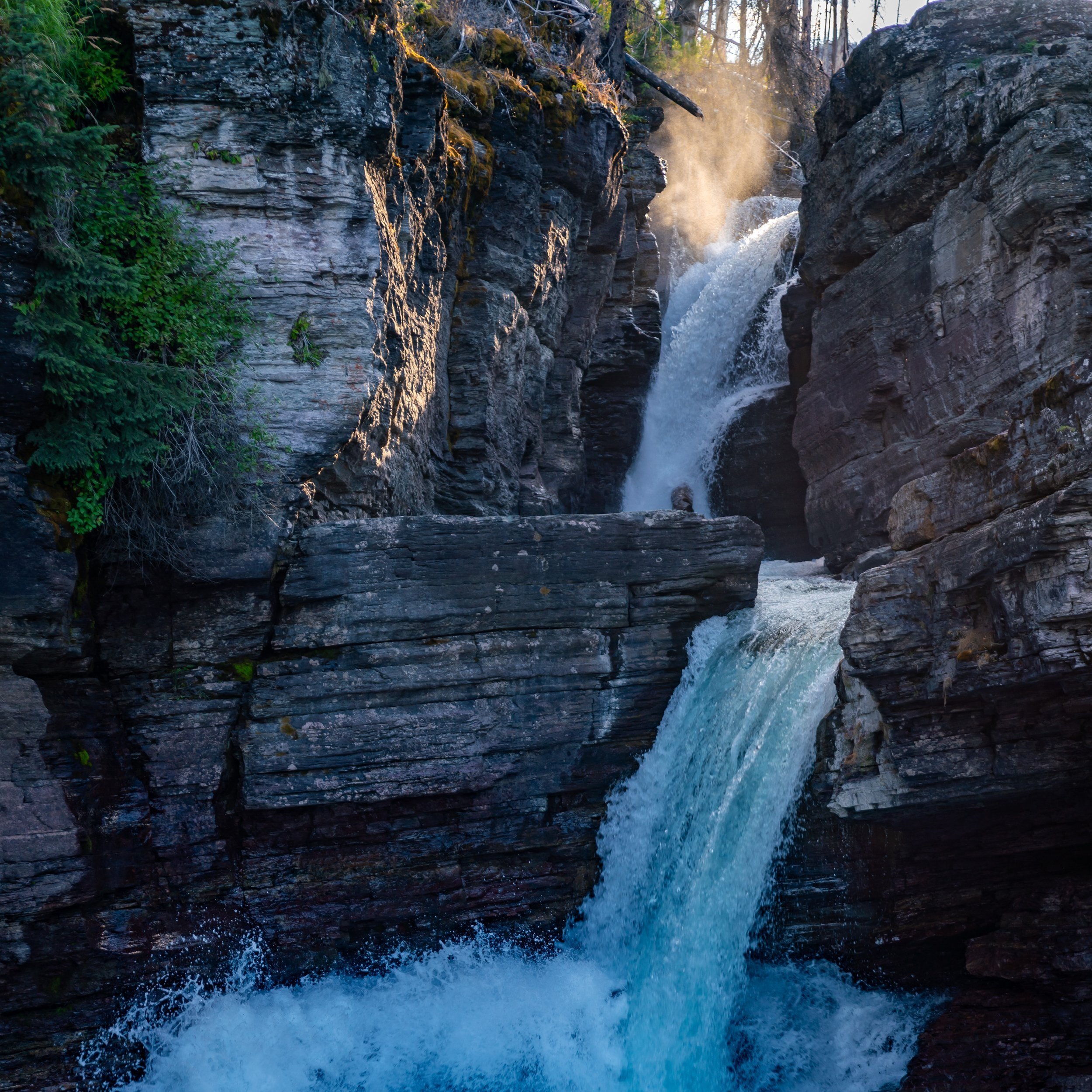
The fireweed on the trail is always one the most beautiful plants found throughout Glacier National Park.
This is where the infamous Haystack Butte really starts to come into view.
Even sections just like this are areas where slipping and falling off the trail pose the greatest risk.
As the trail nears Haystack Butte, you’ll start to see the two main switchbacks that make up the majority of the uphill to hike around the infamous peak.
Haystack Butte
Outside of the optional Grinnell Glacier Overlook, the elevation gain up Haystack Butte is the most significant on the entire Highline Trail.
For some, Haystack Butte is the turnaround point on the Highline Trail, but I highly recommend pushing forward because majority of the remaining hike is downhill to reach the Granite Park Chalet and The Loop Trailhead.
That being said, the uphill doesn’t end at Haystack Butte, but it continues for another 0.6 miles (1.0 km) until the downhill starts to take over.
This obviously excludes the optional Grinnell Glacier Overlook.
This is the view looking back toward Haystack Butte.
Past Haystack Butte, these views out toward Red Rock Point and Lake McDonald were some of my favorite on the entire Highline Trail.
As the trail nears the Grinnell Glacier Overlook Trail, you’ll start to see the first views of the Granite Park Chalet off in the distance.
Highline-Grinnell Glacier Overlook Junction
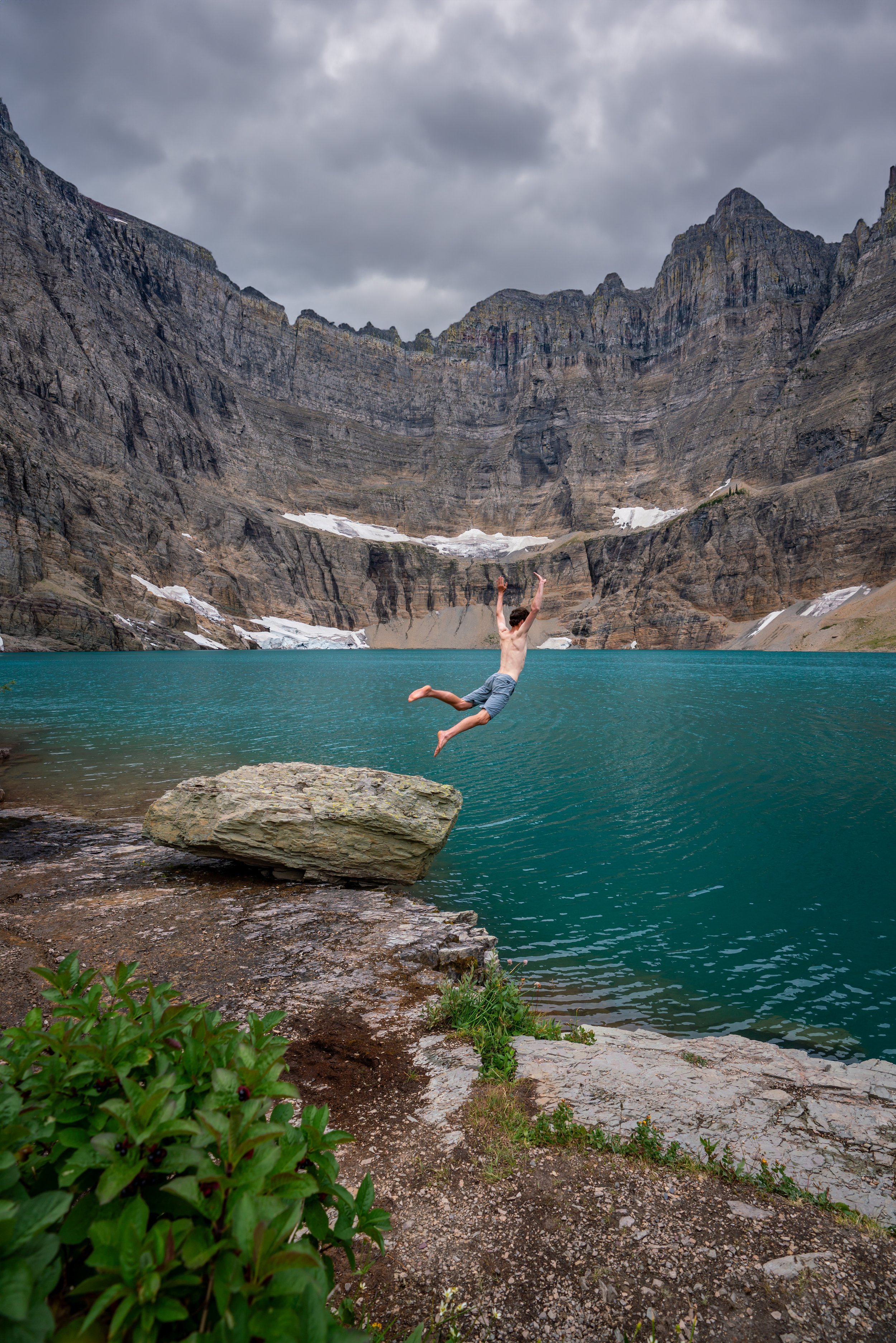
At about 6.8 miles (10.9 km) into the hike, the Highline Trail arrives at the junction that leads up to the Grinnell Glacier Overlook.
When most people see the elevation gain required to reach the overlook, they sigh, then start the ascent anyway because of how much it took to make it this far.
I was no different, but on a hot, bluebird August afternoon, this ascent in the direct afternoon sun was anything but easy.
Grinnell Glacier Overlook Trail
Distance: 0.8 miles / 1.3 km
Elevation Gain: ~1,000 ft. / 305 m
The ascent to the Grinnell Glacier Overlook may only be 0.8 miles (1.3 km) each way, but it’s the elevation gains that’s truly notable.
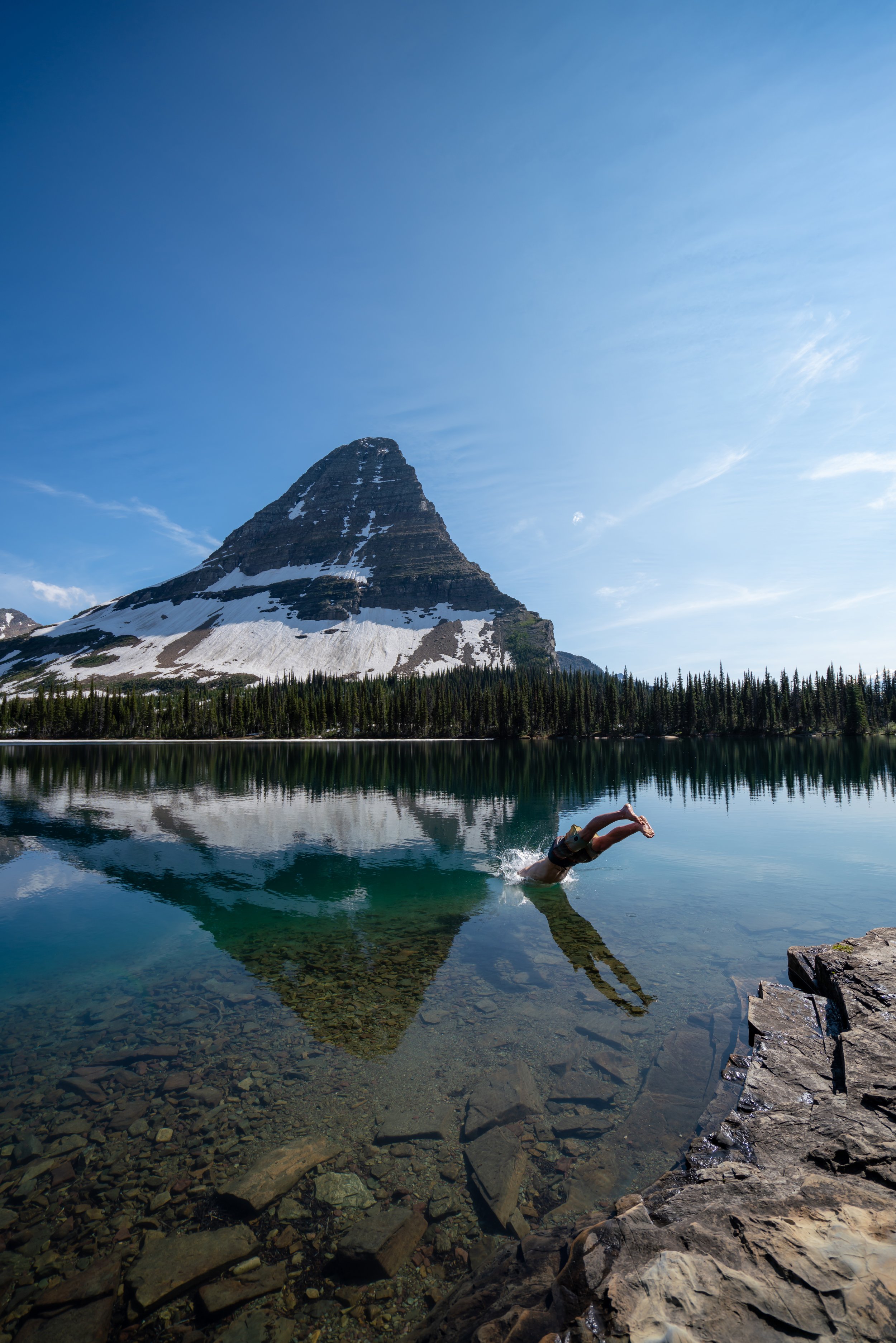
Grinnell Glacier Overlook
The Grinnell Glacier Overlook is a pretty amazing experience to be able to see one of the best hikes out Many Glacier from this unique perspective.
Additionally, if you are visiting Many Glacier, I couldn’t recommend hiking to Grinnell any more highly. It’s easily one of the best hikes in all of Glacier!
Read My Separate Post: Grinnell Glacier Trail
Highline Trail
Once back on the Highline Trail, the Granite Park Chalet is only another 0.8 miles (1.3 km) away.
Highline-Granite Park Junction
Leaving the trail to visit the Granite Park Chalet was not only a cool and unique experience, but it was also one of the best ways to have some time out of the sun.
However, from this junction, there is still 4 miles (6.4 km) left to hike in order to reach Going-to-the-Sun Road, so if you’re pushing your time for the last shuttle, you need to hurry down these last 4.0 miles (6.4 km) in order to secure a ride back up to Logan Pass.
Granite Park Chalet
Up to this point, the Granite Park Chalet has the only restrooms on the Highline Trail since leaving Logan Pass.
Inside the chalet you can find a place to relax, enjoy photos of the park, get the weather, and talk with not only other hikers but employees who stay at the chalet throughout much of the summer season.
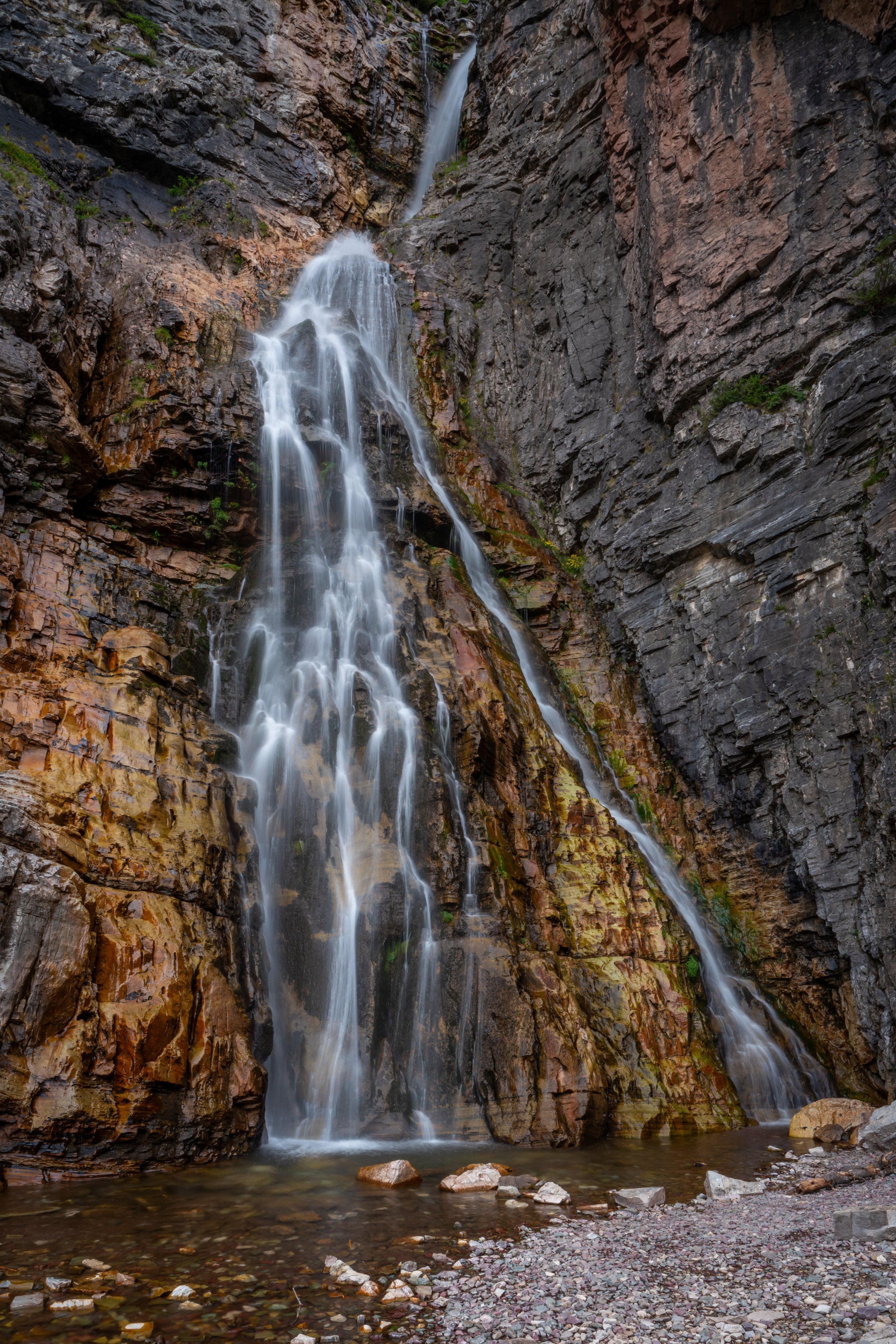
I would expect these prices to continually rise, as everything has to travel up the same Granite Park Trail off Going-to-the-Sun Road that is shown below.
If you think you may want to purchase anything like sunscreen or a Gatorade, make sure to bring cash!
It’s pretty cool to look back from the chalet and see where you’ve come from.
Granite Park Trail
Distance: 4.1 miles / 6.6 km
From the intersection shown above, 'The Loop' leaves the Highline Trail to begin the Granite Park Trail down to Going-to-the-Sun Road.
Granite Park Campground Junction
The first split in the trail on the way to The Loop Trailhead is for the Granite Park Campground, which is only a short distance after leaving the chalet.
When the trail makes the hard switchback to the west, this began what felt like a never ending switchback!
However, when it finally makes one more turn toward the road, it’s a good mental checkpoint that you’re nearing the end.
This is the final switchback that turns back toward Going-to-the-Sun Road.
Packer’s Roost Junction
Just before The Loop Trailhead is one more split in the trail, and hikers have disappointedly gone the wrong way before!
Go left at this junction, and The Loop Trailhead will only be another 0.5 miles (0.8 km) away!
The Loop Trailhead
After a long day on the Highline Trail, Going-to-the-Sun Road was the best sight to see!
Go right down the road, and The Loop Shuttle Stop will be located shortly ahead.
The Loop Shuttle
Since hiking the Highline Trail as a 'Loop' is a popular option, it’s likely that you’ll arrive at the shuttle stop at the same time in the late afternoon/ evening as a number of other hikers.
However, since hikers treat the Highline Trail as a one-way hike, the trail never feels crowded because you’re not passing very many people, as you would on an out-and-back hike.
Warning
Afternoon thunderstorms in high Mountain West areas, such as this, are a serious concern during the summer monsoon season.
Even if the weather forecast doesn’t predict any storms, I can tell you from personal experience that they may show up out of nowhere and can put you and your entire group in a very dangerous situation.
I say this to emphasize the importance of turning around at the first sign of lightning, thunder, or even heavy cloud buildup. However, if you ever get caught in a storm unsuspectingly, follow the steps linked below to reduce the risk of getting struck.
U.S. Forest Service: Lightning Safety Tips
More Glacier Adventures
If you’re interested in reading about some more amazing adventures within Glacier National Park, check out my separate posts below!

Best Way to Find Places to Stay!
Wherever I travel, I love to start my search for places to stay on VRBO.
Even if I don’t end up booking through them, I think it’s one of the best ways to see what’s in the area!

Washington
Best Way to Book Rental Cars!
I travel quite a bit, and I know firsthand that finding a good rental car deal can be a challenge, but that’s why I recommend comparing all of your options with Discover Cars.
In short, Discover Cars is a well-known, reputable business that allows you to search for the best deal across companies, and they have the best full-refund cancellation policy I’ve ever seen, valid up to 72, or sometimes even 48, hours prior to your reservation!
Book Here: Discover Cars

Discover Cars!
Safety
Always be mindful that Glacier National Park and the surrounding area is Grizzly Bear country. Therefore, you need to be hiking with bear spray and know how to react in the event of a Black or Brizzly Bear encounter.
Aside from wildlife, Glacier National Park, like any area in the Mountain West, is known for its violent afternoon thunderstorms, which are more typical in the warmer summer months than other times of the year.
That said, it’s important to check the local forecast before setting off on any adventure, as lightning strikes are not uncommon in and near mountain ranges across the West. I have personally been knocked to the ground by a strike that hit near me in the past, and I confidently say that it’s an experience you don’t want to live through. This is why I highly recommend checking Mountain Forecast for any high-elevation adventures you may be interested in—especially when climbing a summit.
Finally, know that when micro-spikes are necessary for an early-season adventure, micro-spikes are never supposed to be a substitute for conditions that require crampons.
As always, find the most up-to-date information and conditions on the official National Park website.
National Park Service: Glacier National Park


U.S. National Parks Pass
Did you know that the same America the Beautiful Pass that grants access to all 63 U.S. National Parks can be purchased in advance at REI?
Yes, you can save time when you arrive by purchasing your National Park pass, along with your other outdoor gear, at REI before traveling to the park!
More U.S. National Parks
If you’d like to read more about some of my best recommendations when visiting other U.S. National Parks, check out some of my other posts below!


Disclaimer
All information provided on this blog is for informational purposes only and is not intended to be a substitute for information or advice from qualified professionals or managing agencies.
Noah Lang Photography LLC makes no representations or warranties regarding the accuracy or completeness of the information provided here, and readers should use their own discretion, judgement, and seek professional advice where it is appropriate.
Furthermore, Noah Lang Photography LLC shall not be held responsible for any injuries, lost individuals, or legal issues arising from the use of information provided on this website, and if applicable, the above safety disclaimer should be referenced to provide a generic overview of the risks involved.
All said, the content on this blog is for the sole use of Noah Lang Photography LLC, and unauthorized use or reproduction of this content is strictly prohibited.
Disclosure
This post is not sponsored.
However, some of the links in this post are affiliate links, which means that I may earn a small commission if a purchase is made through one of those links. This commission comes at no additional cost to you, and I only recommend products that I personally use and believe will add value to my readers. Thank you for your support, which enables me to continue creating more!
To read the full privacy policy, click here.

About This Blog
Noah Lang Photography, also known as @noahawaii, is 100% reader-supported!
I do not accept guest articles or sponsored content of any kind on my blog, which is why, if you enjoy the outdoor and travel content I create, please consider buying me a coffee!
I appreciate your support, which helps me continue to keep this blog alive!