


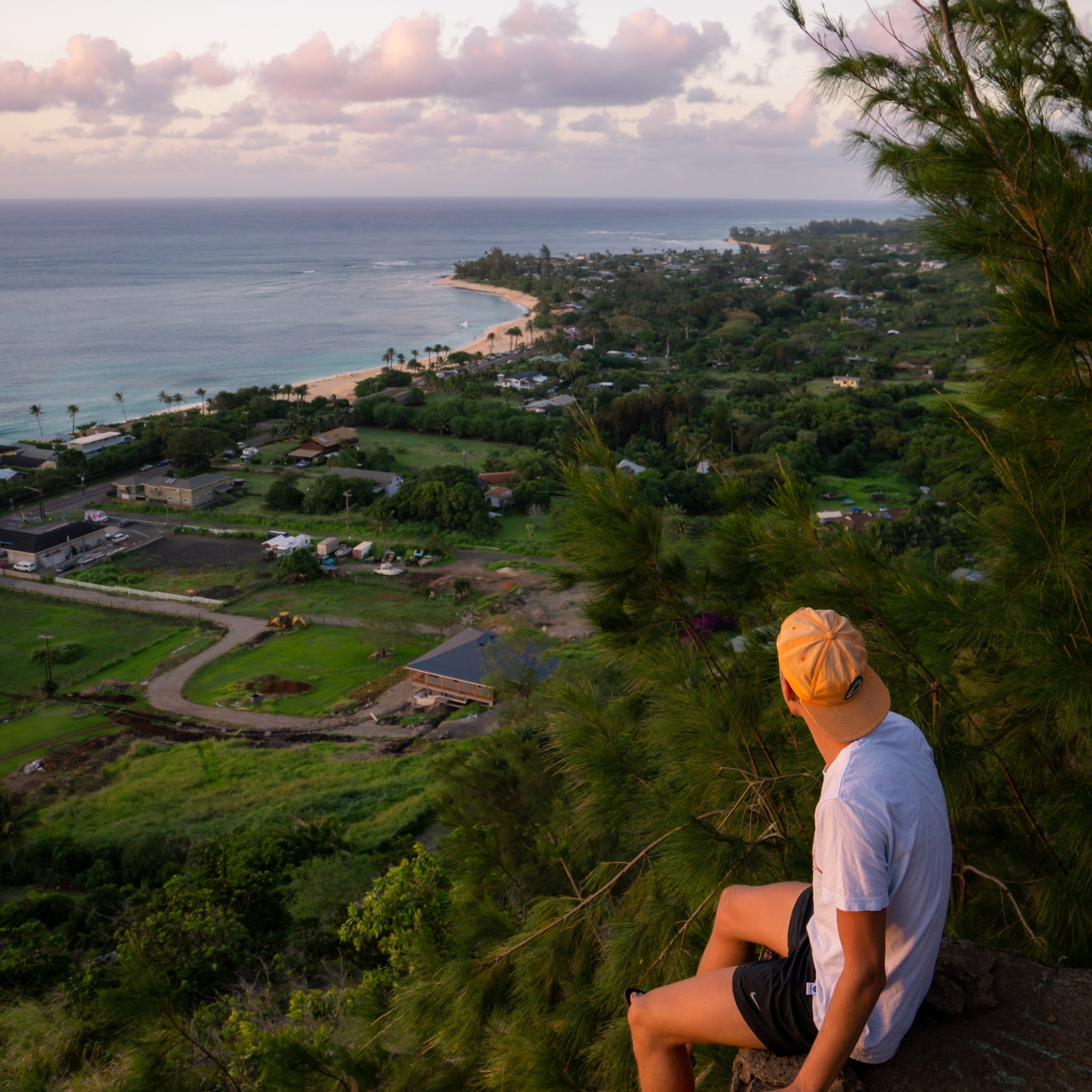
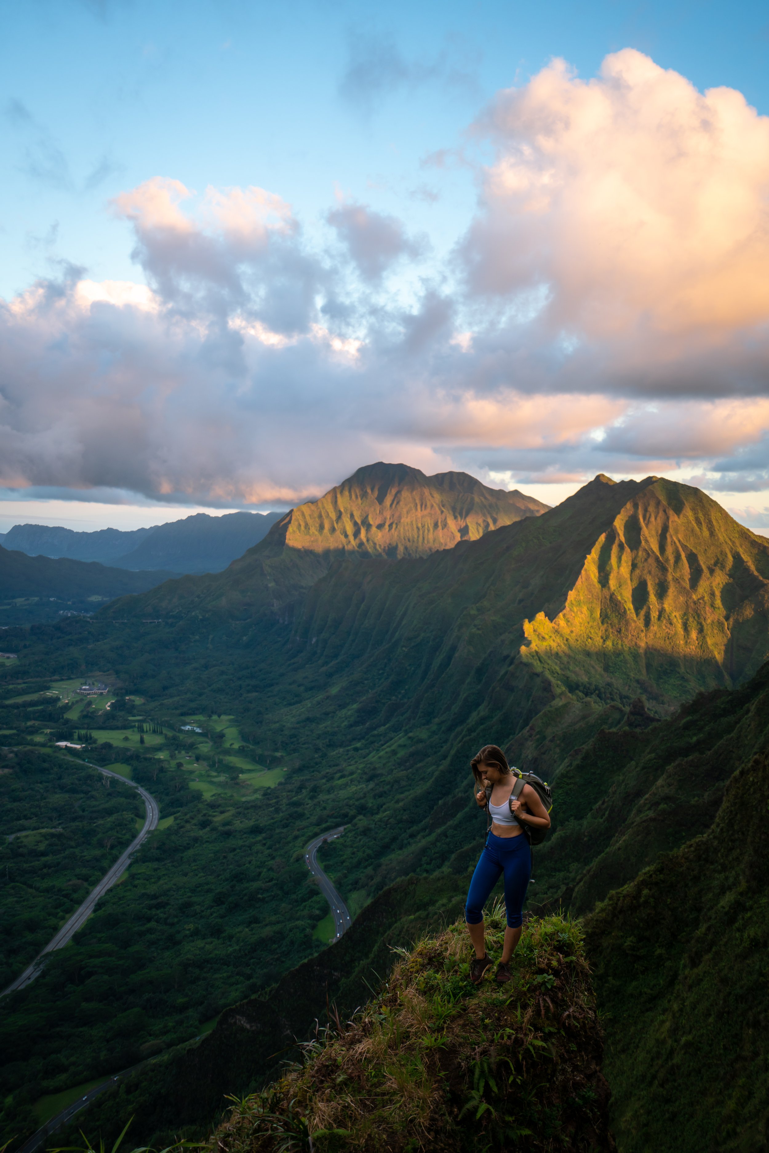
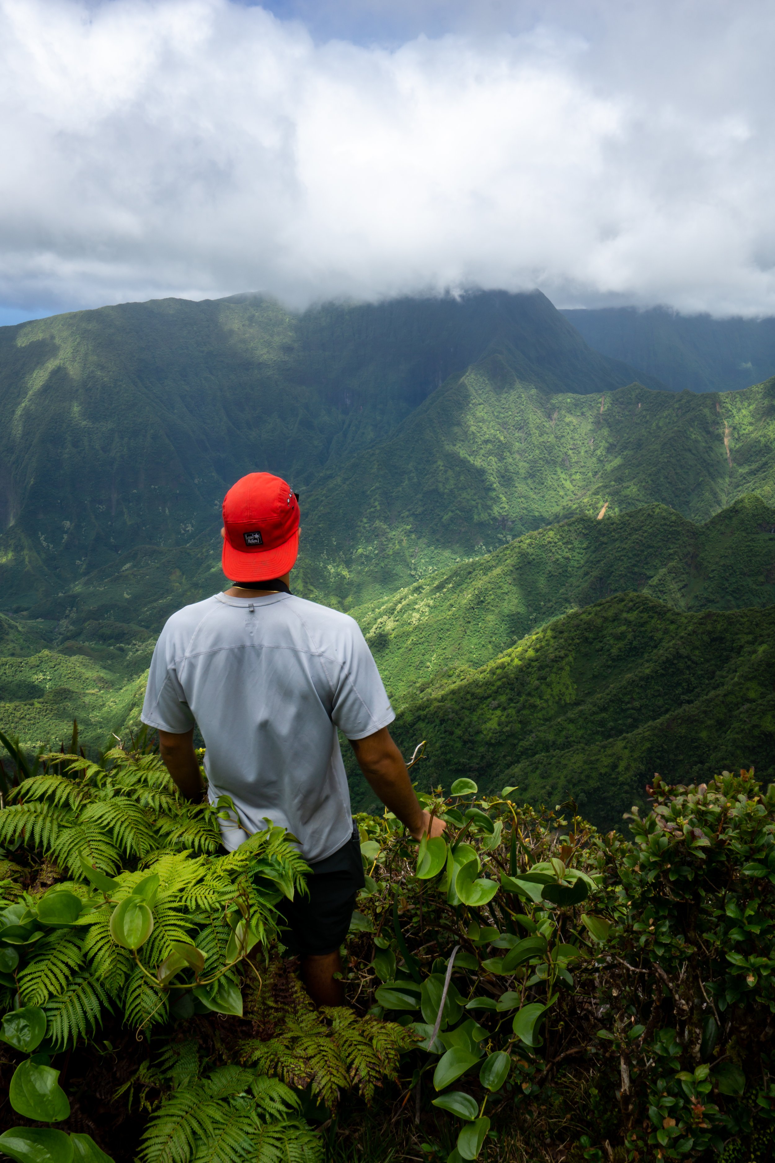
Hiking the Kaʻena Point Trail & Pillbox on the North Shore of Oʻahu, Hawaiʻi
Distance to Predator-Proof Fence: 2.4 miles / 3.9 km
The Kaʻena Point Trail in Mokulēʻia, on the North Shore of Oʻahu, is a beautiful, flat, and easy day hike along one of the island’s most protected coastlines.
For these reasons, the North Kaʻena Point Trail is one of the most popular biking and trail-running hikes on Oʻahu. This aside, the north side of Kaʻena Point is quite a different experience from the neighboring West Kaʻena Point Trail, as the North Shore of Kaʻena Point is, by and large, more expansive. By this, I mean that there is simply more room on the North Shore side of Kaʻena Point, whereas the West Kaʻena Point Trail is pressed up against the mountains for the majority of the hike.
This is exactly why permitted vehicles have the ability to drive on the North Shore of Kaʻena Point, and it’s what makes the North Kaʻena Point Trail the best side to see a variety of beaches, wildlife, and native plants, which you can read about in more detail in my side-by-side comparison below.
That said, the Kaʻena Point Trail from either direction is a very comparable, mostly flat hike, making Kaʻena Point a great, easy, kid-friendly adventure—so long as you avoid hiking during the heat of the day.
Note that the distance above is only the distance to the start of the predator-proof fence and does not include any exploring around Kaʻena Point or the additional 0.4-mile (0.6 km) hike up to the Kaʻena Point Pillbox.
Kaʻena Point Trail - North Shore vs. West Side
Kaʻena Point can either be hiked from North Shore or West Side of Oʻahu, with both distances being roughly the same.
With that in mind, I suggest against letting the 0.3-mile (0.5 km) difference in distance to be deciding factor regarding which trail you choose to hike, as it should really come down to which option sounds more desirable below.
West Side
By and large, the West Kaʻena Point Trail has better views on account of the beautiful and dramatic ridges along the Waiʻanae Coast.
In addition to this, I personally prefer to hike Kaʻena Point on the West Side, as it follows a true hiking trail, unlike the North Shore, which parallels the Kaʻena Point 4WD Access Road, making the area busier overall.
To this point, the West Kaʻena Point Trail is almost always less crowded than the North Shore, as the tedious drive to the trailhead is typically longer for most hikers compared to the drive to the trailhead Mokulēʻia on Oʻahu’s North Shore. This can make the West Kaʻena Point Trail—along with Mākua and Yokohama Beach in Kaʻena Point State Park—a great place to spend a long day exploring this quiet, secluded part of the island!
Read My Separate Post: Kaʻena Point Trail (West Side)
North Shore
Considering everything mentioned above, the North Shore of Kaʻena Point still has a ton to offer that the West Side does not.
For one, I generally consider the North Shore to be a safer place to park. Now, that doesn’t mean the that West Side is inherently unsafe, but break-ins do happen on Oʻahu, typically to people who leave bags or valuables visible in their vehicles.
That aside, the North Kaʻena Point Trail is by far the better of the two sides for seeing a variety of native Hawaiian plants while you hike, whereas native plants on the West Side of Kaʻena Point are truly few and far between.
Finally, the North Kaʻena Point Trail generally has a much higher chance of encountering a Hawaiian Monk Seal because there simply aren’t as many suitable places for them to beach themselves on the West Side. That said, the North Kaʻena Point Trail passes numerous beaches on the way out to the point, all of which are great places to look for Monk Seals prior to the predator-proof fence at the end of the hike.
This all goes without saying, I recommend an early morning or late evening/ sunset hike for either trail, as both sides of the island can get very hot and lack shade—not to mention the West Kaʻena Point Trail is typically less windy. For these reasons, I highly recommend hiking Kaʻena Point in a hooded sun shirt, regardless of the direction you choose to begin.


North Kaʻena Point Trailhead Parking
Parking for the Kaʻena Point Trail on the North Shore is located in either one of two parking areas at the very of Farrington Highway. This is also where the pavement ends and the Kaʻena Point Access Road begins.
Out of caution, consider either Kaʻena Point Trailhead to be a high-crime area for petty theft, meaning you should never leave visible bags or anything valuable in your car.
Google Maps Directions: North Kaʻena Point Trailhead
My Hawaiʻi Hiking Checklist
Osprey 3L Water Bladder - The Osprey 3L water bladder is the most universal hiking and backpacking water bladder on the market, and it’s my go-to because of the slide-off seal that allows it to be quickly filled from the top. Additionally, individual parts are easily replaceable, such as the bite valve.
Blister / Heel Protectors - I swear by these cheap, amazing heel protectors to prevent blisters for nearly every kind of hiking and backpacking that I do!
Hiking / Trail Running Shoes - Depending on the type of trail, I prefer to use either the Keen Targhee for longer, more rugged hiking or the HOKA Zinal Trail-Running Shoe for lighter, less intense trails. In either case, both have been amazing to me for many years across countless environments, and both can be found in men’s and women’s sizes. - (Men’s Keen / Women’s Keen) (Men’s HOKA / Women’s HOKA)
Sun Shirt w/ Hood - A quality sun shirt can be your best friend on a trail with minimal shade, which can be found in both men’s and women’s sizes.
High SPF Sunscreen - Packing high-SPF sunscreen is a must for long days outside!


Hiking the Kaʻena Point Trail
The North Kaʻena Point Trail is quite different from the route that begins on the West Side because there are countless interconnecting paths that hikers can follow between both the 4WD Access Road and the Coastal Trail, which run parallel to one another for nearly the entire distance to the predator-proof fence.
That being said, I highly recommend sticking to the Coastal Kaʻena Point Trail as much as possible, as it’s truly a much more beautiful hike along the water compared to staying farther inland on the main 4WD Access Road.
After just 0.1 miles (0.2 km), the North Kaʻena Point Trail splits around one of many protected restoration sites.
Here, hikers can either go right to walk along the beach or left to stay above the shoreline.
Personally, I recommend going left because it’s easier to walk, and if there are any Monk Seals or Sea Turtles down below, there’s a good chance they’ll be easier to spot from the upper trail.
This is where the Kaʻena Point Trail continues around the left (upper) side of the restoration area.
At a few different points around the restoration area, there are little overlooks on the right-hand side that make for great places to look for Monk Seals or Sea Turtles that have come onshore to rest.
This is the second overlook along the upper trail.
After roughly 0.4 miles (0.6 km), the North Kaʻena Point Trail returns toward the ocean.
Since the North Kaʻena Point Trail is so flat and wide open, trail running the 2.4 miles (3.9 km) out to the predator-proof fence is one of the most popular ways to explore Kaʻena Point—especially since the 4WD Access Road and Coastal Trail can be taken separately when going to and from.
For those that are interested, these are my preferred trail-running shoes, which not only work great here at Kaʻena Point and others like the ʻAiea Loop Trail, but they are also my go-to hiking shoes for much less overgrown trails outside of Hawaiʻi.

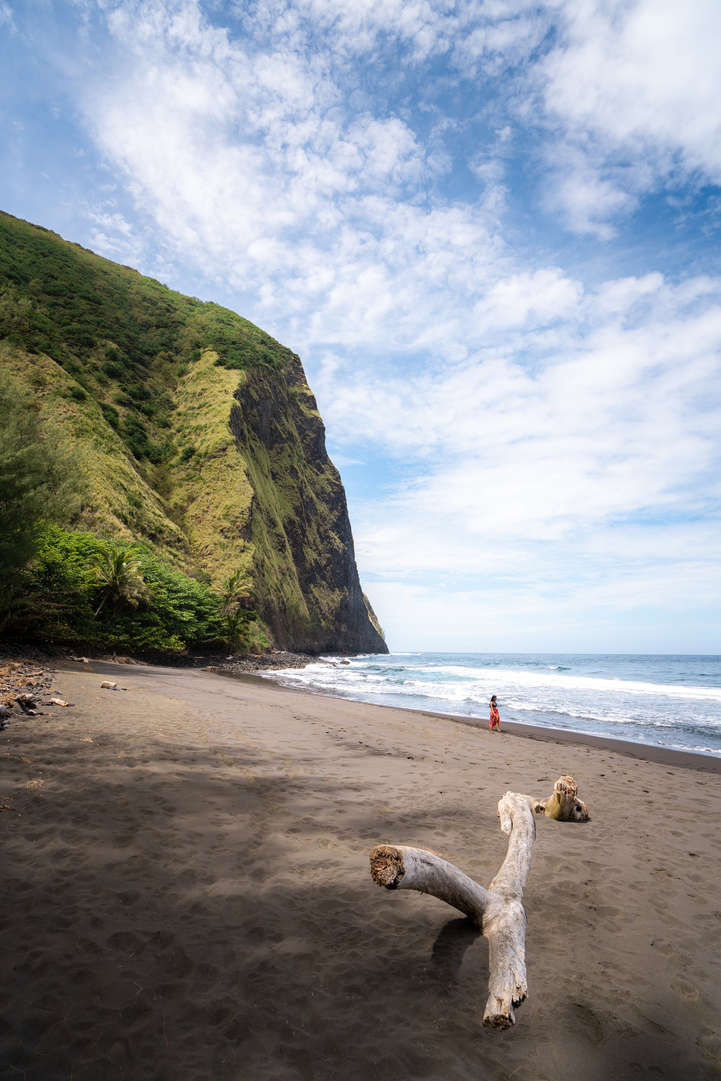
Beaches like this are great places to look for Monk Seals along the North Kaʻena Point Trail, but please pay attention to the signs posted throughout the trail, which I discuss in more detail below.
Manini Gulch
Unlike the West Kaʻena Point Trail, where evidence of the old Kaʻena Point Railroad is visible throughout, the North Shore has far fewer places where these remnants of the past can still be found—the most notable of which are the walls and foundation of the former bridge that once spanned Manini Gulch.
What is the Kaʻena Point Railroad?
In 1895, the Oʻahu Railway and Land Company (OR&L) began construction on a railroad around Kaʻena Point as a means of transporting people and goods between the sugar plantations on the North Shore and Honolulu.
Over the years, the railway began to serve a number of different purposes beyond its original intention, including sightseeing and transporting the military during WWII.
However, by the late 1940s, the railroad was abandoned and subsequently dismantled, leaving behind only small pieces of evidence that we can still see today, such as this bridge foundation on either side of Manini Gulch.
This is where the North Kaʻena Point Trail climbs out of Manini Gulch on the far side.
Even though the majority of Kaʻena Point from the North Shore is flat, the trail is notably hillier than the West Kaʻena Point Trail, which makes seeing the navigation aid at the very end of the hike more challenging compared to the West Side.
In fact, the navigation aid at the end of Kaʻena Point typically isn’t visible from the North Shore for over half of the hike, which is quite different from the West Side, where it can easily be seen much closer to the trailhead.
Signs like this do a great job of showing what land managers are up against here and in other coastal areas, like the Kaʻiwi Shoreline on the east side of Oʻahu, because even though restoration work is always underway at Kaʻena Point, the vast majority of plants along both the coast and adjacent ridges are non-native, invasive species—like Koa Haole, Fountain Grass, and Saltbush, to name just a few.
Don’t forget to look out for this hidden turn down to Manini Beach on the right-hand side when hiking north, as this beach is without a doubt one of the most beautiful on the North Kaʻena Point Trail—not to mention, it’s consistently one of the best places to see Hawaiʻi’s endemic and endangered Monk Seals before reaching Kaʻena Point.
Manini Beach (Sand Cove)
Manini Beach, or Manini Cove, is the largest beach that the North Kaʻena Point Trail crosses, and, as previously mentioned, it’s one of the best places to see Hawaiian Monk Seals before the predator-proof fence at the very end.
Hawaiian Monk Seals
There is a real possibility that you will come across one of Hawaiʻi’s endemic and endangered Hawaiian Monk Seals along the trail.
Therefore, please be aware of the following guidelines before visiting Kaʻena Point State Park:
If you see a Monk Seal, please use common sense and do not approach! Many visitors have been tracked down through social media videos and prosecuted for getting too close, touching, or harassing Hawaiian Monk Seals, and be aware that Kaʻena Point State Park is one of the most patrolled state parks in all of Hawaiʻi, both by state law enforcement and community volunteers.
Be aware that Monk Seals come to the shoreline to rest and escape predation, meaning that if someone were to scare one back into the water, the seal is again exposed to the risks of predation from sharks.
Finally, feel free to stop, take photos, and enjoy them, but do so from a distance. NOAA and Hawaiʻi’s Department of Land and Natural Resources (DLNR) recommend at least 50 ft. (15.2 m) of distance.
After Manini Beach, the Coastal Kaʻena Point Trail simply follows a series of 4WD roads that parallel the main access road until the point where the two come together just before the predator-proof fence, about 1.0 mile (1.6 km) away.
As the North Kaʻena Point Trail approaches the predator-proof fence, all the side trails along the water begin to converge toward the 4WD Access Road, leading to the final gate before the fence, with the first example being the one shown below.
For just a short distance, the Coastal Kaʻena Point Trail meets with the main 4WD Access Road to get around ʻĀlau Cove.
This is where the coastal trail branches away to the right.
That being said, both routes meet again about 0.5 miles (0.8 km) ahead, which is why some hikers prefer to stay to the left here to take a more direct route to the end.
Regardless of my thoughts above, I chose to continue on the main Coastal Trail to show the entirety of the North Kaʻena Point Trail.
As I’m sure it’s obvious from these photos, there are essentially no places on the North Kaʻena Point Trail to get out of the sun, apart from a few trees at Manini Beach.
This is exactly why I recommend hiking Kaʻena Point in a hooded sun shirt, regardless of the direction you choose to begin.
Just outside of the predator-proof fence, both the Coastal Trail and Kaʻena Point 4WD Access Road become one.
This is the farthest that permitted vehicles can drive on the Kaʻena Point Access Road.
Kaʻena Point Predator-Proof Fence
After 2.4 miles (3.9 km), the North Kaʻena Point Trail reaches the predator-proof fence, where visitors have the option to either go right through the first gate in the fence or left toward the Pillbox Trail Trail, where a second and often less used entrance can be found.
Personally, I recommend the entering through the first gate shown here, as both routes from either gate meet again on the other side of the fence shortly ahead.
To skip ahead to the Kaʻena Point Pillbox Trail, click here.
Kaʻena Point
On the far side of the predator-proof fence, the Kaʻena Point Trail simply follows one of a few designated trails out to the westernmost point of Oʻahu.
That being said, these designated trails are designed to protect everything inside the predator-proof fence, as Kaʻena Point is home to a number of native plant and animal species. This is why I think it’s important to mention the immense amount of conservation work that has been undertaken to make Kaʻena Point what it is today.
By this, I mean that Oʻahu—and all the populated Hawaiian Islands—are dominated by non-native, invasive predators such as rats and mongooses, which prey on Hawaiʻi’s native shorebirds, plants, and snails. This is why places like Kaʻena Point are of the utmost importance, similar to the Moʻomomi Preserve on Molokai, as they are among the last refuges where these species can find sanctuary from invasive predators. It is for these reasons that it’s imperative to ensure that the predator-proof fence door latches properly.
Furthermore, there are 11 federally listed endangered species found at Kaʻena Point, and I personally ask that you do your part to minimize your impact by remaining on the designated trails and not approaching any birds, Monk Seals, Sea Turtles, or other wildlife.
This is where both trails from the two gates on the north side of Kaʻena Point come together.
Laysan Albatrosses are among the most common native birds that hikers can encounter at Kaʻena Point.
Unlike the West Side of Kaʻena Point, the trail along the north splits a number of times before reaching the navigation aid at the very end.
That said, it doesn’t matter which direction you choose to go, as all routes meet again shortly ahead.
This is where the side trails come back together.
This is the navigation aid that can be seen from at least a mile away on the north side of Kaʻena Point!
The farthest reaches of Kaʻena Point are arguably the best place on the entire hike to see Hawaiian Monk Seals, but again, please stay at least 50 ft. (15.2 m) away.
Kaʻena Point Pillbox Trail
To hike to the Kaʻena Point Pillbox from the North Shore, start by following the outside of the predator-proof fence until you find one of two trails leading up the ridge.
This is the second and often less-used gate on the North Shore side of the predator-proof fence.
Waiʻanae Summit Trail (WST)
This is where the Kaʻena Point Pillbox Trail branches away from the predator-proof fence, which is located more on the downhill side to the north of Kaʻena Point than the west.
On a different note, the Kaʻena Point Pillbox Trailhead is also one of two terminuses for the much longer and more extensive Waiʻanae Summit Trail (WST), but that is truly a hike for another day.
Read My Separate Post: Waiʻanae Summit Trail (WST)
At first, the Kaʻena Point Pillbox Trail can be a little annoying through the invasive grasses and Koa Haole, but eventually, the trail pops out at this the first platform, which is where I believe the hike to the top gets more enjoyable compared to the beginning.
Kaʻena Point Pillbox
In total, the short 0.4-mile (0.6 km) trail up to the Kaʻena Point Pillbox gains about 520 ft. (158 m) from the start of the predator-proof fence to the pillbox at the top.
This where I recommend catching sunset if you’re visiting on a clear night and have headlamps for the hike back to the trailhead.
Finally, the WST continues further up the ridge from the Kaʻena Point Pillbox, but as previously mentioned, it’s truly a hike for another day, being that any adventure on the Waiʻanae Summit is typically long and very involved—not to mention that the next best place to descend is the Keālia Trail, located well before the North Kaʻena Point Trailhead.
Read My Separate Post: Waiʻanae Summit Trail (WST)


Native Plants on the Kaʻena Point Trail
The North Kaʻena Point Trail is the better of the two routes for seeing native Hawaiian plants along the entire hike, not just beyond the predator-proof fence at the very end.
Some of these include Naio, ʻŌhai, Koali ʻawa, ʻIlima, Maʻo, ʻIlima, Nohu, Milo, Maiapilo, Naupaka, ʻAkiʻaki, and Kīpūkai, to truly only name a few.
If you would like to learn more about these and many other native Hawaiian plants from across the islands, I encourage you to check out my separate post linked below.
Read My Separate Post: Native Hawaiian Plant Guide
More Oʻahu Adventures
If you’re interested in reading about some more amazing Oʻahu adventures, check out my separate posts below!


Best Hotels & Restaurants in Waikīkī
If you’re trying to decided where to stay on Oʻahu, check out my top 10 list for the best resorts and restaurants in Waikīkī.
I break down what makes one hotel a better choice over another, so that you can find the best fit for your stay on the island.
Read My Separate Post: Best Waikīkī Hotels & Restaurants

Waikīkī
HNL Airport-Hotel Shuttle
Prices on ride-share apps like Uber/ Lyft cannot beat the price of booking your hotel shuttle prior to arrival. I say this because there are additional fees for ride-share airport pick-ups at Honolulu Airport (HNL), which is why I recommend booking your transportation in advance using the options below.
Additionally, the last option below will go as far as the Ko ʻOlina Resorts on the West Side and Turtle Bay on Oʻahu’s North Shore!
Best Way to Book Rental Cars!
I travel quite a bit, and I know firsthand that finding a good rental car deal can be a challenge, but that’s why I recommend comparing all of your options with Discover Cars.
In short, Discover Cars is a well-known, reputable business that allows you to search for the best deal across companies, and they have the best full-refund cancellation policy I’ve ever seen, valid up to 72, or sometimes even 48, hours prior to your reservation!
Book Here: Discover Cars

Oʻahu
Visiting Other Islands
If you are visiting Oʻahu or heading to another island, check out some of my personal recommendations for Oʻahu, Maui, Kauaʻi, Molokai, Lānaʻi, and Hawaiʻi Island (Big Island) in these separate posts.
If you’re trying to decide which island is right for your visit, check out my overview about each island in the post below.
Read My Separate Post: What is the Best Hawaiian Island to Visit?


What is the Best Time of Year to Visit Hawaiʻi?
The weather in Hawaiʻi can often appear to be warm and beautiful throughout the year, but in my experience, there is a lot more to consider when planning what time of year to visit the islands, such as what island you are considering, what sides of each island do you plan to stay, what activities are you most interested in, the wildlife, and countless other nuanced variables that can all impact the type of trip you can expect to have.
For these reasons, I highly recommend reading through my separate article to not only understand my thoughts regarding the best time of year to come to Hawaiʻi but also what you need to consider based on the time of year that you plan to visit.
Read My Separate Post: What is the Best Time of Year to Visit Hawaiʻi?
10 Best Tours & Excursions on Oʻahu
There are a lot of different tour options to choose from on Oʻahu, but to make it easier to decide, I made a list of my favorite tours because some things simply are better with a local guide!
Read My Separate Post: Best Tours on Oʻahu

Oʻahu
Safety
All hikes in Hawaiʻi should not be compared to trails outside of the islands, and hikers should exercise due caution on every adventure, given that many are extremely dangerous.
By this, I mean that Hawaiʻi is known for hot, humid weather, steep, dramatic, and unstable cliffs, and flash floods, which can occur without warning. Therefore, it is important that you check the local forecast, understand the physical condition of your entire group, and pack sufficient food and water before attempting any adventure.
Disclaimer
All information provided on this blog is for informational purposes only and is not intended to be a substitute for information or advice from qualified professionals or managing agencies.
Noah Lang Photography LLC makes no representations or warranties regarding the accuracy or completeness of the information provided here, and readers should use their own discretion, judgement, and seek professional advice where it is appropriate.
Furthermore, Noah Lang Photography LLC shall not be held responsible for any injuries, lost individuals, or legal issues arising from the use of information provided on this website, and if applicable, the above safety disclaimer should be referenced to provide a generic overview of the risks involved.
All said, the content on this blog is for the sole use of Noah Lang Photography LLC, and unauthorized use or reproduction of this content is strictly prohibited.
Disclosure
This post is not sponsored.
However, some of the links in this post are affiliate links, which means that I may earn a small commission if a purchase is made through one of those links. This commission comes at no additional cost to you, and I only recommend products that I personally use and believe will add value to my readers. Thank you for your support, which enables me to continue creating more!
To read the full privacy policy, click here.

About This Blog
Noah Lang Photography, also known as @noahawaii, is 100% reader-supported!
I do not accept guest articles or sponsored content of any kind on my blog, which is why, if you enjoy the outdoor and travel content I create, please consider buying me a coffee!
I appreciate your support, which helps me continue to keep this blog alive!