


Hiking the Phelps Lake Loop Trail in Grand Teton National Park
Distance: 7.2 miles / 11.6 km
The Phelps Lake Loop Trail in Grand Teton National Park is, by far, my personal favorite of the three main loop trails, which include Jenny Lake, String Lake, and, of course, the Phelps Lake Loop—and I say this for several reasons.
This first is that the Phelps Lake Trail features the fun cliff-jumping rock, which makes for a great adventure on a hot summer day, but perhaps more importantly, the Phelps Lake-Death Canyon area of Grand Teton National Park is, by and large, less busy compared to the other two trails.
For these reasons, I have had incredible luck seeing bears on countless adventures in the Phelps Lake area, which I do not say to deter but to encourage everyone to hopefully see and enjoy from a safe distance!
To skip ahead to the Phelps Lake Cliff Jumping Rock, click here.
U.S. National Park Pass
Did you know that the same America the Beautiful Pass that grants access to all 63 U.S. National Parks can be purchased in advance at REI?
Yes, you can save time when you arrive by purchasing your National Park pass, along with your other outdoor gear, at REI before traveling to the park!


Black Bear - (Ursus americanus)
Phelps Lake Trailhead Parking
The Phelps Lake Loop Trail could begin at either the Death Canyon or Laurance S. Rockefeller Preserve Trailhead.
However, the LSRP Trailhead is a far better choice, as the hike from the Death Canyon Trailhead descends about 600 ft. (183 m) to get to Phelps Lake, which would have to be hiked back up on the way out. All the while, the LSRP (Lake Creek/ Woodland Trails) are much more flat, with only a few rolling hills to get to Phelps Lake.
Overall, while the Phelps Lake Loop Trail is far less busy than Jenny or String Lake, the LSRP Trailhead is, by far, the most difficult to visit if you arrive mid to late morning during the busy summer season. The parking lot is the smallest of all three trailheads, and on this day when I arrived back to the LSRP at about noon, there was a line of cars backed up by the Park Service because there simply wasn’t any more room in the small lot. The first photo below was taken at about 7 a.m., and the second photo is when I returned after the loop hike.
This is all to say, arrive early!
Google Maps Directions: Laurance S. Rockefeller Preserve
Hiking Checklist - Yellowstone-Tetons
Here is a complete list of must-have things that you will want for any hike in the Yellowstone-Teton area.
Bear Spray & Holster - If you aren’t flying, don’t rent bear spray! It’s a waste of money. Prepare ahead of time by buying your own, as this may be one of the most important items on this list.
Osprey 3L Water Bladder - The Osprey 3L water bladder is the most universal hiking and backpacking water bladder on the market, and it’s my go-to because of the slide-off seal that allows it to be quickly filled from the top. Additionally, individual parts are easily replaceable, such as the bite valve.
Black Diamond Headlamp - Personally, I recommend the Black Diamond Storm because it is one of the brightest, lightest, and longest-lasting headlamps on the market—and trust me, the weight-to-battery-life ratio really does matter!
Hiking / Trail Running Shoes - Depending on the type of trail, I prefer to use either the Keen Targhee for longer, more rugged hiking or the HOKA Zinal Trail-Running Shoe for lighter, less intense trails. In either case, both have been amazing to me for many years across countless environments, and both can be found in men’s and women’s sizes. - (Men’s Keen / Women’s Keen) (Men’s HOKA / Women’s HOKA)
Blister / Heel Protectors - I swear by these cheap, amazing heel protectors to prevent blisters for nearly every kind of hiking and backpacking that I do!
Waterproof Rain Shell - You never know when it may rain, and I’ve learned over the years that a rain shell is far better than a rain jacket. By this, I mean that it’s best to have something that the water will roll right off of, which is why I recommend the Patagonia Torrentshell 3L available in both men’s and women’s sizes.
High SPF Sunscreen - Packing high-SPF sunscreen is a must for long days outside!


Hiking the Phelps Lake Loop Trail
The hike around Phelps Lake begins on the same trail that leads to the Laurance S. Rockefeller Preserve Visitor Center.
Once at the visitor center, you can go either way to reach the Lake Creek Trailhead that leads to Phelps Lake.
Lake Creek Trailhead
The first part of any hike from the LSRP begins on the Lake Creek Trail, which will soon split into a variety of trails around the greater Phelps Lake area.
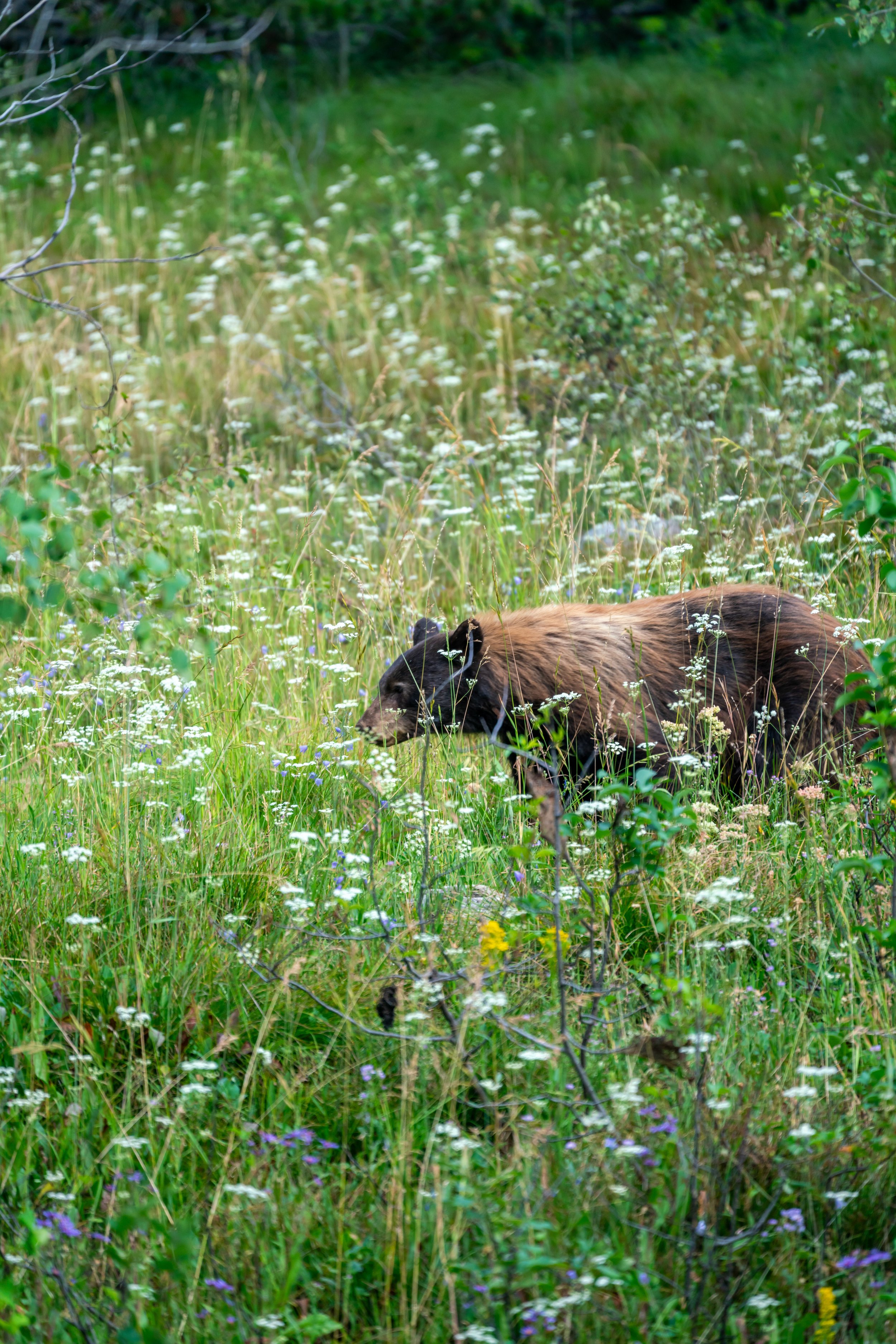
As previously mentioned, I have hiked the Phelps Lake Loop Trail many different times, and I almost always have at least one or more bear encounters on the hike.
It’s widely known that black bears frequent the Phelps Lake area, but be prepared for any kind of encounter, meaning one should always hike with bear spray!


Lake Creek-Woodland Junction
The first junction on the Phelps Lake Loop Trail is for the option to either stay on the Lake Creek or Woodland Trail.
If your goal is to hike to the Phelps Lake Cliff-Jumping Rock, then go right to take the Woodland Trail, as it’s the much faster choice to get to the lake.
On this hike, I choose to stay on the Woodland Trail and return later on the Lake Creek Trail once I had made it around the Phelps Lake Loop.
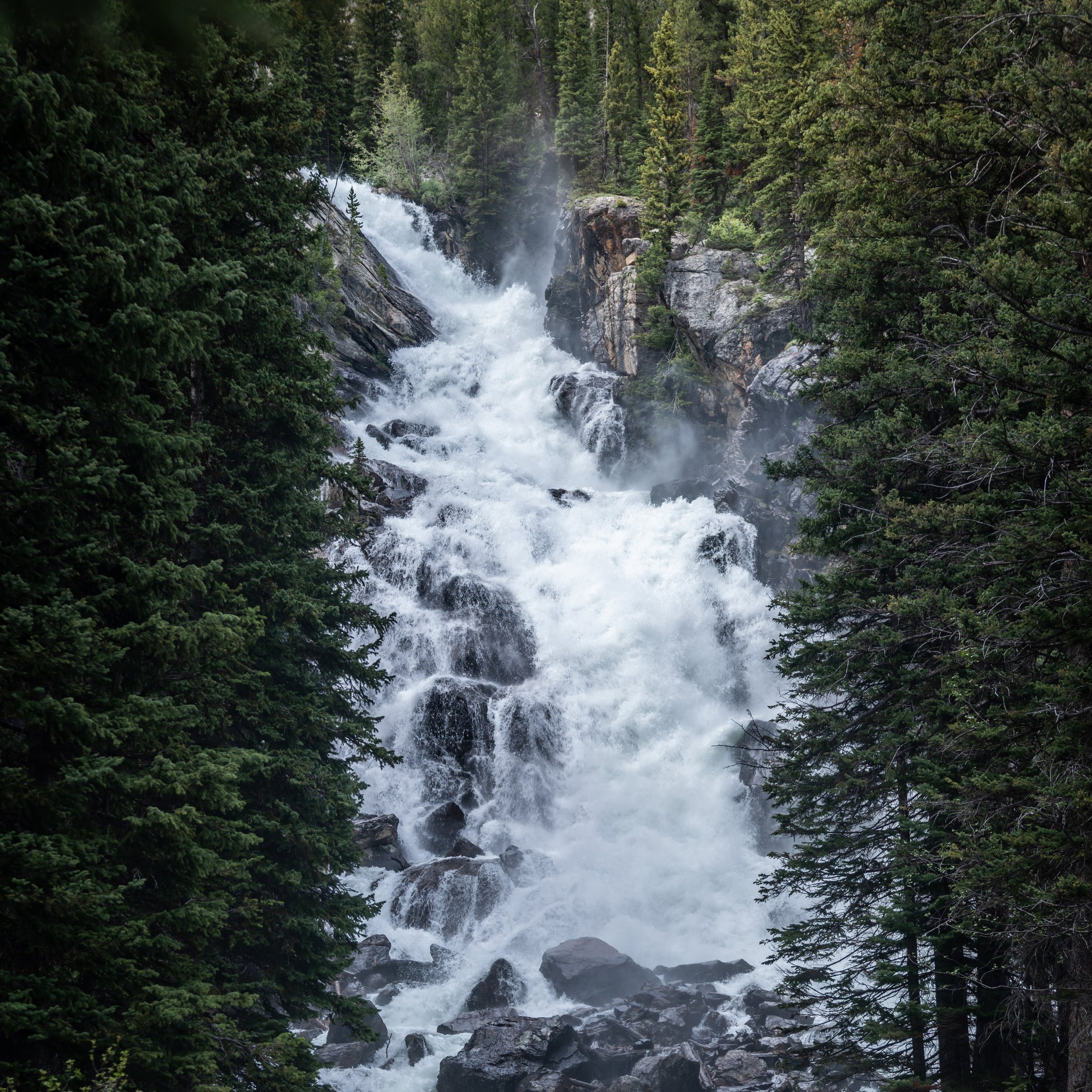
Then, just a few minutes into the hike, I came across this beautiful black bear about 100 ft. (30.5 m) off the trail.
If you remain calm and keep your distance, watching a bear is a pretty beautiful site to see!
Moose Wilson Road
Both the Woodland and Lake Creek Trails cross over Moose Wilson Road on the way to and from Phelps Lake.
I caution you to not only look out for cars but also bicyclists, as they tend to not slow down on this stretch of road.
Woodland-Boulder Ridge Junction
The next junction is the Boulder Ridge Trail, and it’s typically a lesser-known/ hiked trail in the Phelps Lake area.
To this point, both the Boulder and Aspen Ridge Trails on the south side of Phelps Lake create one large loop, which can make for great place to spot wildlife, as they are not as busy as the Phelps Lake Loop shown here.
In any case, go straight to continue on the fastest route to Phelps Lake.
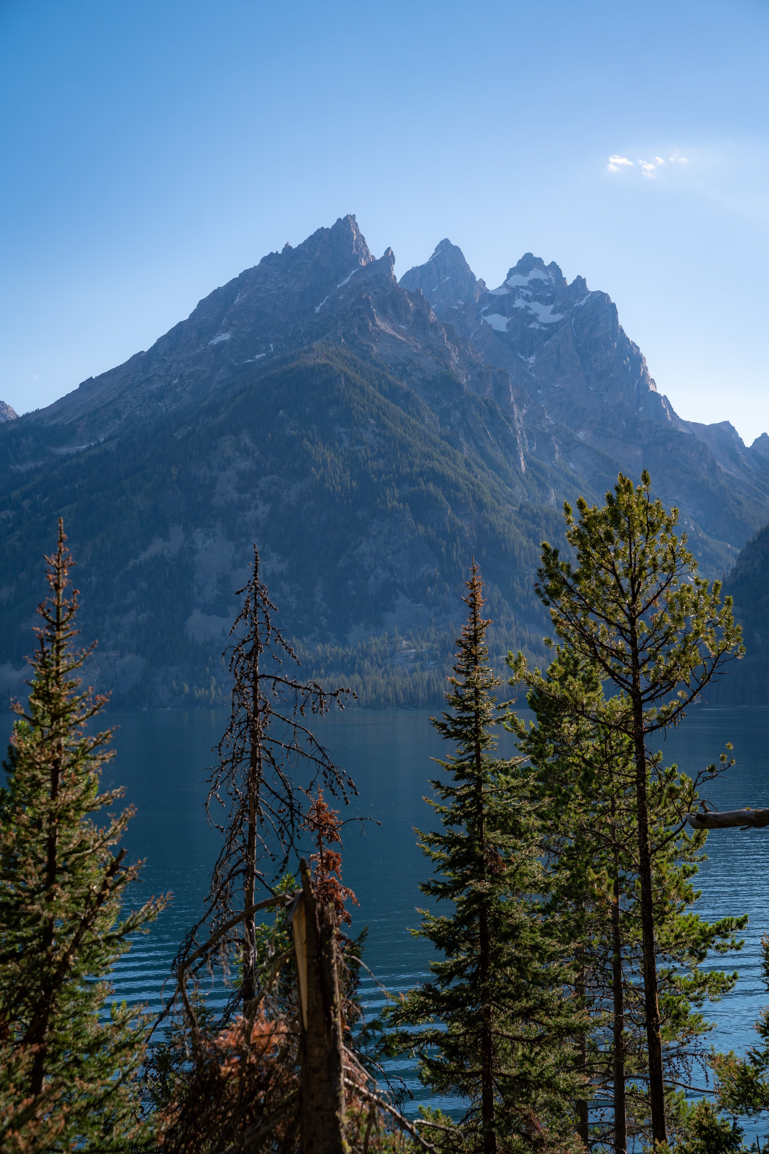
Phelps Lake Loop Trail
After 1.3 miles (2.1 km), the Woodland Trail ends where the Phelps Lake Loop Trail begins.
You can either go right or left around the lake, but I choose to go right, so that I could take the Lake Creek Trail back to the LSRP on my return hike.
Moreover, go right if you’re trying to reach the Phelps Lake Cliff-Jumping Rock.
Phelps Lake-Boulder Ridge Junction
After 0.1 miles (0.2 km) on the Phelps Lake Trail, the Boulder Ridge Trail will branch off into its own separate loop that works its way back toward the LSRP.
In my experience, the east side of Phelps Lake tends to have more hikers than the west side, which may have something to do with the jumping rock, located about two-thirds of the way up the lake from the south side.
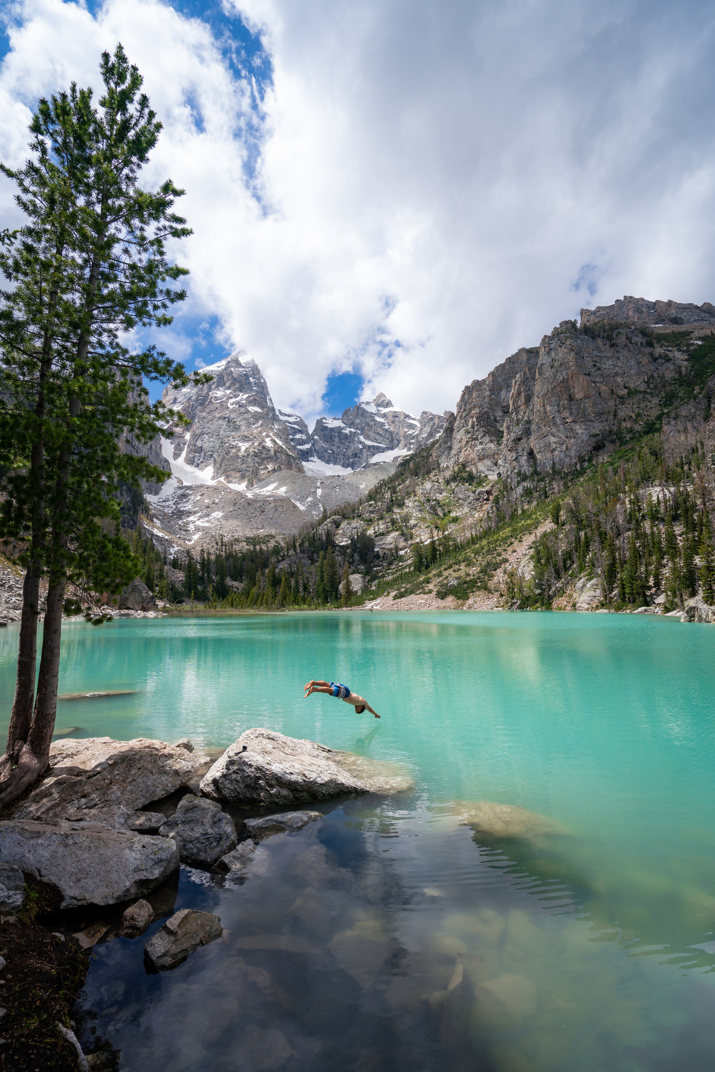
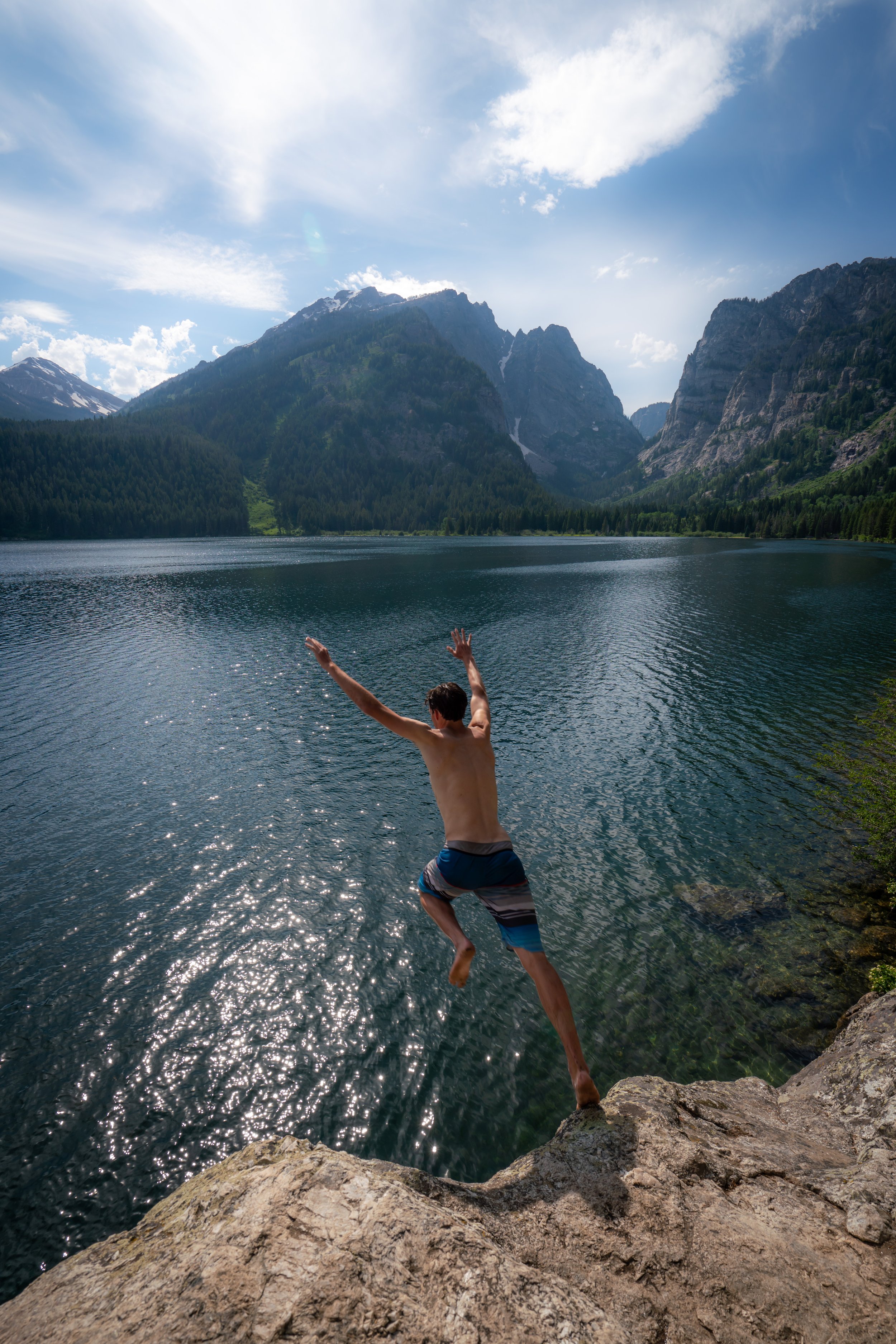
Phelps Lake Cliff Jumping Rock
I can’t say for sure, but there must have been some issues with bears and swimmers at the rock for the Park Service to post this sign.
Additionally, if you’ve read this post prior to my Phelps Lake cliff-jumping post, then there’s really no new information in that post to reach this same area.
However, if you’re curious about the jump itself, I encourage you to read the section about the jumping rock at the end.
Read My Separate Post: Phelps Lake Cliff Jumping Rock
Phelps Lake Campsite
Then, just before the Phelps Lake Beach, the loop trail passes by a number of campsites, which can be reserved through the Park Service if you’re interested in spending a few nights.
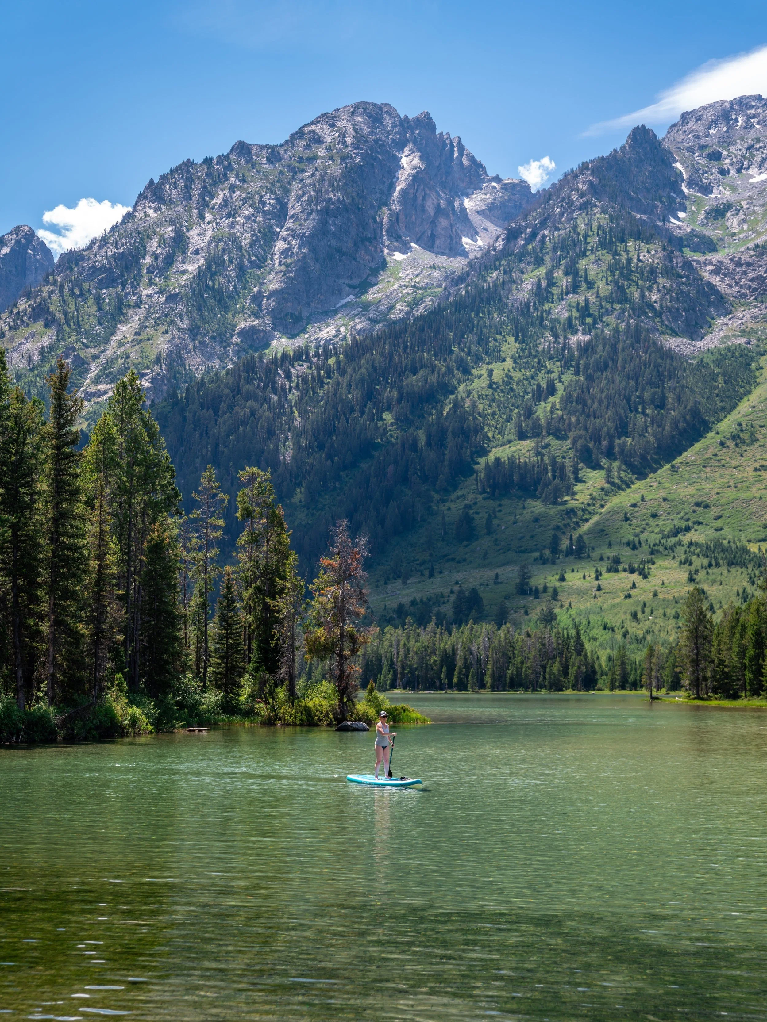
Phelps Lake Beach
On a hot summer day, the Phelps Lake Beach is one of the best places to visit in Grand Teton National Park.
This and the cliff-jumping rock are two of best locations on the entire Phelps Lake Loop Trail!
While the Red Baneberry fruits may look edible, they are considered poisonous and can cause a whole host problems should anyone consume them.
Phelps Lake-Death Canyon Junction
Past the Phelps Lake Beach, the next junction on the trail is for the Phelps Lake Overlook and Death Canyon Trailhead. Personally, I recommend hiking to the Phelps Lake Overlook from the Death Canyon Trailhead, which you can read more about in my separate post.
Go left to continue around the Phelps Lake Loop.
Read My Separate Post: Phelps Lake Overlook Trail
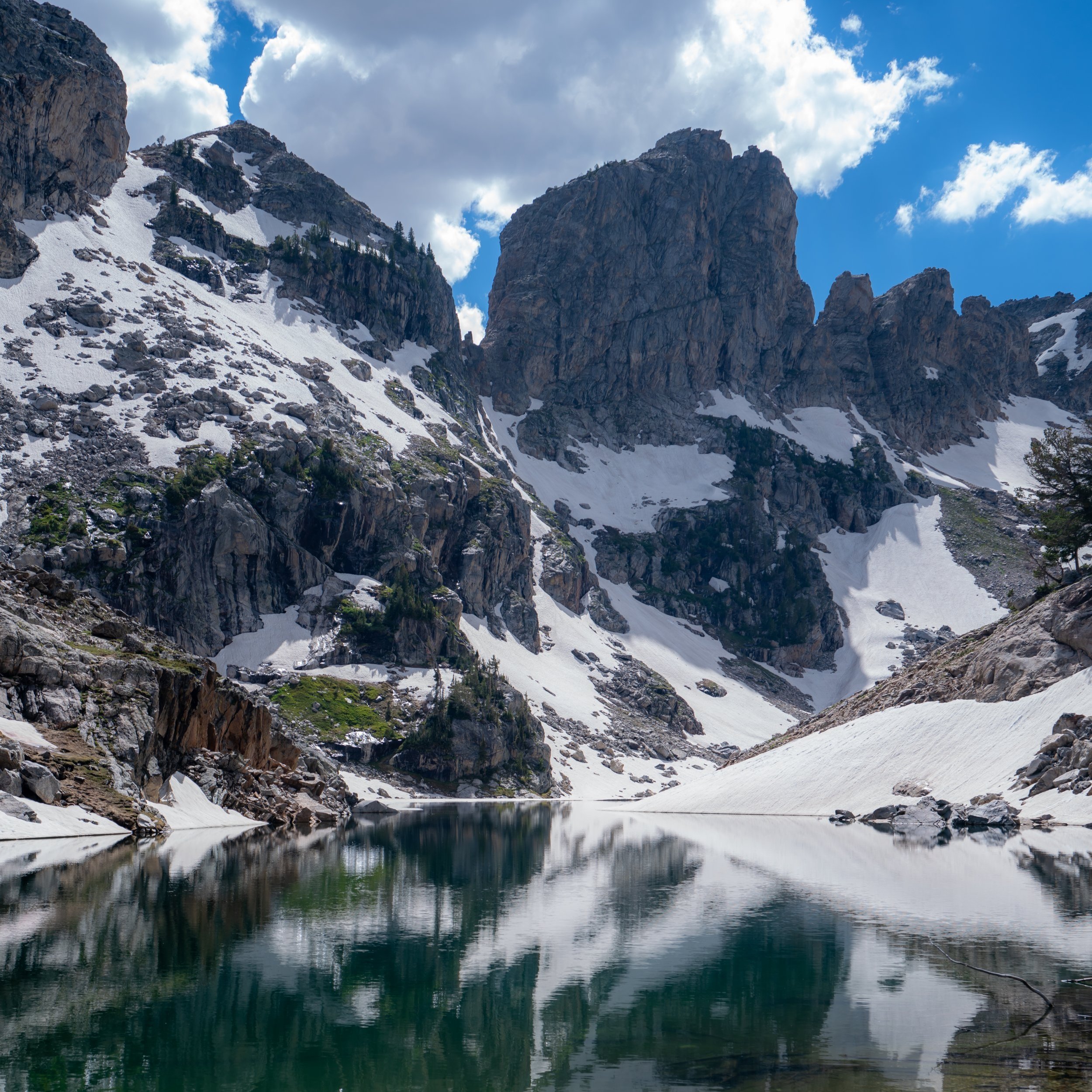
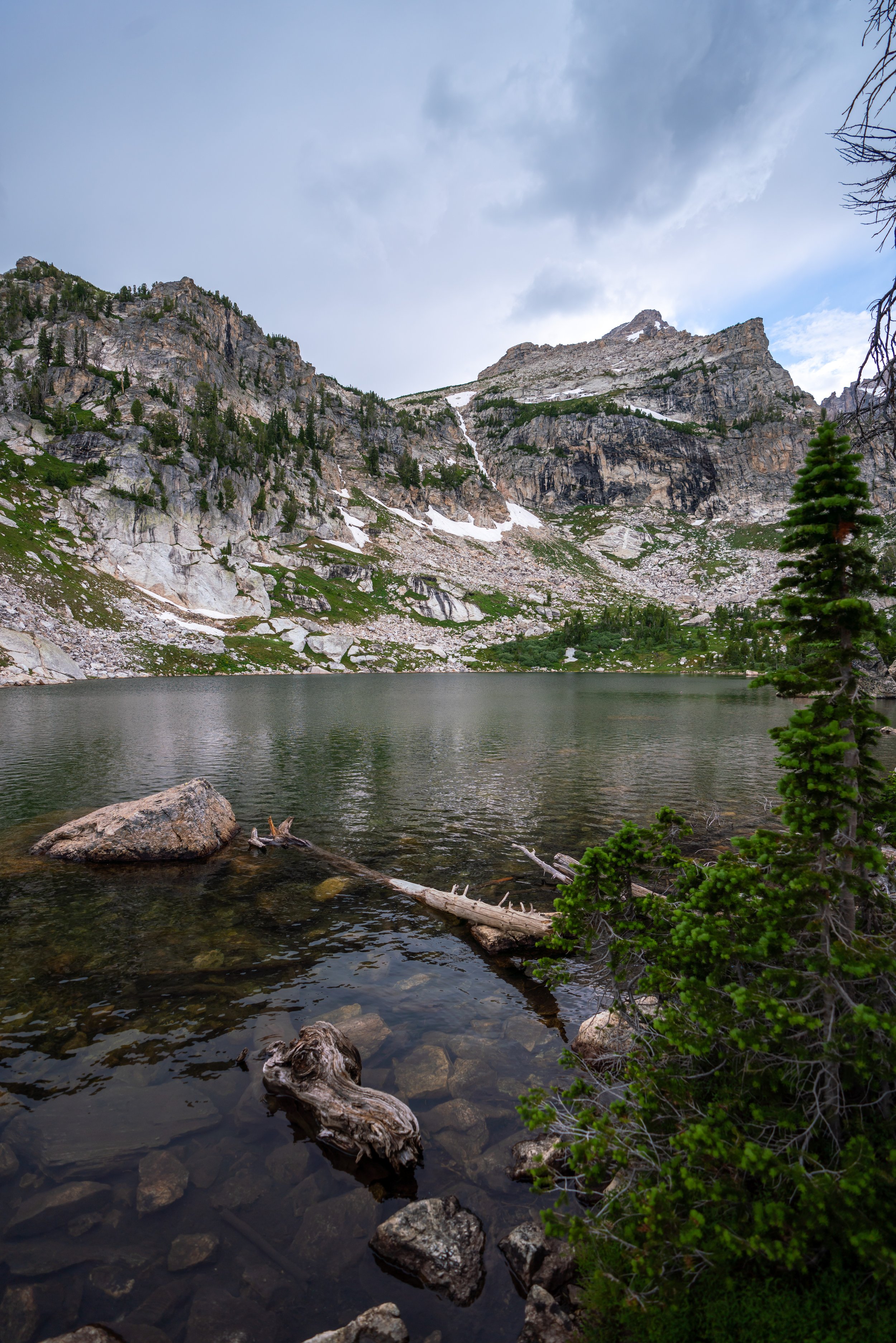
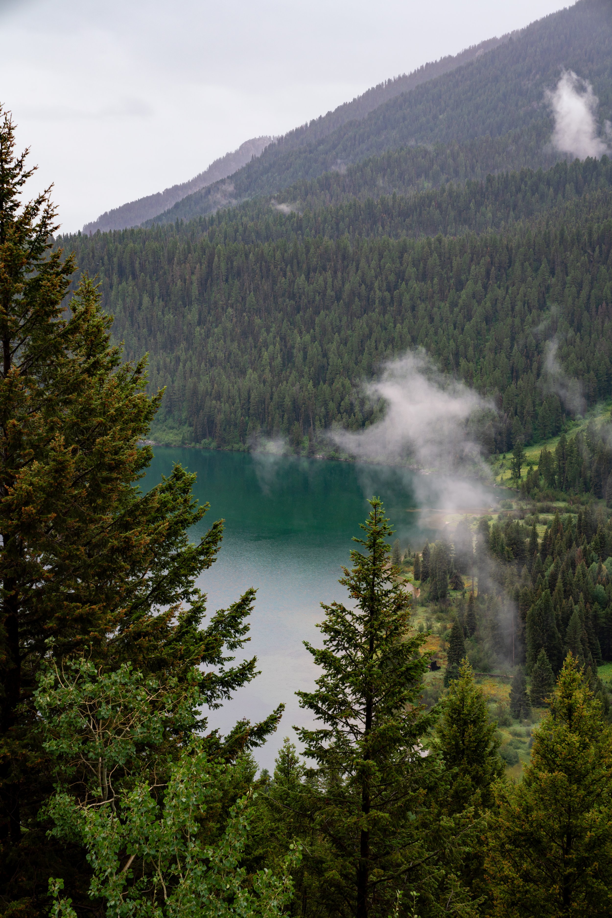
Death Canyon Creek
While the Death Canyon junction may feel like the halfway point, the Death Canyon Creek is a bit more accurate for a halfway checkpoint around Phelps Lake.
Additionally, like I said before, the west side of Phelps Lake is hiked a lot less compared to the east side, meaning that I would personally expect to see more wildlife on this half of the lake.
Phelps Lake-Open Canyon-Valley Trail Junction
The only true junction on this side of Phelps Lake is for the Open Canyon/ Valley Trails.
However, most hikers typically don’t venture up this way unless they are looking to do some overnight backpacking within the park.
Huckleberry Point
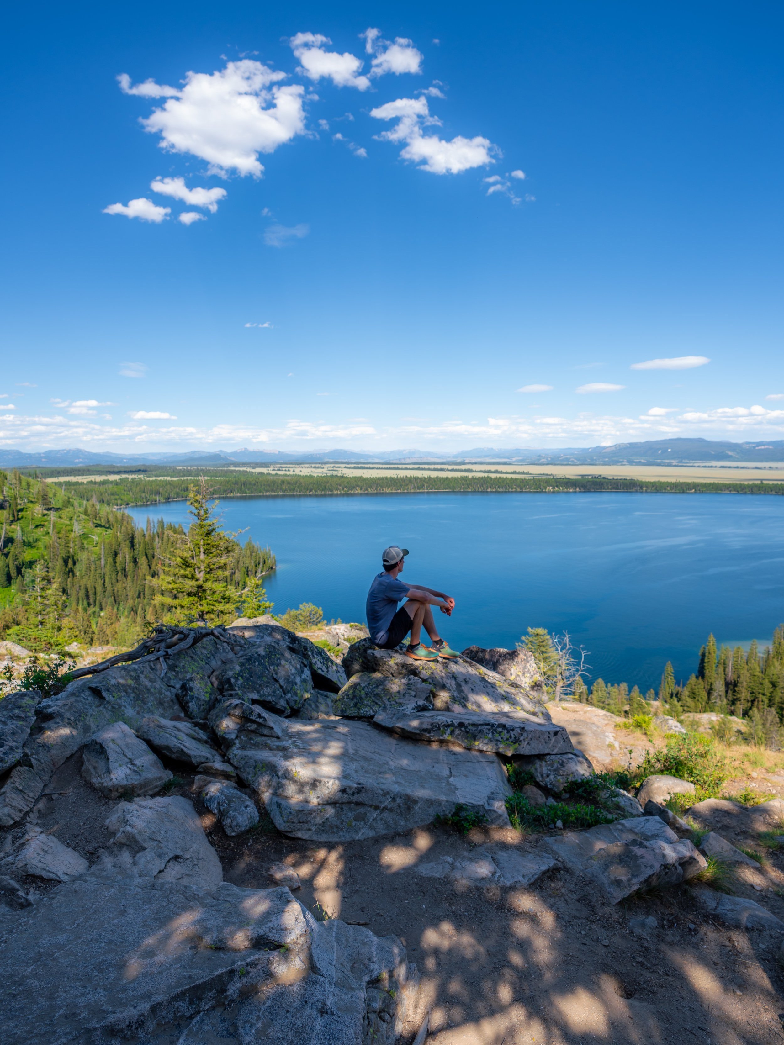
At about two-thirds of the way down the west side of Phelps Lake is a small little side trail to an overlook called Huckleberry Point.
It’s a pretty cool spot, and it’s only a short distance away from the end of the Lake Creek Trail if you’re not interested in a hike around the entire loop.
Personally, I have seen bears in this area of Phelps Lake before, so keep an eye out through this open swampy area.
Phelps Lake-Aspen Ridge Junction
Then, just prior to the return loop on the Lake Creek Trail is the split for the Aspen Ridge Trail.
Go left to continue on to the Lake Creek Trail.
Phelps Lake-Lake Creek Junction
Once back on the south side of Phelps Lake, you can either go straight to continue back to the Woodland Trail where this hike began, or turn right to take the alternate Lake Creek Trail back to the LSRP.
Additionally, the South Phelps Lake Overlook is a popular end destination for some hikers who don’t want to hike as far as the loop shown in this post.
Lake Creek Trail
Since I hiked up the Woodland Trail to Phelps Lake, I choose to take the Lake Creek Trail back to the LSRP.
Boulder-Aspen Ridge Junction
This is where the Aspen Ridge Trail from above loops back to the Lake Creek/ Boulder Ridge Trails.
Keep going straight to continue back to the LSRP.
Moose Wilson Road
Again, watch out for cyclists on the Moose Wilson Road.
Lake Creek-Woodland Junction
This is the same Lake Creek-Woodland junction as the first split shown in this post.
Simply go right to return back to the Laurance S. Rockefeller Preserve Trailhead.
How Bad are the Mosquitoes?
If this is your first trip to Wyoming, you’re likely unfamiliar with how bad the mosquitoes will be. Locals don’t joke when they call the mosquito the Wyoming state bird, which is why I recommend grabbing this cheap bug net before going. You never know where and when you may want it because even midday in the most unsuspecting places, the mosquitoes can be out in clouds!

More Grand Teton Adventures
If you’re interested in reading about some more amazing adventures within Grand Teton National Park, check out my separate posts below!
Best Way to Find Places to Stay!
Wherever I travel, I love to start my search for places to stay on VRBO.
Even if I don’t end up booking through them, I think it’s one of the best ways to see what’s in the area!

Washington
Best Way to Book Rental Cars!
I travel quite a bit, and I know firsthand that finding a good rental car deal can be a challenge, but that’s why I recommend comparing all of your options with Discover Cars.
In short, Discover Cars is a well-known, reputable business that allows you to search for the best deal across companies, and they have the best full-refund cancellation policy I’ve ever seen, valid up to 72, or sometimes even 48, hours prior to your reservation!
Book Here: Discover Cars

Discover Cars!
Safety
From personal experience, I’ve seen that the Yellowstone-Teton area has one of the highest Grizzly Bear densities in the country. Even on the popular trails, you need to be hiking with bear spray and know how to react in the event of a Black or Grizzly Bear encounter.
Aside from wildlife, Wyoming, like any Mountain West state, is known for its violent afternoon thunderstorms, which are more typical in the warmer summer months than other times of the year.
That said, it’s important to check the local forecast before setting off on any adventure, as lightning strikes are not uncommon in and near mountain ranges across the West. I have personally been knocked to the ground by a strike that hit near me in the past, and I confidently say that it’s an experience you don’t want to live through. This is why I highly recommend checking Mountain Forecast for any high-elevation adventures you may be interested in—especially when climbing a summit.
Finally, know that when micro-spikes are necessary for an early-season adventure, micro-spikes are never supposed to be a substitute for conditions that require crampons.
As always, find the most up-to-date information and conditions on the official Yellowstone and Grand Teton National Park websites.
National Park Service: Grand Teton National Park / Yellowstone National Park
U.S. National Parks Pass
Did you know that the same America the Beautiful Pass that grants access to all 63 U.S. National Parks can be purchased in advance at REI?
Yes, you can save time when you arrive by purchasing your National Park pass, along with your other outdoor gear, at REI before traveling to the park!
More U.S. National Parks
If you’d like to read more about some of my best recommendations when visiting other U.S. National Parks, check out some of my other posts below!


Disclaimer
All information provided on this blog is for informational purposes only and is not intended to be a substitute for information or advice from qualified professionals or managing agencies.
Noah Lang Photography LLC makes no representations or warranties regarding the accuracy or completeness of the information provided here, and readers should use their own discretion, judgement, and seek professional advice where it is appropriate.
Furthermore, Noah Lang Photography LLC shall not be held responsible for any injuries, lost individuals, or legal issues arising from the use of information provided on this website, and if applicable, the above safety disclaimer should be referenced to provide a generic overview of the risks involved.
All said, the content on this blog is for the sole use of Noah Lang Photography LLC, and unauthorized use or reproduction of this content is strictly prohibited.
Disclosure
This post is not sponsored.
However, some of the links in this post are affiliate links, which means that I may earn a small commission if a purchase is made through one of those links. This commission comes at no additional cost to you, and I only recommend products that I personally use and believe will add value to my readers. Thank you for your support, which enables me to continue creating more!
To read the full privacy policy, click here.

About This Blog
Noah Lang Photography, also known as @noahawaii, is 100% reader-supported!
I do not accept guest articles or sponsored content of any kind on my blog, which is why, if you enjoy the outdoor and travel content I create, please consider buying me a coffee!
I appreciate your support, which helps me continue to keep this blog alive!