


Hiking the Tantalus Loop Trail to the Pauoa Flats Bench on Oʻahu, Hawaiʻi
Distance: 8.4 miles / 13.5 km
The Tantalus trail network on the south side of Oʻahu is the largest complex of interconnecting trails found anywhere on the island, similar to that of Polipoli and the Redwood Loop Trail on Maui.
That being said, the sheer number of trails on Tantalus may seem overwhelming, but there is one best route to hike the vast majority of trails on Tantalus, known as the Tantalus Loop Trail.
In short, the Tantalus Loop Trail is the outermost loop that parallels both the Mānoa and Nuʻuanu sides of Tantalus, beginning and ending at the trailhead in Makiki Valley.
The three trails that are the exceptions to this loop are the Nuʻuanu Trail, which descends Tantalus into Nuʻuanu Valley; the ʻAihualama Trail, a connector trail between Tantalus and Mānoa Falls; and the Tantalus Arboretum Trail, which is an entirely isolated 0.3-mile (0.5 km) loop trail, separate from this network altogether.
Makiki Valley Trailhead Parking
The Tantalus Loop Trail could begin at any number of trailheads off of Tantalus-Round Top Drive that meet up with the central loop, but for the purposes of this article, I began at the trailhead in upper Makiki Valley—the lowest point on the loop.
This is the Makiki Arboretum Trailhead, located within Makiki Valley State Recreation Area, and it’s the biggest parking area found anywhere on Tantalus, which I like to utilize to get the uphill out of the way at the beginning of the hike.
Out of caution, consider the Makiki Valley State Recreation Area and any parking area on Tantalus to be a high-crime area for petty theft, meaning you should never leave visible bags or anything valuable in your car.
Google Maps Directions: Makiki Valley State Recreation Area
My Hawaiʻi Hiking Checklist
Osprey 3L Water Bladder - The Osprey 3L water bladder is the most universal hiking and backpacking water bladder on the market, and it’s my go-to because of the slide-off seal that allows it to be quickly filled from the top. Additionally, individual parts are easily replaceable, such as the bite valve.
Blister / Heel Protectors - I swear by these cheap, amazing heel protectors to prevent blisters for nearly every kind of hiking and backpacking that I do!
Black Diamond Headlamp - Personally, I recommend the Black Diamond Storm because it is one of the brightest, lightest, and longest-lasting headlamps on the market—and trust me, the weight-to-battery-life ratio really does matter!
Hiking / Trail Running Shoes - Depending on the type of trail, I prefer to use either the Keen Targhee for longer, more rugged hiking or the HOKA Zinal Trail-Running Shoe for lighter, less intense trails. In either case, both have been amazing to me for many years across countless environments, and both can be found in men’s and women’s sizes. - (Men’s Keen / Women’s Keen) (Men’s HOKA / Women’s HOKA)
Waterproof Rain Shell - You never know when it may rain, and I’ve learned over the years that a rain shell is far better than a rain jacket. By this, I mean that it’s best to have something that the water will roll right off of, which is why I recommend the Patagonia Torrentshell 3L available in both men’s and women’s sizes.
High SPF Sunscreen - Packing high-SPF sunscreen is a must for long days outside!


Hiking the Tantalus Loop Trail
To skip ahead to any one particular trail in this article, click on the links below.
Makiki Arboretum Trail
Distance: 0.4 miles / 0.6 km
The Tantalus Loop Trail begins on the Makiki Arboretum Trail within the Makiki Valley State Recreation Area.
This short 0.4-mile (0.6 km) trail leads to the main area within the State Recreation Area, where the Tantalus Loop begins.
At this split, go left to stay on the Makiki Arboretum Trail.
Then, simply follow the signs to get to the Tantalus Loop Trailhead shown below.
Maunalaha-Kānealole Junction (Tantalus Loop Trail)
The Maunalaha-Kānealole junction is where the Tantalus Loop Trail truly begins.
Personally, I prefer to go right on the Maunalaha Trail in order to hike the most challenging elevation gain in the beginning, as opposed to the Kānealole to Nahuina Trail, where the elevation gain is spread out over a longer distance.
Maunalaha Trail
Distance: 0.8 miles / 1.3 km
In regards to my thoughts above, I chose to go right on the Maunalaha Trail.
I feel this way because after the Moleka Trail, there is only about 300 ft. (91 m) of additional elevation to climb over the next 2.4 miles (3.9 km), which is hardly noticeable over that distance.
Almost immediately, the Maunalaha Trail will begin climbing about 700 ft. (213 m) of elevation for nearly the entire distance to the Makiki Valley-ʻUalakaʻa junction.
Makiki Valley-ʻUalakaʻa Junction
After 0.8 miles (1.3 km), the Maunalaha Trail comes to the Makiki Valley-ʻUalakaʻa junction.
From here, follow the Makiki Valley Trail for about 0.1 miles (0.2 km) until the beginning of the Moleka Trail on the left-hand side.
This junction is the third photo below—not the Makiki Valley Trail adjacent to the trails map.
With that in mind, the Makiki Valley Trail adjacent to the trails map is the way to go for the shorter loop, which is the route that most hikers take that aren’t interested in hiking the full Tantalus Loop Trail.
Moleka Trail
Distance: 0.8 miles / 1.3 km
After 0.1 miles (0.2 km), the Makiki Valley Trail will meet the Moleka Trail on the left-hand side.
That being said, the Makiki Valley Trail simply continues out to Roundtop Drive, where there is a very small roadside parking area for the trailhead.
Then, over the next 0.8 miles (1.3 km), the Moleka Trail climbs about 100 ft. (30.5 m) in elevation to get to the junction with Roundtop Drive and the Mānoa Cliff Trail.
The interesting thing about the Moleka Trail is that you feel like you are hiking in a completely forested landscape, but all the while, the trail is actually winding right by a number of houses and people’s backyards, which are just out of view!
Mānoa Cliff Trail
Distance: 1.6 miles / 2.6 km
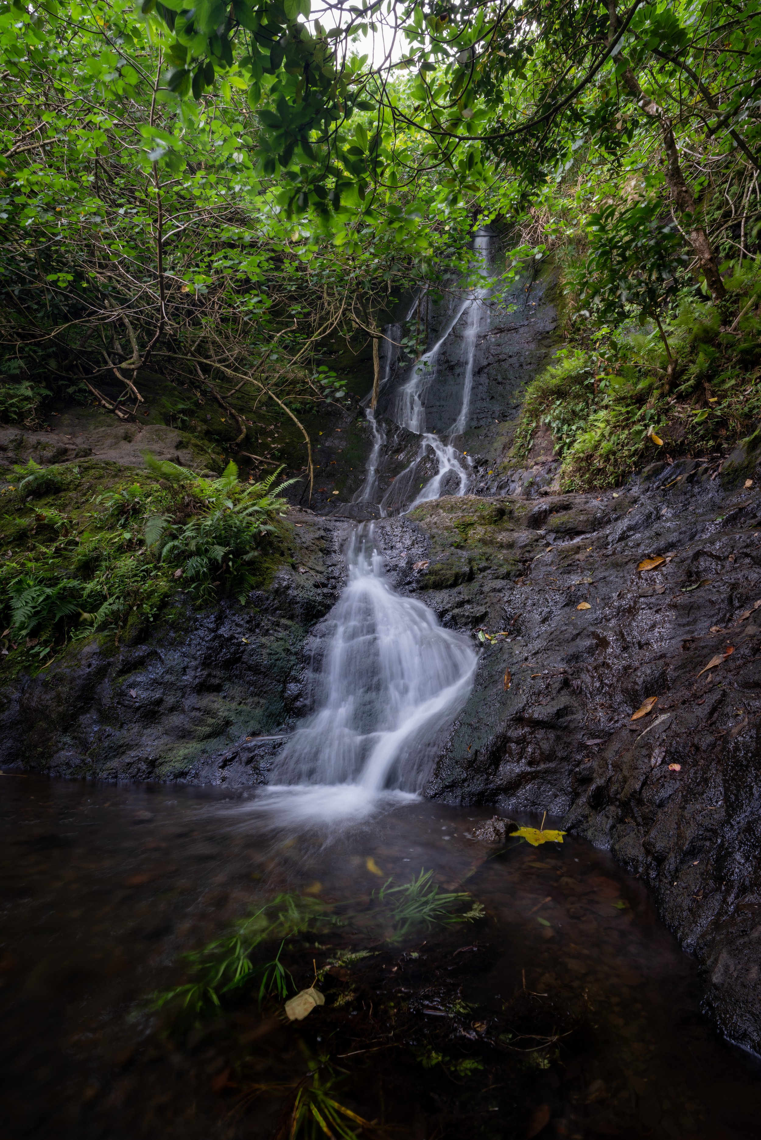
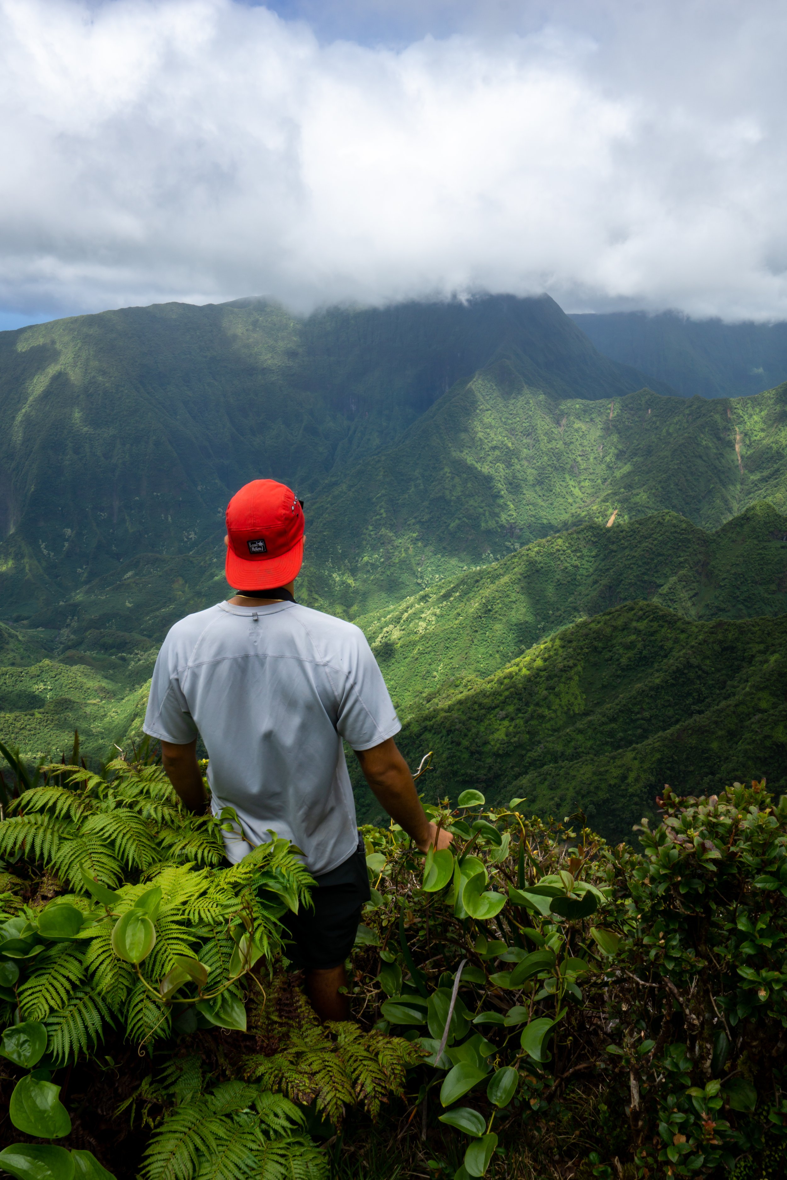
After the Moleka Trail, the Tantalus Loop crosses Roundtop Drive to begin the Mānoa Cliff Trail, which is easily the local favorite among all the different trails on Tantalus.
This is because the Mānoa Cliff Trail has the best views on the entire hike, and you get the opportunity to slow down through a beautifully restored native Hawaiian forest, which is something that sadly can’t be said about the rest of the Tantalus Loop Trail.
By this, I mean that you may find native plants here and there on the rest of the loop, but they are not nearly in the same density as you will find on the Mānoa Cliff Trail.
In any case, you may notice that the official distance for the Mānoa Cliff Trail is 1.9 miles (3.1 km), but the Tantalus Loop Trail cuts out the last 0.3 miles (0.5 km) at the end to stay on the loop toward the Pauoa Flats Bench.
Just after this bench on the Mānoa Cliff Trail, there are a number of endemic Lama trees growing alongside the trail.
Mānoa Cliff Restoration Area
This gate signifies the beginning of the Mānoa Cliff Restoration Area, which is vital to protect this area from non-native ungulates that would destroy all the hard work being put in to keep this forest intact.
That being said, there are volunteer opportunties available to help out in the Mānoa Cliff Restoration Area, which you can learn more about by clicking the link below.
In any case, please be sure to close the gate behind you!
Learn More: Mānoa Cliff Volunteer Opportunities
Mānoa Cliff-Puʻu ʻŌhiʻa Junction
Shortly after the gate, the Mānoa Cliff Trail will pass by the junction for the Puʻu ʻŌhiʻa Trail.
However, to stay on the Tantalus Loop, don’t follow the Puʻu ʻŌhiʻa Trail. Rather continue on the Mānoa Cliff Trail going straight.
The Mānoa Cliff Restoration Area is the most native forested section on the entire trail.
That said, some of the native Hawaiian plants that you can expect to see include ʻIeʻIe, ʻŌhiʻa lehua, Koa, Kokiʻo Keʻokeʻo (Hawaiian Hibiscus), Kōpiko, Maile, Māmaki, and Hōʻawa, to truly only name a few.
If you are curious about trying the native Hawaiian Māmaki tea, I kindly ask that you don’t harvest Māmaki from our native forests but, instead, buy from one of the local reputable vendors, such as those listed below.
If you would like to learn more about these and many other native Hawaiian plants from across the islands, I encourage you to check out my separate post linked below.
Read My Separate Post: Native Hawaiian Plant Guide


This second gate is the end of the Mānoa Cliff Restoration Area.
Again, please close the gate behind you!
Mānoa Cliff-Pauoa Flats Junction
After the upper gate, the Mānoa Cliff Trail splits with the Pauoa Flats Trail.
Here, you either have the option of taking the shorter loop back to the beginning by going left to continue on the Mānoa Cliff Trail, or you can go right to begin the Pauoa Flats Trail, which is what I recommend.
I say this because the end of the Pauoa Flats Trail is the Pauoa Flats Bench, where some of the best views on all of Tantalus are located.
Pauoa Flats Trail
Distance: 0.8 miles / 1.3 km
From the start of the Pauoa Flats Trail, the distance to the bench is 0.8 miles (1.3 km) each way. However, the roundtrip on the Pauoa Flats Trail, returning to the Kalāwahine Trail to continue the loop, is 1.4 miles (2.3 km).
In short, the Tantalus Loop Trail doesn’t return to the start of the Pauoa Flats Trail after visiting the bench, which hopefully helps explain the difference in these distances.
Know that unless you were planning on hiking to Nuʻuanu Valley, Mānoa Valley via ʻAihualama, or Puʻu Kōnāhuanui, the bench is the furthest and most practical end destination on the Tantalus Loop Trail.
Pauoa Flats-Kalāwahine Junction
After 0.2 miles (0.3 km), the Pauoa Flats Trail reaches the first of three junctions that split off the Pauoa Flats Trail.
This is the Kalāwahine Trail, and it’s the beginning of the return loop back down to the Makiki Valley State Recreation Area.
With that in mind, you can go left here if you have no interest in hiking the remaining 0.4 miles (0.6 km) each way to the Pauoa Flats Bench, but I chose to continue straight (right).
To skip ahead to the start of the Kalāwahine Trail, click here.
Pauoa Flats-Nuʻuanu Junction
Shortly after the Kalāwahine Trail junction, the Pauoa Flats Trail meets the Nuʻuanu Trail on the left, followed by the ʻAihualama Trail shortly thereafter on the right.
In short, the Nuʻuanu Trail descends Tantalus to the west, down into Nuʻuanu Valley where it meets with the Judd Trail once at the bottom.
For most hikers doing the Tantalus Loop Trail, it doesn’t make sense to take either of these side trails, as both end far away from where the Tantalus Loop started in Makiki Valley.
Read My Separate Post: Nuʻuanu Trail
Pauoa Flats-ʻAihualama Junction
Finally, the Pauoa Flats Trail meets the ʻAihualama Trail, which is the final split in the Tantalus Trail network before the Pauoa Flats Bench.
Here, go straight (left) to reach the bench shortly ahead, as the ʻAihualama Trail descends Tantalus to the east, down into Mānoa Valley, ending right at Mānoa Falls.
This is all to say that I personally think that both the Nuʻuanu and ʻAihualama Trail make for great connector trails when creating a loop, such as Lulumahu Ridge to Puʻu Kōnāhuanui and down Nuʻuanu, or Mānoa Middle to Puʻu Kōnāhuanui and down ʻAihualama.
However, these are both much more advanced adventures that should not be compared to any trail on the Tantalus Trail network, as they require a bit more preparation to do them safely!
Read My Separate Post: ʻAihualama Trail
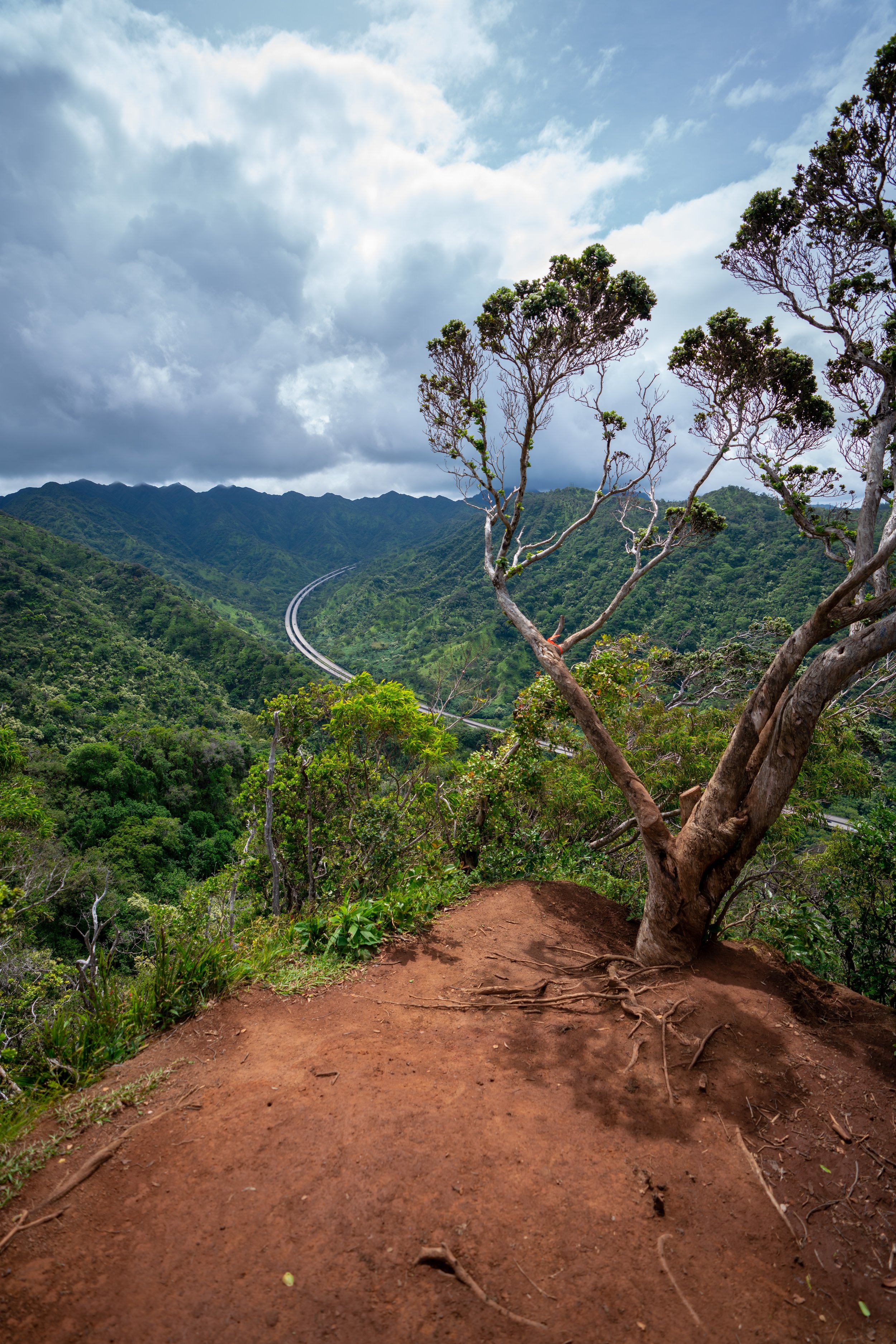
Pauoa Flats Bench
This is the Pauoa Flats Bench, and this viewpoint is the end of the maintained trail network on Tantalus.
By this, I mean that the ridge does continue further up toward the Koʻolau Summit, but if you weren’t prepared to hike that far, I recommend turning back, as the hiking only gets more and more challenging from this point on.
Read My Separate Post: Puʻu Kōnāhuanui Ridge Trail
Kalāwahine Trail
Distance: 1.3 miles / 2.1 km
Once back at the Kalāwahine junction, go right to begin the Nuʻuanu Valley side of the Tantalus Loop Trail.
The Kalāwahine Trail is a mostly flat trail that contours Tantalus, descending only about 150 ft. (46 m) of elevation from the Pauoa Flats Trail to the junction at Telephone Road.
Mānoa Cliff-Kalāwahine Junction
This is the Mānoa Cliff-Kalāwahine junction, and it’s where you would come if you chose to go right at the Pauoa Flats Trailhead immediately after the Mānoa Cliff Restoration Area.
That being said, go straight (right) to continue hiking the Kalāwahine Trail to Telephone Road.
In the short section between the native snail habitat signs, there are a few randomly placed Māmaki plants growing alongside the trail.
Telephone Road (Kalāwahine Trailhead)
The end of the Kalāwahine Trail is where the Tantalus Loop meets up with Tantalus Drive at the junction with Telephone Road.
Here, go right on Tantalus Drive to walk toward the Nahuina Trail on the left-hand side of the road.
Nahuina Trail
Distance: 0.8 miles / 1.3 km
This is the Nahuina Trailhead, and it will be found over the guardrail on the left-hand side of Tantalus Drive, about 0.1 miles (0.2 km) away from the Kalāwahine-Telephone Road junction.
Once on the Nahuina Trail, the rest of the Tantalus Loop is entirely downhill until the trailhead in Makiki Valley.
With that in mind, the Nahuina Trail descends quickly, which is pretty much the only thing to note about this section of the loop.
Nahuina-Makiki Valley Junction
When you get to the Nahuina-Makiki Valley junction, go left on the Makiki Valley Trail for about 0.25 miles (0.4 km) until the Kānealole Trail junction, as the Makiki Valley Trail to the right simply leads up to Tantalus Drive and a small parking area shortly thereafter.
Makiki Valley-Kānealole Junction
At the Makiki Valley-Kānealole junction, go right to begin the final trail on the Tantalus Loop, which leads back down to the Makiki Valley State Recreation Area—and yes, the Makiki Valley Trail—going straight—is the same trail that met the Tantalus Loop at the Makiki Valley-ʻUalakaʻa junction earlier in this article.
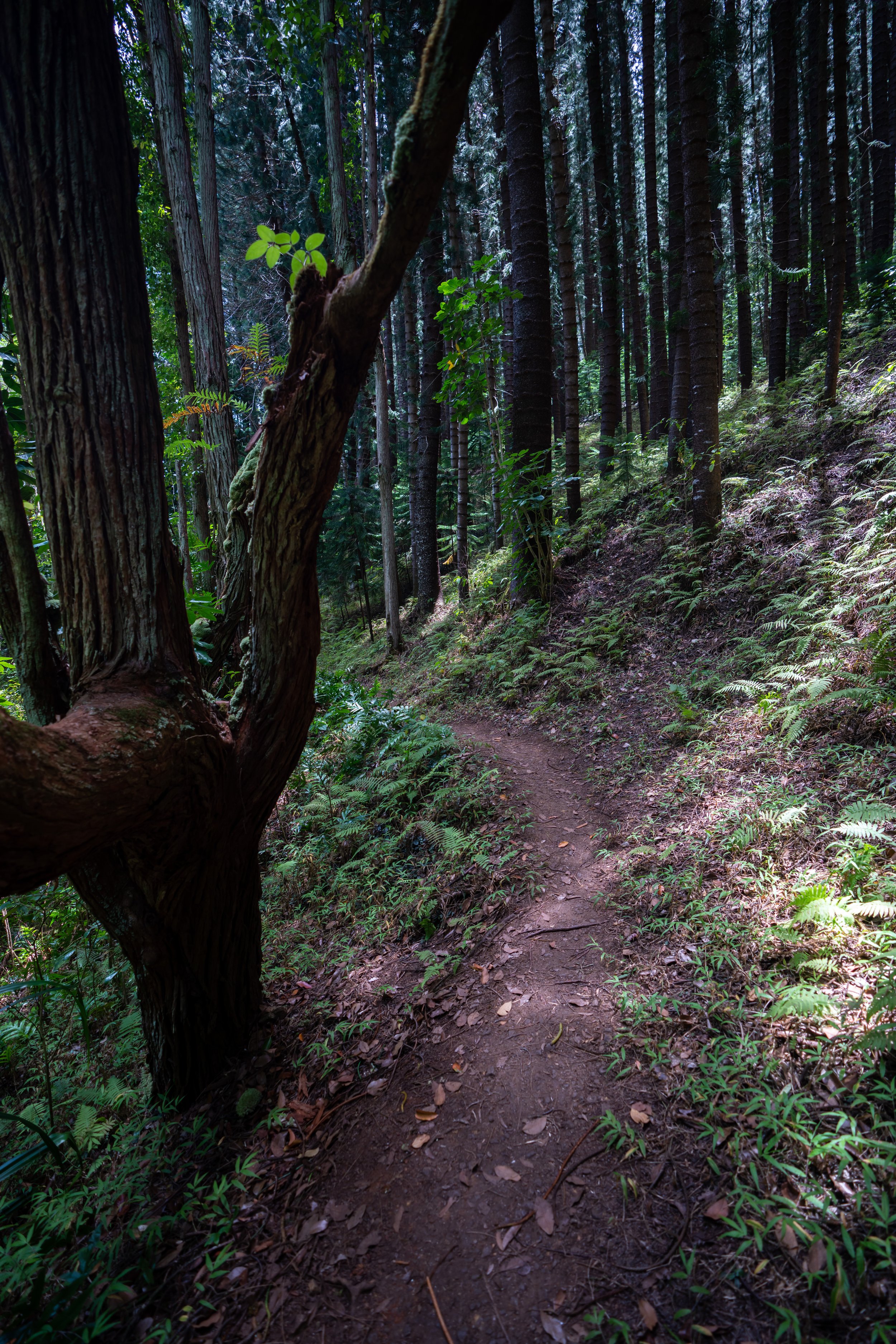
Kānealole Trail
Distance: 0.8 miles / 1.3 km
This final 0.8-mile (1.3 km) section on the Kānealole Trail simply parallels the Kānealole Stream back down to the trailhead in Makiki Valley.
Along this final section of the Kānealole Trail, there are a few native Hawaiian plants just before the Makiki Arboretum junction.
Here, you can find natives like Lonomea, Wiliwili, Lama, and others, as they are planted and maintained by the nearby staff from the Hawaiʻi Department of Land and Natural Resources, located within the Makiki Valley State Recreation Area.
Maunalaha-Kānealole Junction (Tantalus Loop Trail)
This is the beginning of the Tantalus Loop from the beginning of this article.
At this junction, go right to begin the Makiki Arboretum Trail, back through the State Recreation Area.
Native Plants on the Tantalus Loop Trail
Under the Mānoa Cliff Restoration Area section, I mentioned the majority of the information that you would need to know to find various native plants on the Tantalus Loop Trail.
That being said, the Mānoa Cliff Restoration Area is easily the most native section on the loop, and unfortunately, most of the rest of the loop hike is dominated with non-native and invasive introductions.
If you would like to learn more about these and many other native Hawaiian plants from across the islands, I encourage you to check out my separate post linked below.
Read My Separate Post: Native Hawaiian Plant Guide
More Oʻahu Adventures
If you’re interested in reading about some more amazing Oʻahu adventures, check out my separate posts below!


Best Hotels & Restaurants in Waikīkī
If you’re trying to decided where to stay on Oʻahu, check out my top 10 list for the best resorts and restaurants in Waikīkī.
I break down what makes one hotel a better choice over another, so that you can find the best fit for your stay on the island.
Read My Separate Post: Best Waikīkī Hotels & Restaurants

Waikīkī
HNL Airport-Hotel Shuttle
Prices on ride-share apps like Uber/ Lyft cannot beat the price of booking your hotel shuttle prior to arrival. I say this because there are additional fees for ride-share airport pick-ups at Honolulu Airport (HNL), which is why I recommend booking your transportation in advance using the options below.
Additionally, the last option below will go as far as the Ko ʻOlina Resorts on the West Side and Turtle Bay on Oʻahu’s North Shore!
Best Way to Book Rental Cars!
I travel quite a bit, and I know firsthand that finding a good rental car deal can be a challenge, but that’s why I recommend comparing all of your options with Discover Cars.
In short, Discover Cars is a well-known, reputable business that allows you to search for the best deal across companies, and they have the best full-refund cancellation policy I’ve ever seen, valid up to 72, or sometimes even 48, hours prior to your reservation!
Book Here: Discover Cars

Oʻahu
Visiting Other Islands
If you are visiting Oʻahu or heading to another island, check out some of my personal recommendations for Oʻahu, Maui, Kauaʻi, Molokai, Lānaʻi, and Hawaiʻi Island (Big Island) in these separate posts.
If you’re trying to decide which island is right for your visit, check out my overview about each island in the post below.
Read My Separate Post: What is the Best Hawaiian Island to Visit?


What is the Best Time of Year to Visit Hawaiʻi?
The weather in Hawaiʻi can often appear to be warm and beautiful throughout the year, but in my experience, there is a lot more to consider when planning what time of year to visit the islands, such as what island you are considering, what sides of each island do you plan to stay, what activities are you most interested in, the wildlife, and countless other nuanced variables that can all impact the type of trip you can expect to have.
For these reasons, I highly recommend reading through my separate article to not only understand my thoughts regarding the best time of year to come to Hawaiʻi but also what you need to consider based on the time of year that you plan to visit.
Read My Separate Post: What is the Best Time of Year to Visit Hawaiʻi?
10 Best Tours & Excursions on Oʻahu
There are a lot of different tour options to choose from on Oʻahu, but to make it easier to decide, I made a list of my favorite tours because some things simply are better with a local guide!
Read My Separate Post: Best Tours on Oʻahu

Oʻahu
Safety
All hikes in Hawaiʻi should not be compared to trails outside of the islands, and hikers should exercise due caution on every adventure, given that many are extremely dangerous.
By this, I mean that Hawaiʻi is known for hot, humid weather, steep, dramatic, and unstable cliffs, and flash floods, which can occur without warning. Therefore, it is important that you check the local forecast, understand the physical condition of your entire group, and pack sufficient food and water before attempting any adventure.
Disclaimer
All information provided on this blog is for informational purposes only and is not intended to be a substitute for information or advice from qualified professionals or managing agencies.
Noah Lang Photography LLC makes no representations or warranties regarding the accuracy or completeness of the information provided here, and readers should use their own discretion, judgement, and seek professional advice where it is appropriate.
Furthermore, Noah Lang Photography LLC shall not be held responsible for any injuries, lost individuals, or legal issues arising from the use of information provided on this website, and if applicable, the above safety disclaimer should be referenced to provide a generic overview of the risks involved.
All said, the content on this blog is for the sole use of Noah Lang Photography LLC, and unauthorized use or reproduction of this content is strictly prohibited.
Disclosure
This post is not sponsored.
However, some of the links in this post are affiliate links, which means that I may earn a small commission if a purchase is made through one of those links. This commission comes at no additional cost to you, and I only recommend products that I personally use and believe will add value to my readers. Thank you for your support, which enables me to continue creating more!
To read the full privacy policy, click here.

About This Blog
Noah Lang Photography, also known as @noahawaii, is 100% reader-supported!
I do not accept guest articles or sponsored content of any kind on my blog, which is why, if you enjoy the outdoor and travel content I create, please consider buying me a coffee!
I appreciate your support, which helps me continue to keep this blog alive!