


Hiking the Humuʻula Trail to Mauna Kea Summit on the Big Island of Hawaiʻi
Distance (One Way): 6.9 miles / 11.1 km
Elevation Gain: ~4,600 ft. / 1,402 m
Standing at 13,803 ft. (4,207 m) above sea level, Mauna Kea on the Big Island of Hawaiʻi is the highest natural point across all the Hawaiian Islands, and it’s the 6th-highest state high point in the United States!
That being said, the 6.9-mile (11.1 km) Humuʻula Trail—from the Halepōhaku Trailhead off Mauna Kea Access Road to the summit of Puʻu Wekiu—is the main route to the top of Mauna Kea.
I say this because the Mauna Kea Access Road, which parallels the Humuʻula Trail, does climb to observatories near the summit. However, those in the hiking and climbing community would say, "If you didn’t climb it, it doesn’t count"—which is exactly what hiking the Humuʻula Trail is all about!
This inevitably makes the Humuʻula Trail is one of the more popular trails across all of Hawaiʻi, but Humuʻula should not be compared to other state high points of similar elevation. I say this because other upper-elevation state high points across the Mountain West—like Mt. Whitney in California, Kings Peak in Utah, or even Gannett Peak in Wyoming—are considerably more difficult than Mauna Kea, as getting to the summit of Puʻu Wekiu is certainly on the easier end!
Now, it must be addressed that there is a slight controversy about the true summit of Mauna Kea (Puʻu Wekiu), which I discuss in more detail later in this post.
Mauna Kea Trail Registration
Prior to hiking the Humuʻula Trail, the Hawaiʻi Department of Land and Natural Resources (DLNR) requires hikers to fill out a form to gather some basic information about your group.
Following this, you should receive a brief orientation from a ranger about the trail, including some safety tips and general advice. Coming from a long-time hiker in Hawaiʻi, I can honestly say that the Humuʻula Trail is one of the safest hikes across all the islands because of how closely each party is monitored by the rangers.
Furthermore, this form will ask you to provide an expected return time, but it should go without saying that you need to start the Humuʻula Trail early in the morning. I would even go as far to say that starting after 9 a.m. is too late—especially in the winter when the sunset is earlier.
How Hard is the Humuʻula Trail to the Summit of Mauna Kea?
Writing about how difficult a trail is can be one of the most challenging aspects of an article like this. I always like to say that someone’s 'walk in the park' is someone else’s 'Everest,' so there’s truly no definitive way to describe difficulty.
However, I can say that the terrain up the Humuʻula Trail is easy, but it’s generally not the condition of the trail that people are worried about; it’s the elevation.
That being said, for three people living at sea level on Oʻahu, we all found the Humuʻula Trail to be fairly easy. I don’t believe there was one time where I heard someone talk about being out of breath or dizzy.
I think that if you’re used to climbing 14ers on the mainland, you’ll find that climbing Mauna Kea is very easy, but I also think that if you aren’t keeping up with cardio or hiking regularly, you’ll probably have difficulty with the elevation. This was evident with one hiker that we passed, as they were taking a ton of breaks at around 10,000 ft. (3,048 m), not long after beginning the trail.
Humuʻula Trailhead Parking
Parking for the Humuʻula Trail is located in the same parking lot as the Mauna Kea Visitor Information Station. This is also the highest point that non-4WD vehicles can go.
Generally speaking, if you start the Humuʻula Trail early in the morning, as you should, there will never be an issue finding a parking space. However, by the time you return after your hike, the lot and the visitor center are typically much busier as the day goes on.
Google Maps Directions: Mauna Kea Visitor Information Station
My Hawaiʻi Hiking Checklist
Osprey 3L Water Bladder - The Osprey 3L water bladder is the most universal hiking and backpacking water bladder on the market, and it’s my go-to because of the slide-off seal that allows it to be quickly filled from the top. Additionally, individual parts are easily replaceable, such as the bite valve.
Blister / Heel Protectors - I swear by these cheap, amazing heel protectors to prevent blisters for nearly every kind of hiking and backpacking that I do!
Black Diamond Headlamp - Personally, I recommend the Black Diamond Storm because it is one of the brightest, lightest, and longest-lasting headlamps on the market—and trust me, the weight-to-battery-life ratio really does matter!
Hiking / Trail Running Shoes - Depending on the type of trail, I prefer to use either the Keen Targhee for longer, more rugged hiking or the HOKA Zinal Trail-Running Shoe for lighter, less intense trails. In either case, both have been amazing to me for many years across countless environments, and both can be found in men’s and women’s sizes. - (Men’s Keen / Women’s Keen) (Men’s HOKA / Women’s HOKA)
Waterproof Rain Shell - You never know when it may rain, and I’ve learned over the years that a rain shell is far better than a rain jacket. By this, I mean that it’s best to have something that the water will roll right off of, which is why I recommend the Patagonia Torrentshell 3L available in both men’s and women’s sizes.
High SPF Sunscreen - Packing high-SPF sunscreen is a must for long days outside!


Hiking the Humuʻula Trail to Puʻu Wekiu
The Humuʻula Trail begins at about 9,200 ft. (2,804 m) from the Mauna Kea Visitor Information Station and climbs to just above 13,800 ft. (4,206 m) atop Puʻu Wekiu, the summit of Mauna Kea.
From the visitor center, the Humuʻula Trail begins up the Mauna Kea Access Road on the left-hand side, where the road makes the first turn.
In the beginning, there will be a number of splits on the Humuʻula Trail, but at the first split shown in the photo below, it doesn’t matter whether you decide to go right or left.
Next, at the second split, go right to continue up Mauna Kea.
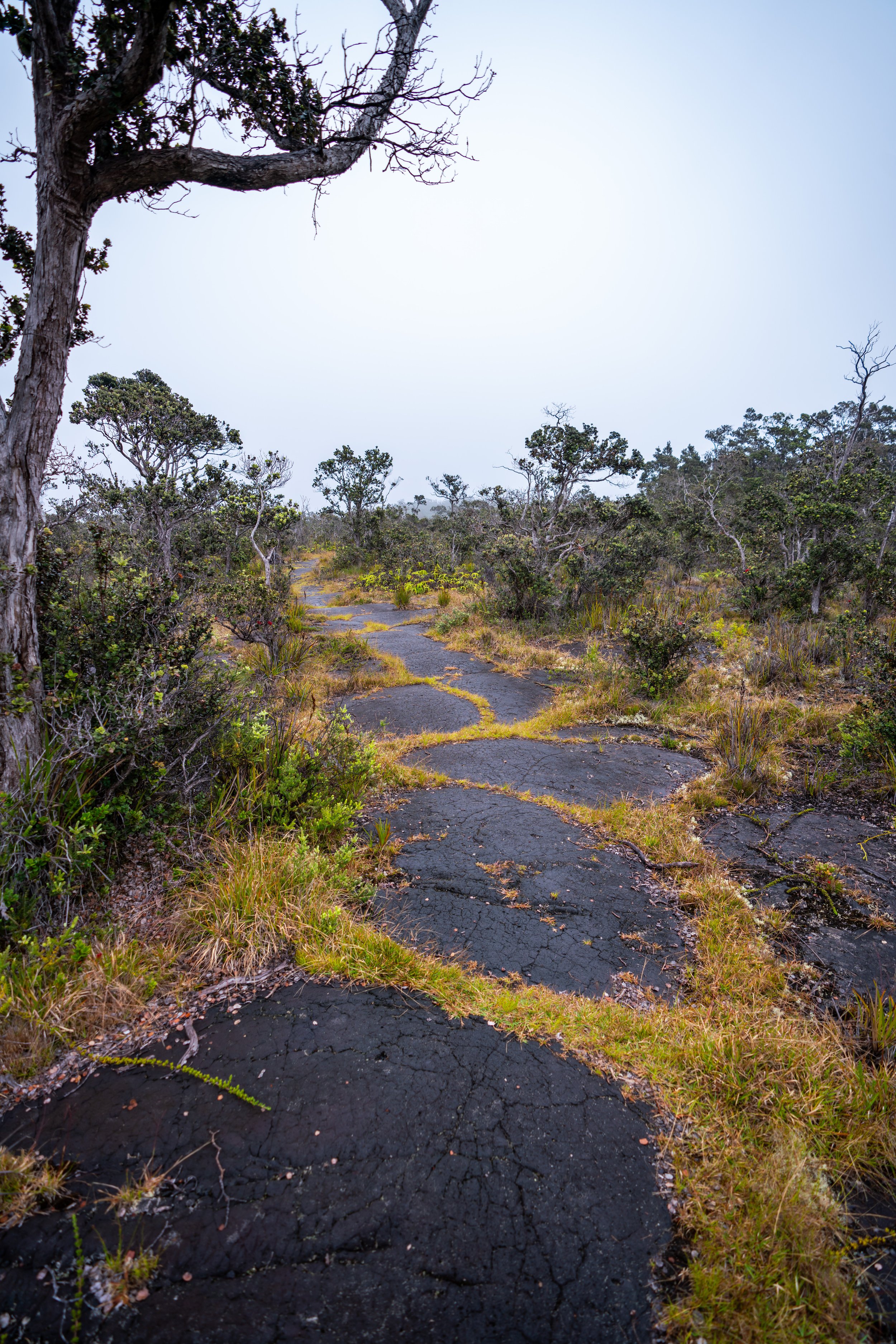
At about 1.0 mile (1.6 km) or 10,000 ft. (3,048 m), the Humuʻula Trail crosses above the Māmane tree line, where the climate continues to get drier and drier the higher you go.
It’s fairly well known that mile two and three, to get up and around Puʻu Keoneheheʻe, is generally considered the steepest part of the entire Humuʻula Trail.
This is the view looking back toward Mauna Loa.
Puʻu Keoneheheʻe
This dark black cinder cone is Puʻu Keoneheheʻe, and it’s a good mental checkpoint on the Humuʻula Trail because of how much higher you can see once you’re beyond it.
At about the 2.1-mile (3.4 km) mark, you finally start to get views of the upper mountain from the Humuʻula Trail.
However, none of the visible peaks is the summit of Mauna Kea, which isn’t visible until the very end of the hike.
As the Humuʻula Trail climbs higher, Puʻu Haukea (on the right) and Puʻu Waiau (on the left) start to really come into view.
These two peaks are both north of 13,000 ft. (3,962 m), which is not only a nice mental checkpoint for the elevation on the trail, but also because Lake Waiau is located in the saddle between the two peaks.
Waiau Trail Junction
At about 4.6 miles (7.4 km), the Humuʻula Trail joins with the Lake Waiau Trail off the Mauna Kea Access Road.
Go left at this junction to continue toward both Lake Waiau and Mauna Kea.
Lake Waiau-Mauna Kea Junction
Just past the previous junction, the Humuʻula Trail splits to both the lake and the summit.
Go left to visit Lake Waiau, or go right to continue toward the summit of Mauna Kea.
Lake Waiau
Lake Waiau on Mauna Kea is one of only five natural lakes in the state of Hawaiʻi.
Visiting the lake only adds an additional 0.25 miles (0.4 km) onto the hike, but know that entering or floating on the water in any way is not allowed.
Shortly past Lake Waiau, the telescopes along the Mauna Kea summit start come into view for the first time.
However, it isn’t until the next photo below where you can truly see the summit for the first time.
The highest peak on the right side of this photo is Puʻu Wekiu, also known as the summit of Mauna Kea.
Mauna Kea Access Road
At about the 5.5-mile (8.9 km) mark, the Humuʻula Trail ends where the Mauna Kea Access Road begins.
Unfortunately, there is no trail from this point until the section just below Puʻu Wekiu, meaning that most of the remaining distance is hiked alongside the Mauna Kea Access Road.
Mauna Kea Summit Loop
When the Mauna Kea Access Road splits, go right to take the fastest route to the summit.
Both directions will lead up to the summit, but the loop to the left is considerably longer.
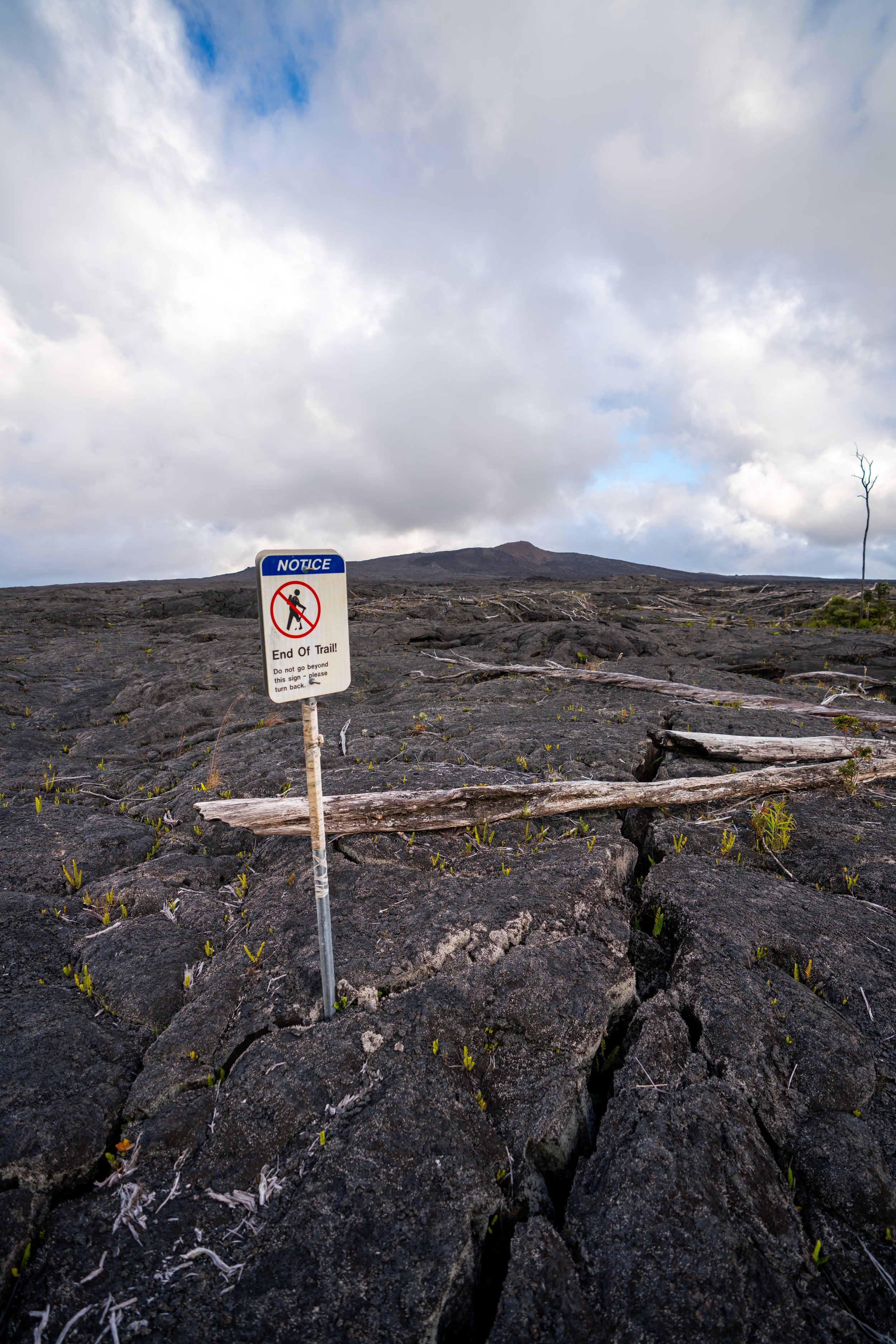
Puʻu Wekiu (Mauna Kea Summit)
Regardless of what the sign says, this is not the summit of Mauna Kea.
Puʻu Wekiu is the true summit of Hawaiʻi, and the DLNR rangers addressed this subject during our initial brief.
Essentially, many Hawaiians believe that the true summit is far too sacred for even them to visit, but that is not to say that visiting Puʻu Wekiu is off-limits. The true Mauna Kea summit is public land, and we were all encouraged to do whatever we were comfortable with. Summiting Mauna Kea (Puʻu Wekiu) is really up to one’s own discretion.
That being said, the true summit is a bit of a controversial topic because of numerous accounts of blatant disrespect that visitors have shown, such as peeing on the summit, leaving trash, etc.
Mauna Kea is not some Colorado 14er, which is why it should go without saying, please be respectful!
Mauna Kea Summit (The Highest Peak in Hawaiʻi)
According to the USGS, Mauna Kea stands at 13,803 ft. (4,207 m), which is considerably different from what the DLNR reports at 13,796 ft. (4,205 m).
Regardless, Mauna Kea is the tallest peak in Hawaiʻi and the sixth tallest of all state high points!
Overall, if you choose to visit the summit of Puʻu Wekiu, please be respectful.
There’s something to be said about peaks with roads to the top, but I personally don’t believe it’s cheating to hitch a ride back down, especially since we were getting passed by rental jeeps on the final summit push up the road.
The DLNR actually said to stick your thumb out and see what happens.
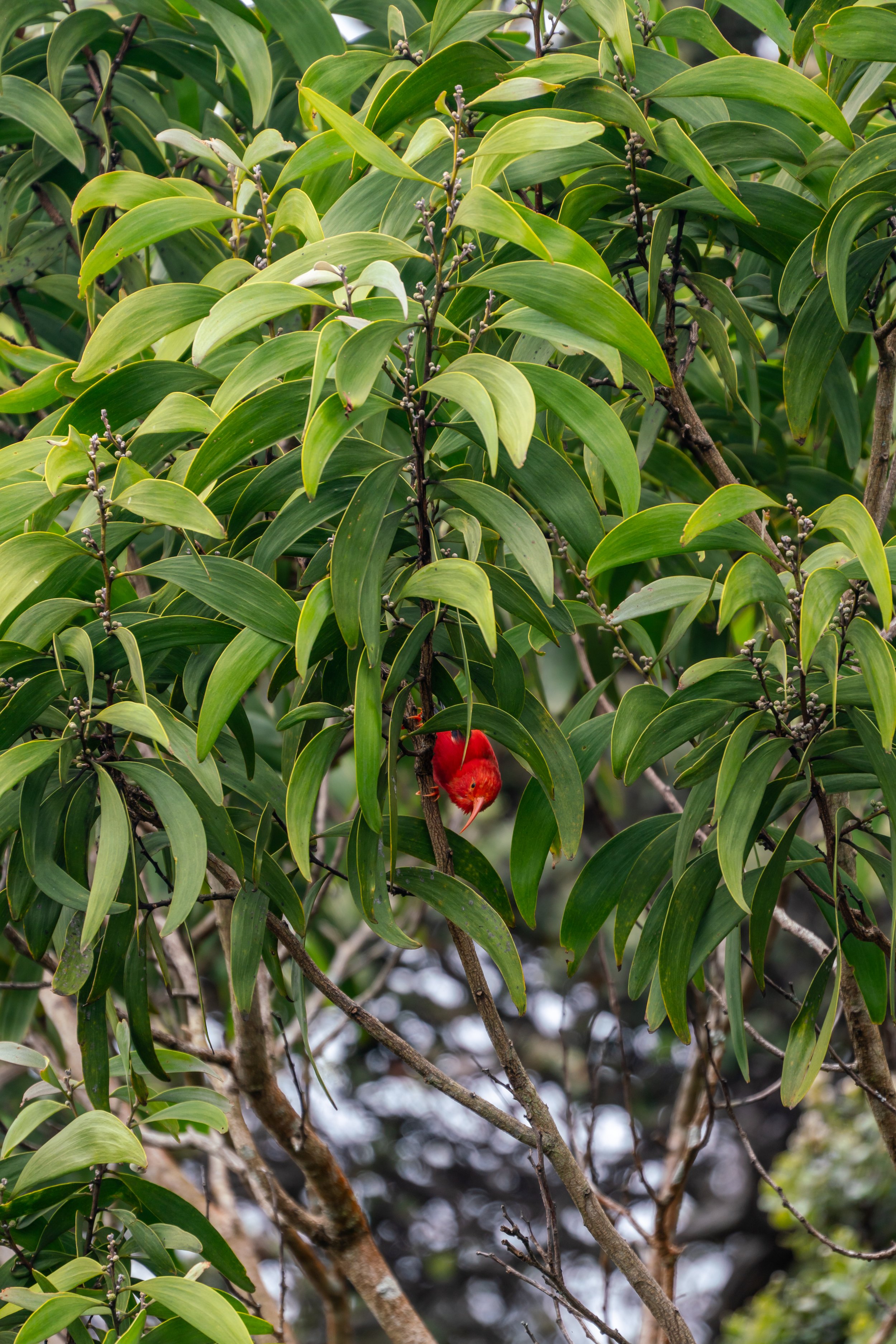
Native Plants on the Humuʻula Trail
Even though Mauna Kea is high above most of Hawaiʻi’s native vegetation, there are still a number of native species to look out for along the trail.
Some of these include Pāwale, Māmane, ʻŌhelo, ʻAʻaliʻi, and if you’re lucky, you might spot a Silversword (ʻĀhinahina).
If you would like to learn more about these and other native Hawaiian plants from across the islands, I encourage you to read more in my separate post.
Read My Separate Post: Native Hawaiian Plant Guide
More Big Island Adventures
If you’re interested in reading about some more amazing Hawaiʻi Island adventures, check out my separate posts below!

Best Hotels & Vacation Rentals on Hawaiʻi Island
Since Hawaiʻi Island is such a big island, I recommend starting your search on VRBO to find places in both Kona and Hilo.
This way, you can plan your adventures on all sides of the island without having to drive too far.
Island of Hawaiʻi
Hawaiʻi Island Airport-Hotel Shuttle
Prices on ride-share apps like Uber/ Lyft cannot beat the price of booking your hotel or vacation rental shuttle prior to arrival.
That being said, the shuttle option below is incredibly cheap, and it’s a great option to get to accommodations across the Kailua-Kona side of the Big Island!
Best Way to Book Rental Cars!
I travel quite a bit, and I know firsthand that finding a good rental car deal can be a challenge, but that’s why I recommend comparing all of your options with Discover Cars.
In short, Discover Cars is a well-known, reputable business that allows you to search for the best deal across companies, and they have the best full-refund cancellation policy I’ve ever seen, valid up to 72, or sometimes even 48, hours prior to your reservation!
Book Here: Discover Cars

One of my favorites!
Visiting Other Islands
If you are visiting Hawaiʻi Island or heading to another island, check out some of my personal recommendations for Oʻahu, Maui, Kauaʻi, Molokai, Lānaʻi, and Hawaiʻi Island (Big Island) in these separate posts.
If you’re trying to decide which island is right for your visit, check out my overview about each island in the post below.
Read My Separate Post: What is the Best Hawaiian Island to Visit?


What is the Best Time of Year to Visit Hawaiʻi?
The weather in Hawaiʻi can often appear to be warm and beautiful throughout the year, but in my experience, there is a lot more to consider when planning what time of year to visit the islands, such as what island you are considering, what sides of each island do you plan to stay, what activities are you most interested in, the wildlife, and countless other nuanced variables that can all impact the type of trip you can expect to have.
For these reasons, I highly recommend reading through my separate article to not only understand my thoughts regarding the best time of year to come to Hawaiʻi but also what you need to consider based on the time of year that you plan to visit.
Read My Separate Post: What is the Best Time of Year to Visit Hawaiʻi?
Safety
All hikes in Hawaiʻi should not be compared to trails outside of the islands, and hikers should exercise due caution on every adventure, given that many are extremely dangerous.
By this, I mean that Hawaiʻi is known for hot, humid weather, steep, dramatic, and unstable cliffs, and flash floods, which can occur without warning. Therefore, it is important that you check the local forecast, understand the physical condition of your entire group, and pack sufficient food and water before attempting any adventure.
Disclaimer
All information provided on this blog is for informational purposes only and is not intended to be a substitute for information or advice from qualified professionals or managing agencies.
Noah Lang Photography LLC makes no representations or warranties regarding the accuracy or completeness of the information provided here, and readers should use their own discretion, judgement, and seek professional advice where it is appropriate.
Furthermore, Noah Lang Photography LLC shall not be held responsible for any injuries, lost individuals, or legal issues arising from the use of information provided on this website, and if applicable, the above safety disclaimer should be referenced to provide a generic overview of the risks involved.
All said, the content on this blog is for the sole use of Noah Lang Photography LLC, and unauthorized use or reproduction of this content is strictly prohibited.
Disclosure
This post is not sponsored.
However, some of the links in this post are affiliate links, which means that I may earn a small commission if a purchase is made through one of those links. This commission comes at no additional cost to you, and I only recommend products that I personally use and believe will add value to my readers. Thank you for your support, which enables me to continue creating more!
To read the full privacy policy, click here.

About This Blog
Noah Lang Photography, also known as @noahawaii, is 100% reader-supported!
I do not accept guest articles or sponsored content of any kind on my blog, which is why, if you enjoy the outdoor and travel content I create, please consider buying me a coffee!
I appreciate your support, which helps me continue to keep this blog alive!